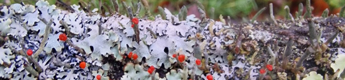
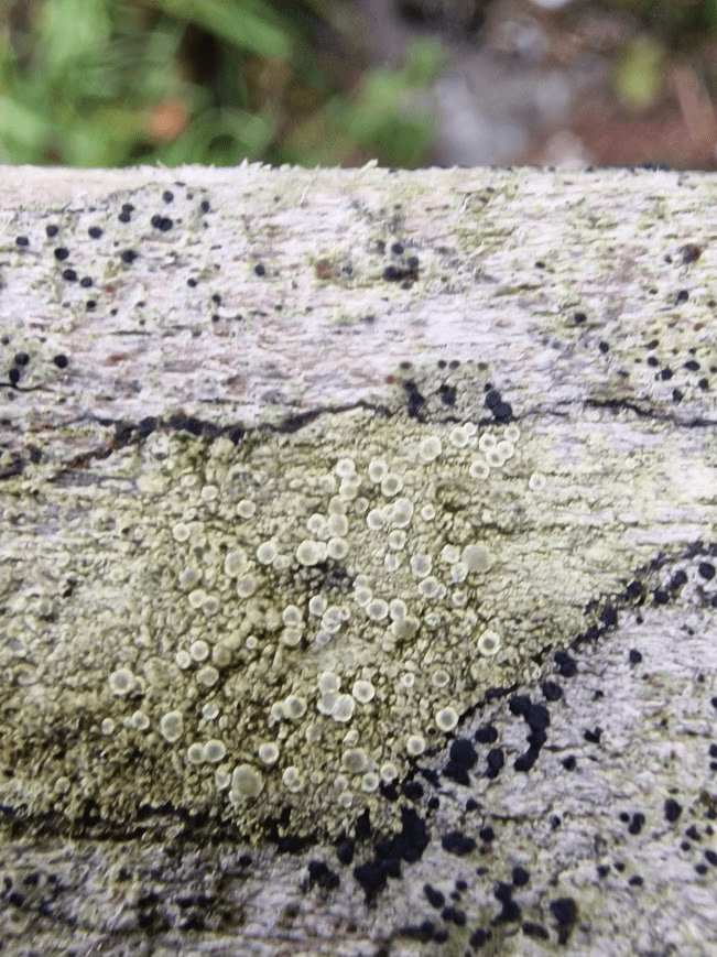
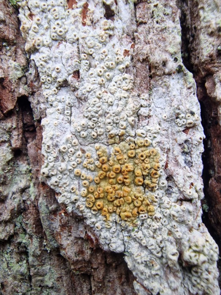
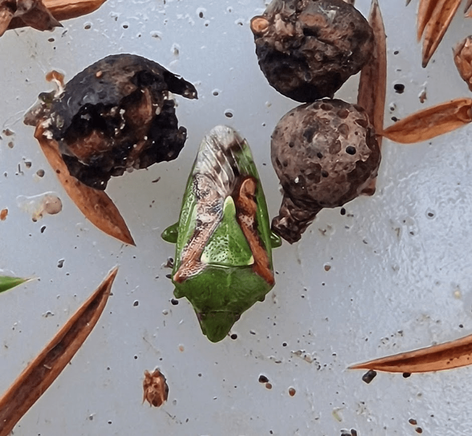
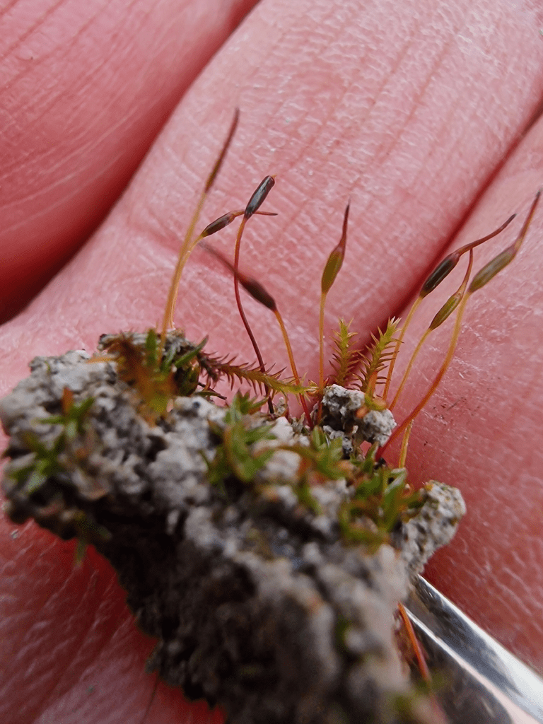
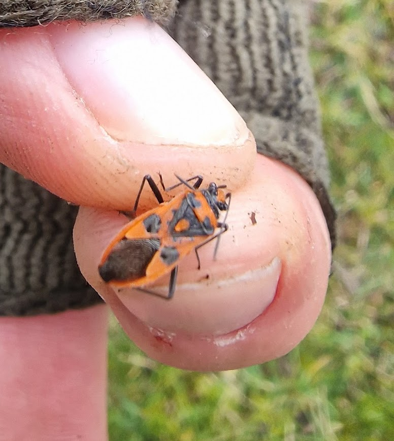
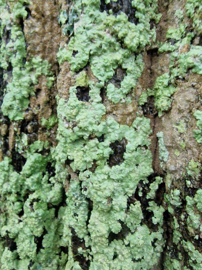
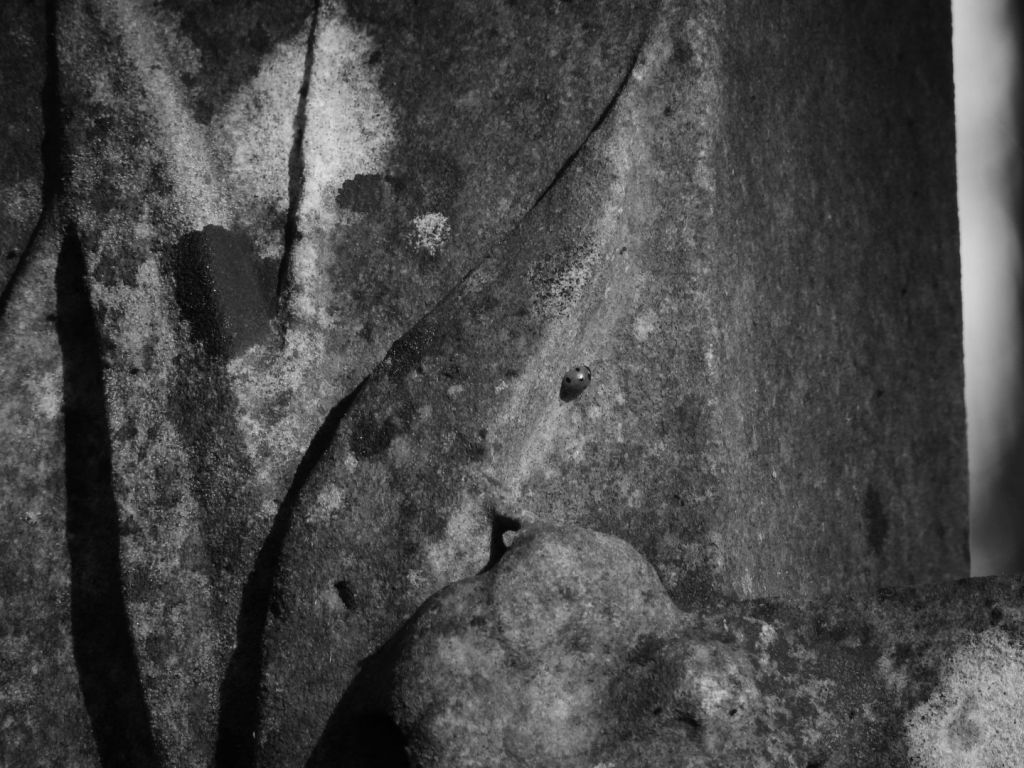
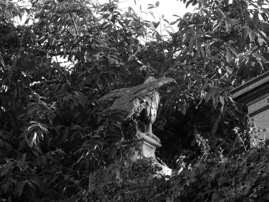
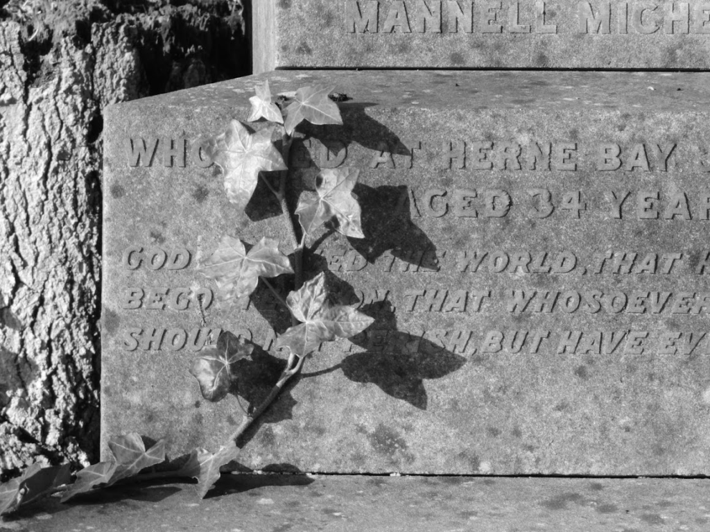
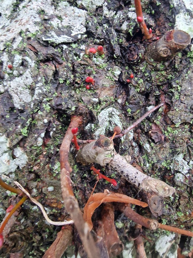
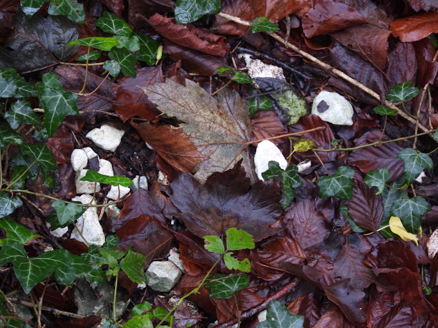
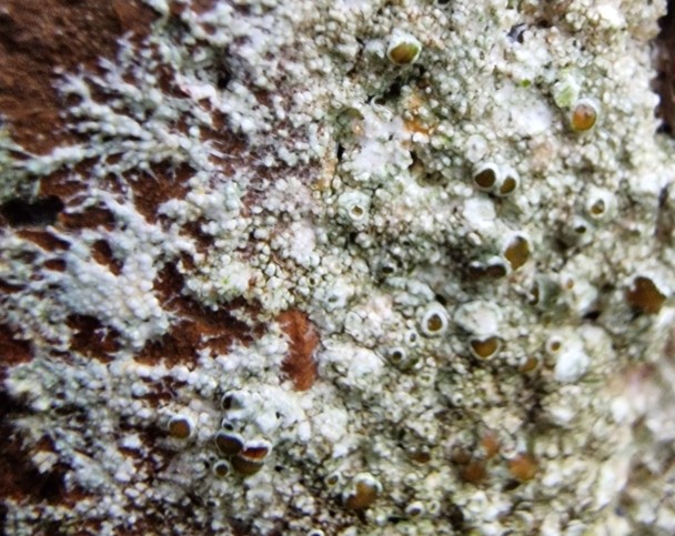
On Sycamore, on verge on Queensway, Craven Vale Estate, Brighton; surrounded by Xanthoria parietina, Lecanora chlarotera s.l., and Arthonia radiata
Habitat: Locally frequent on well-lit trees with basic bark. Now rare in many areas. Very sensitive to SO2 pollution and fertilizer-enrichment.
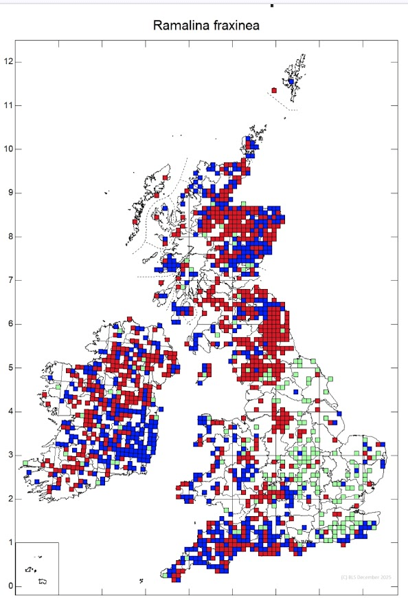
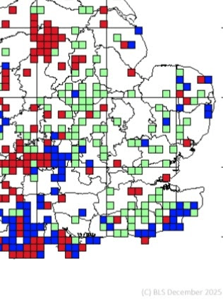
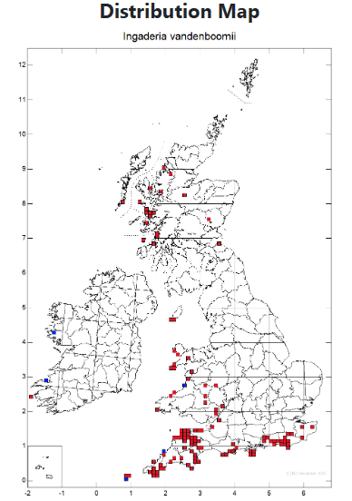
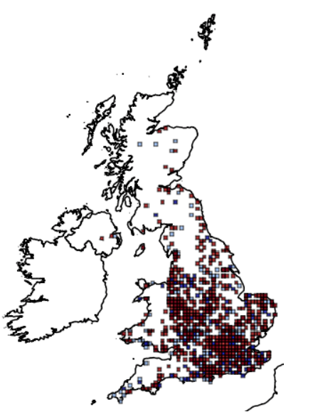
Distribution: East and South England (much decreased), northern England (increasing), Central and East Scotland and East Ireland.
Threats & Status: Declined in areas impacted by sulphur dioxide pollution in the 20th century, with limited recovery as yet, but some recolonisation has been noted
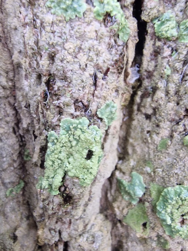
The term “International Responsibility” (IR) refers to lichen species whose populations in a specific country (e.g. the UK) are internationally significant. Because the national population is so important to the overall survival of the species, the nation has a special responsibility to protect it from extinction or decline.
A country can only look after an IR species if we know where they are. This lichen is not on the BLS database yet (I will record it). But we don’t know where important lichens are because there is inadequate recording of lichens in the UK.
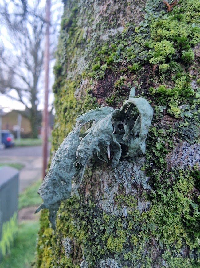
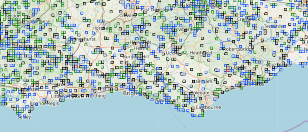
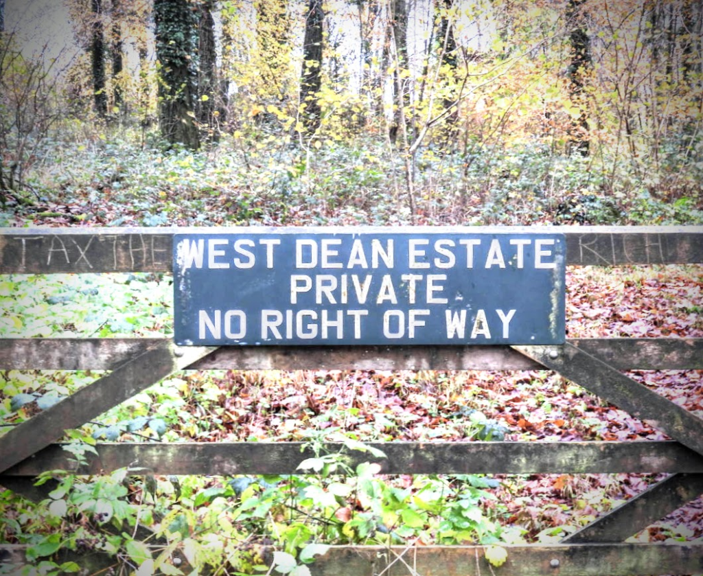
There are 62946 individual lichen records on the British Lichen Society’s database for East & West Sussex (as of 2022). All of these appear to be from rural areas; mostly woodlands, churches and deer parks; none of these records appear to come from urban areas. This is a result of an unconscious bias for rural areas and against urban area, that I am guilty of too. I would much rather walk around a beautiful ancient deer park or a wood or a churchyard than a town. I have seen R. fraxinea in two places in Sussex – in the High Weald countryside, on the Ashburnham Estate, and in the town, in the Craven Vale council estate, Brighton. From this statistically insignificant sample size; you could conclude that you are as likely to see R. fraxinea in an urban setting as a rural setting!
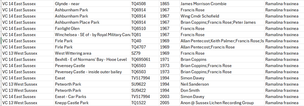
These are the Sussex records for Ramalina fraxinea. They are only 17 R. fraxinea records in 12 places; all of them rural.
I
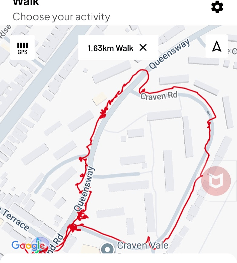
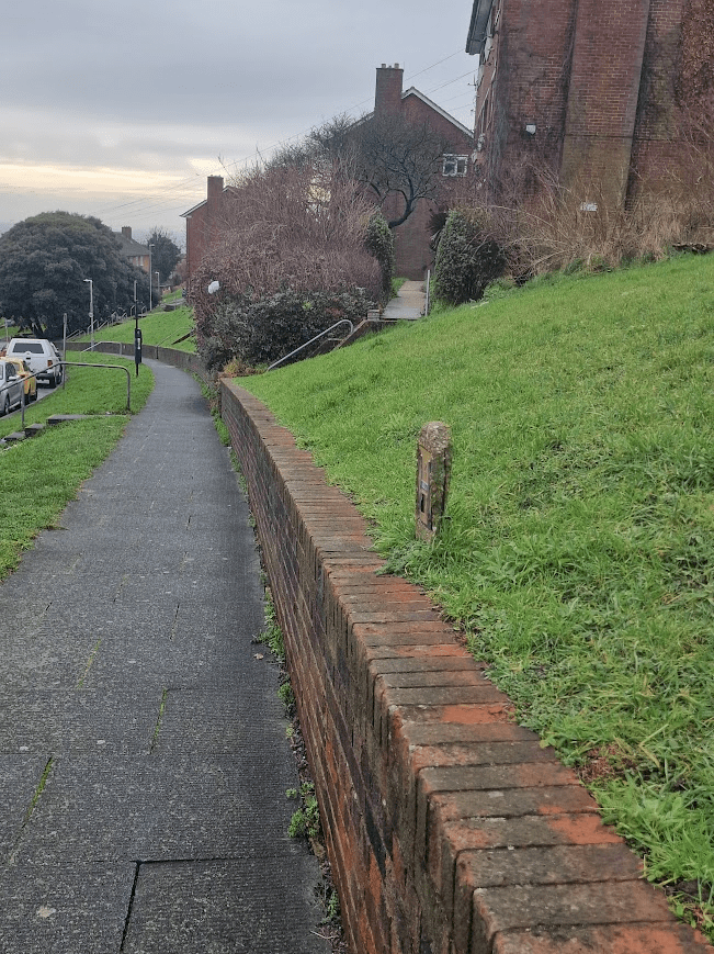
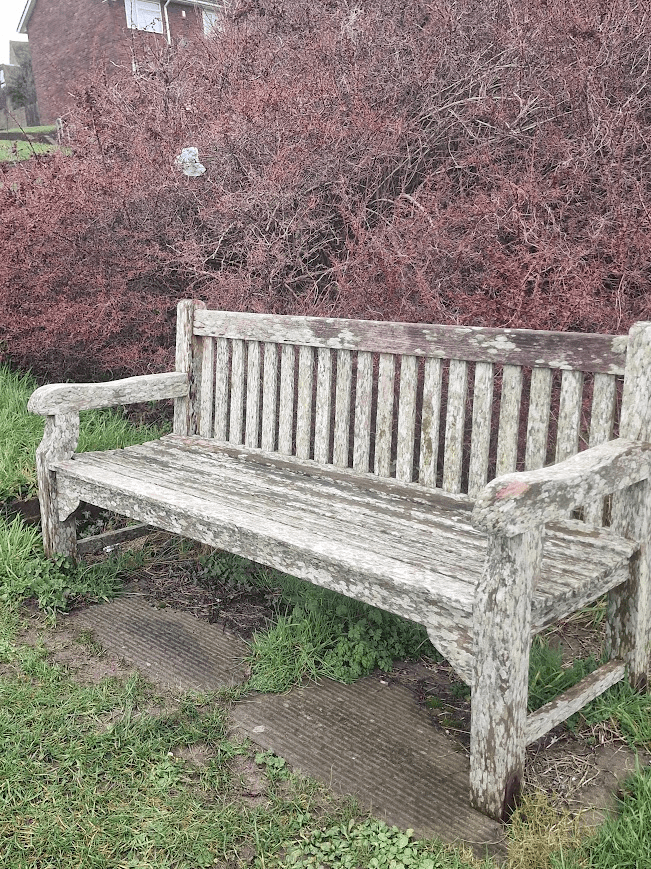
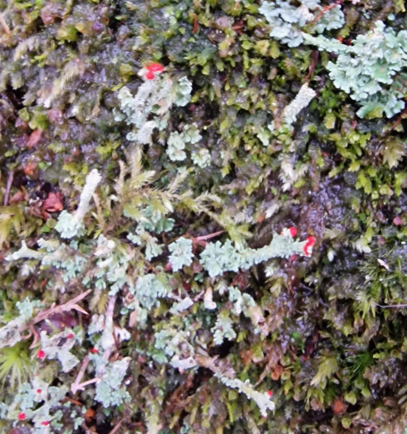
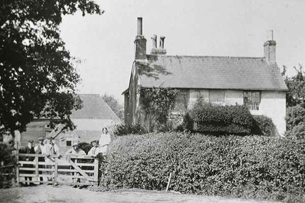
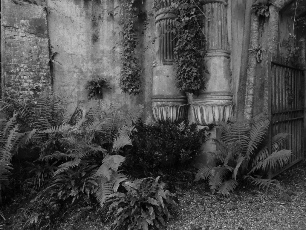
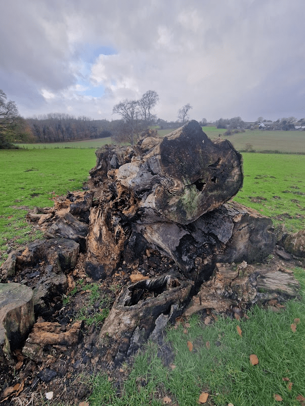
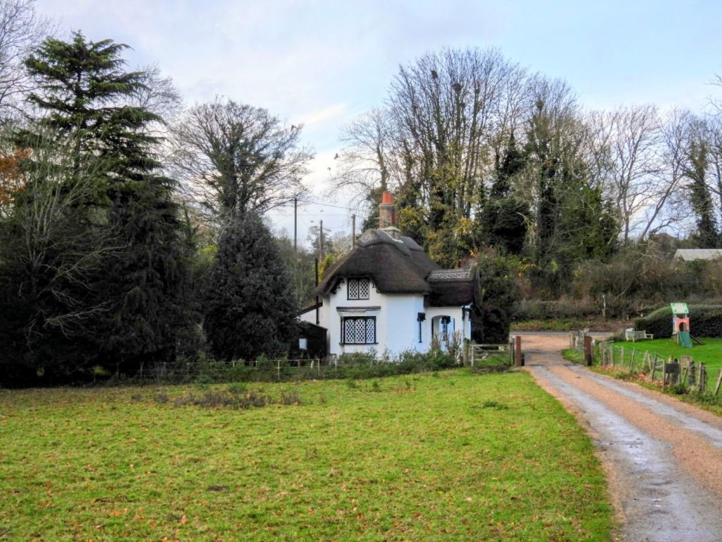
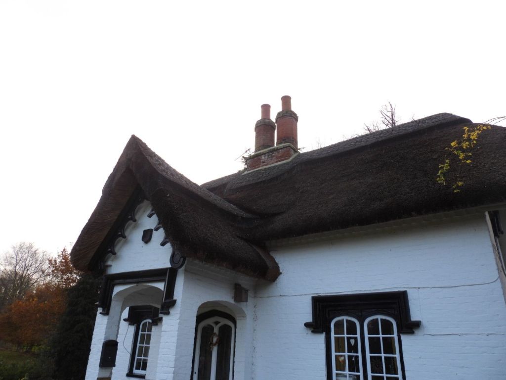
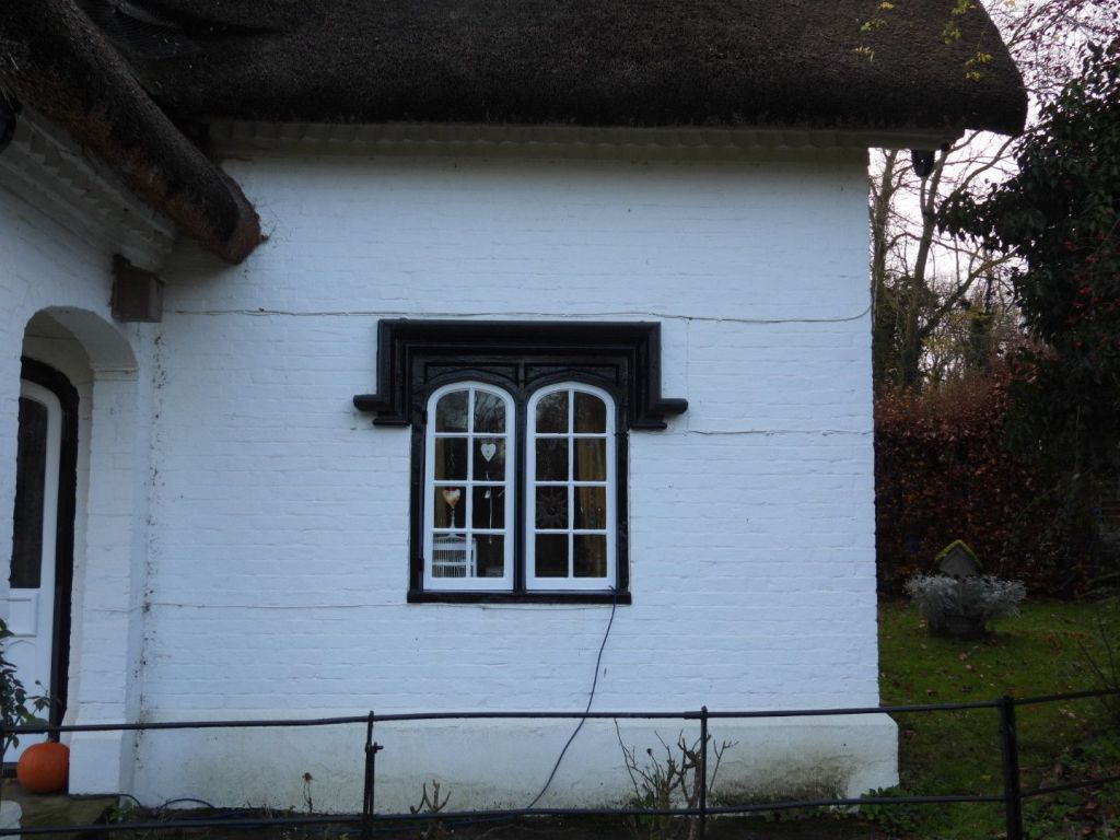
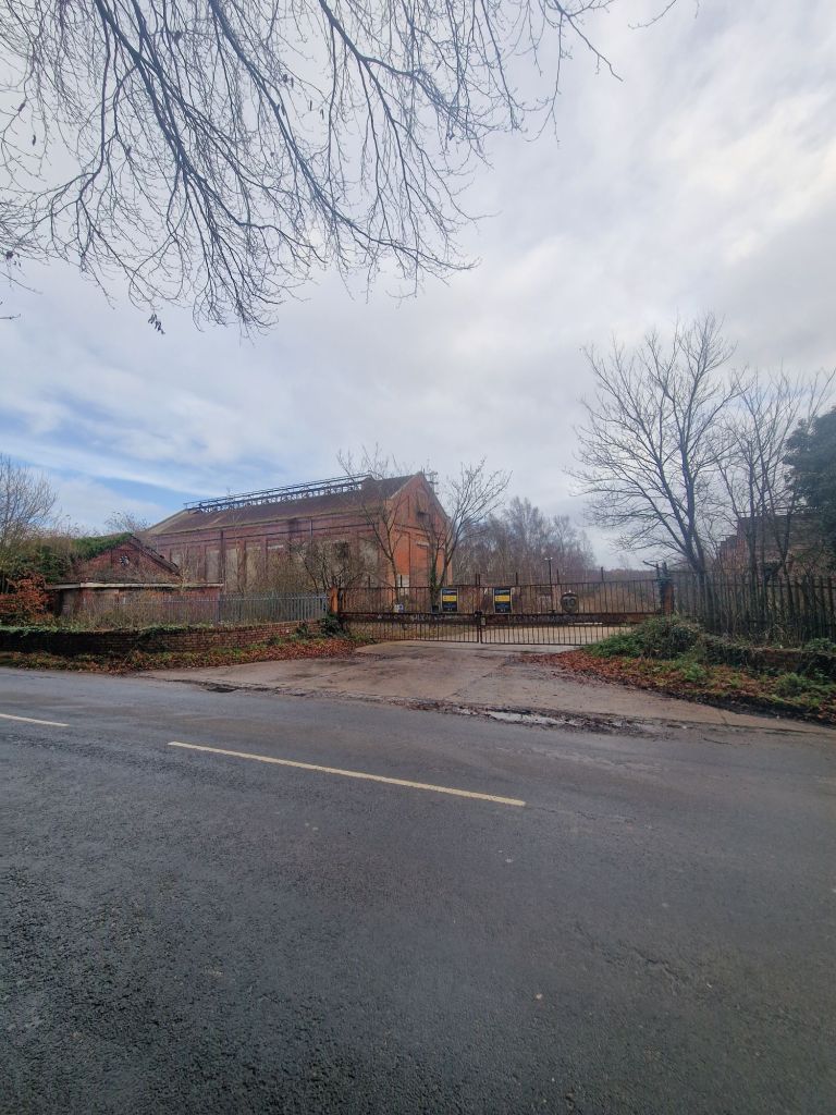
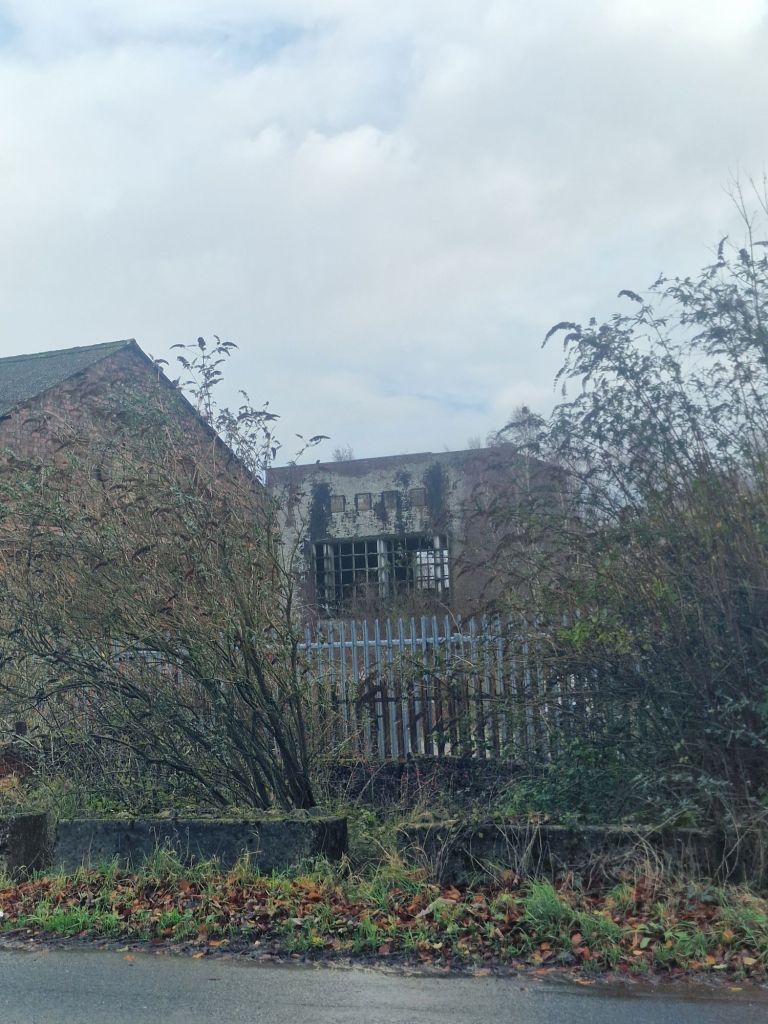
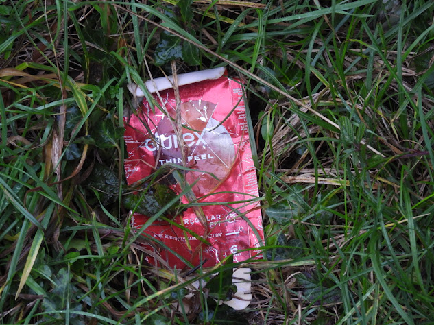
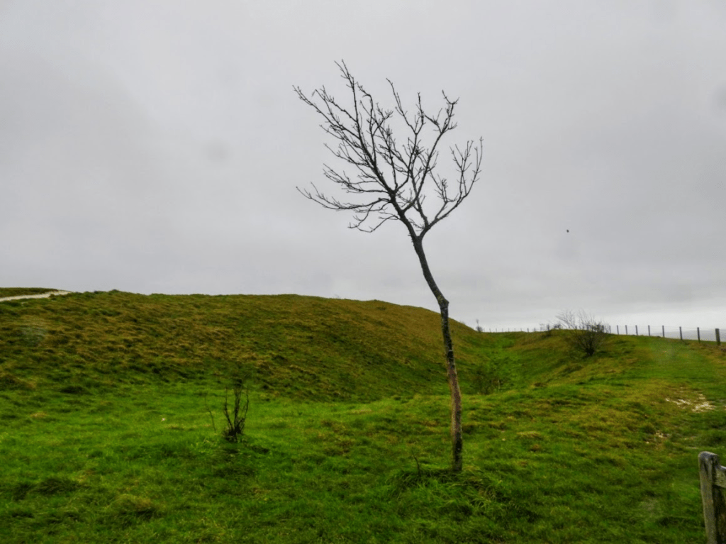
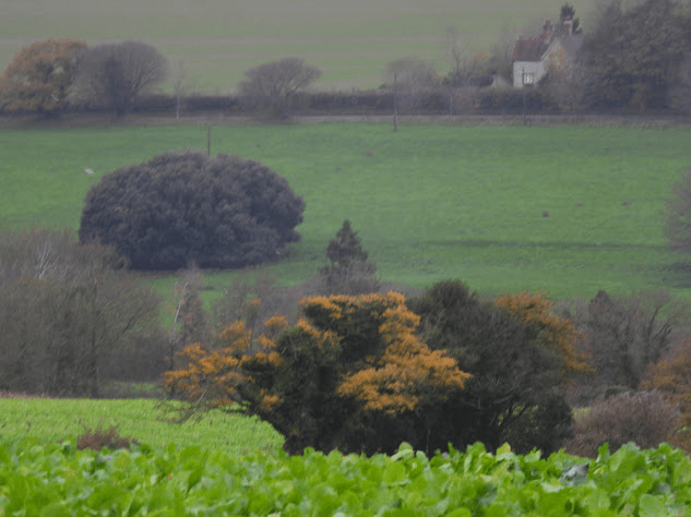
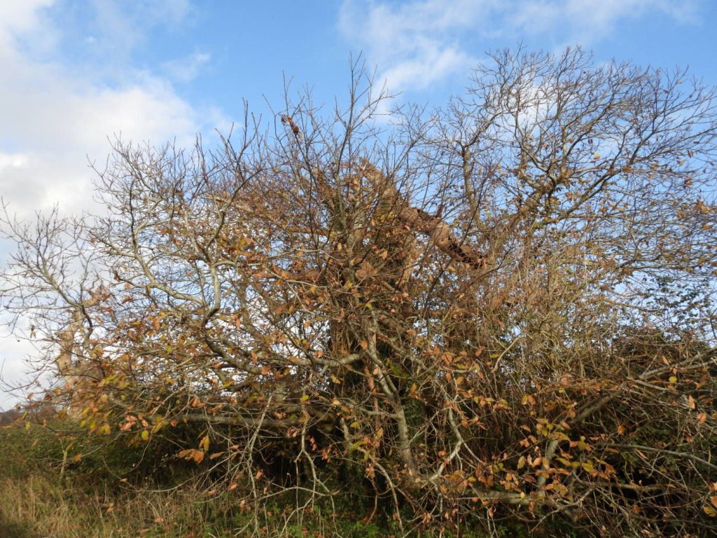
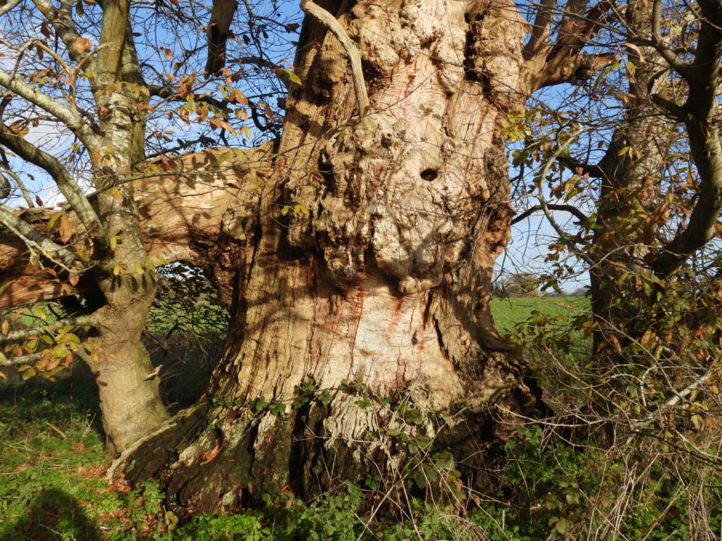
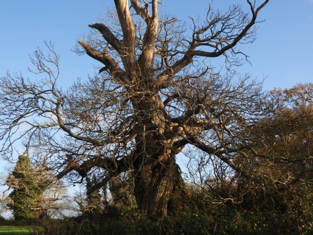
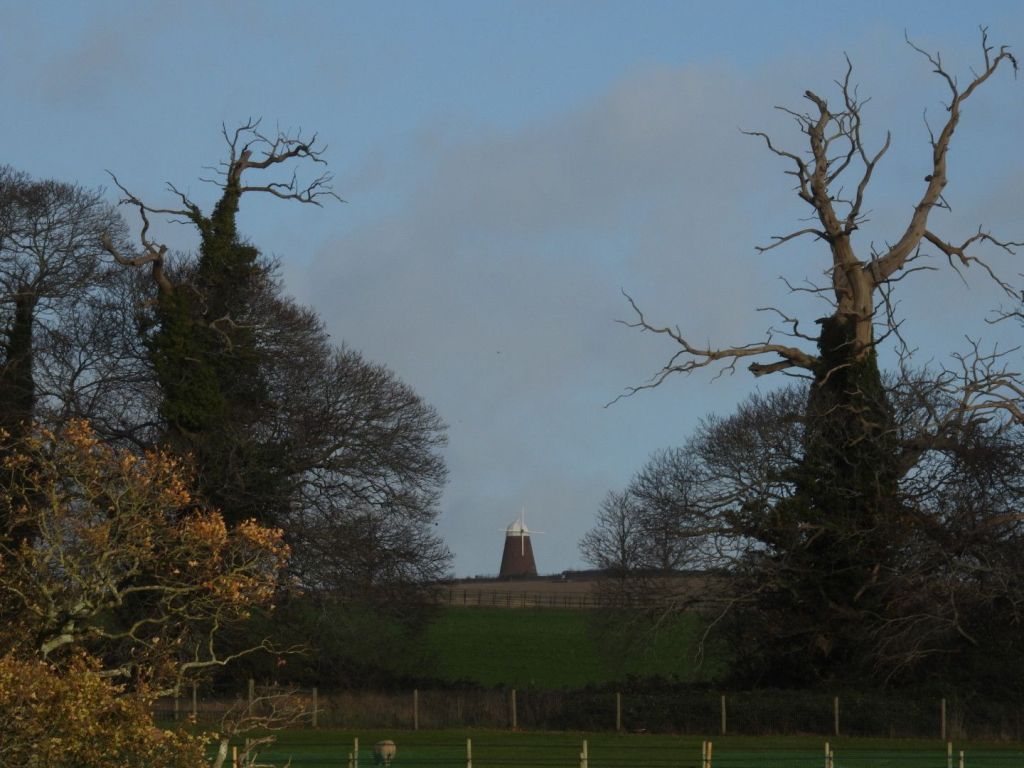
n one hour of walking round the Craven Vale estate this afternoon I saw 25 lichens, many in large abundance, on road trees, brick walls, recycled plastic (street signs), and worked wood (bollards and seats)
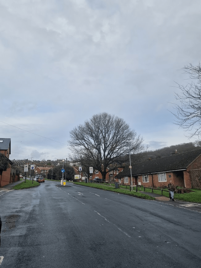
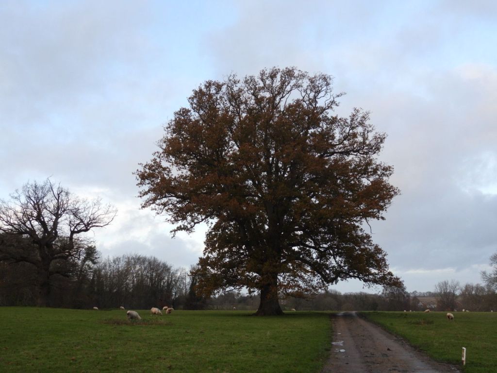
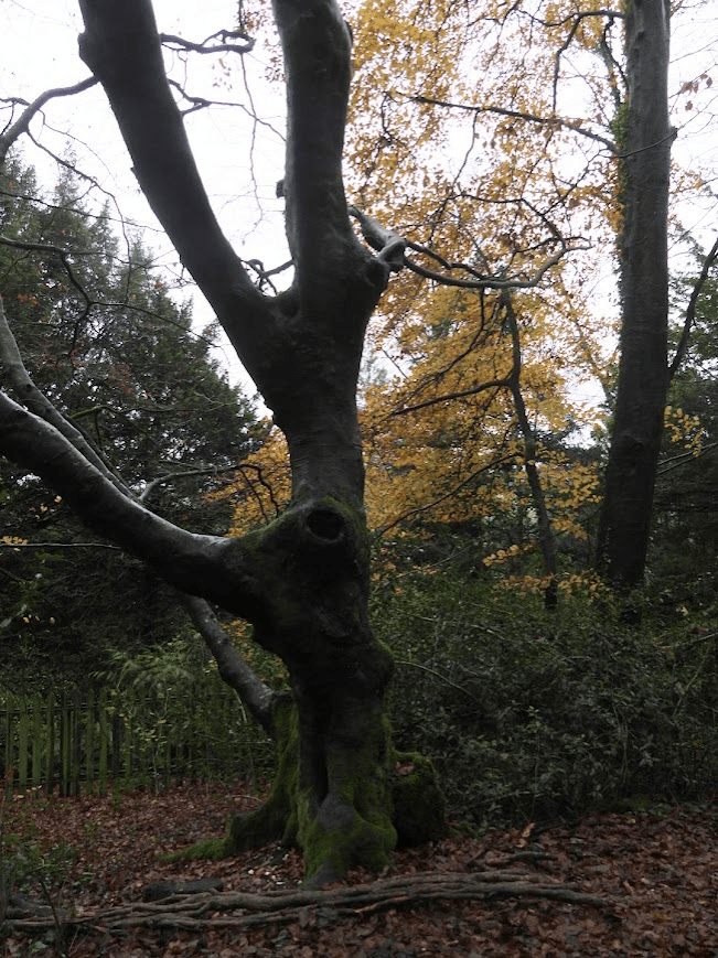
Looking up from my house. The large tree is an English Elm (Ulmus procera); these do not exist in the UK countryside any more as they have been killed by Elm Disease. It only survives because of the cordon sanitaire thrown around the town in 1970 by Brighton Borough Council. This tree started its life probably as a field tree, in the land enclosed in ca. 1825 as agricultural land called Bakers Bottom (now called Craven Vale) a coombe sculptured out Sheep Down (now called Race Hill) by glacial melt water. The tree survived the land being turned into municipal allotments in 1923 and the building of the housing estate in the 1950s. That tree was around when my grandparents and great grandparent grew up in East Brighton.
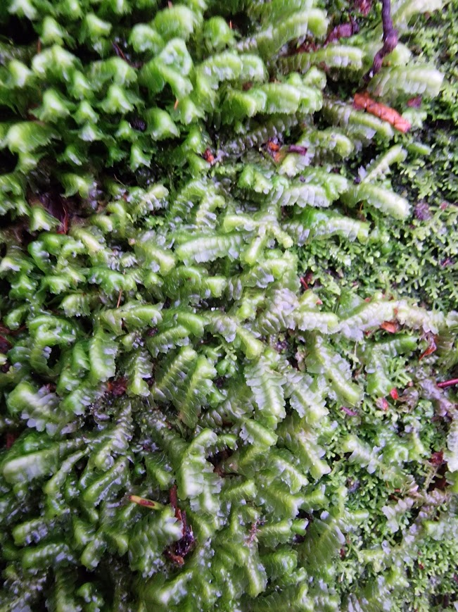
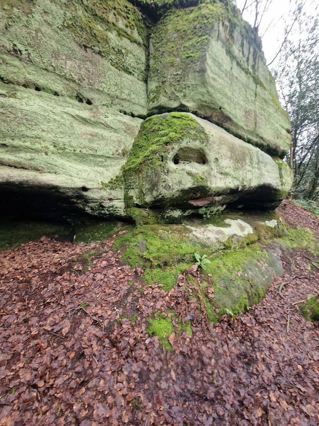
This is the first time I have seen B. trilobata in Lake Wood
A calcifuge, particularly characteristic of western oak woodland, where in humid conditions it can be locally dominant in the bryophyte layer, forming large, deep cushions on banks, boulders, cliffs and rocky outcrops. Plagiochila spinulosa and Scapania gracilis are common associates. It also grows on deep humus and brown earth soils, especially in grazed woodland, as well as on logs; it is occasionally arboreal. In SE England it is mainly associated with sandstone rocks in shaded valleys. British Bryology Society Bazzabia trilobata
I have only seen B. trilobata in two other places in Sussex: Eridge Rocks and Chiddingly. All of these three locations are High Weald ghyll woods; a location which matches the humidity level of Atlantic Woodland because of its ghyll, despite lower precipitation.
Thelotrema lueckingii
Previously I thought this huge patch of Thelotrema on Quercus robur was Thelotrema lepadinum but I hadn’t tested it with chemical reagents. Today I tested its thallus with potassium hydroxide; it was dark yellow. T. lepadinum tests negative to potassium hydroxide; but T. leuckingii tests red to potassium hydroxide. This tested dark yellow. So it may be Thelotrema lueckingii?
Cladonia polydactyla
On mossy bank (over Ardingly sandorck)
Pertusaria pertusa
On Hornbeam
Usnea cornuta
On Pedunculate Oak
Cladonia coniocraea
On dead tree stump; the most likely place you’ll see C. coniocraea in Sussex.
These organisms were found on a British Bryological Society South East Group (Sussex Bryophytes) field meeting. I would really recommend attending these meetings; they are very friendly and very accommodating of beginner bryologists (like me!). With us yesterday was pan-species listing guru Graeme Lyons. The bryologists Ben Bennat, Sue Rubinstein and Brad Scott made all the bryophyte identifications. My specific interests in natural history are birds and lichens; but I am trying to take a pan-species listing approach. No one can be an expert in everything so taking a pan-species listing approach is also an opportunity for social natural history; learning from others who know much more about specific areas of biology than you. My interest in pan-species listing is not the opportunity it provides for listing large numbers of species, but the opportunity it provides to learn more about your own patch and thus travel less, and thus minimise your carbon omissions. Local pan-species listing in your own patch means there will always be more things to find without having travel miles.
Lichens of southerly downland churches: Sullington St Mary’s Church
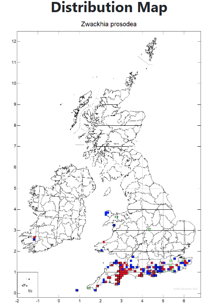
Zwachhia prosodea on ancient yew. A Near Threatened (Red List) Nationally Scarce lichen. This is not a species specifically of chalk but it is very much a species of the south. It grows on ancient trees – mostly Pedunculate Oak and Yew; but I have only seen in on Yew, all in church yards – East Chiltington, Coldwalhtam and Sullington. It is a Graphidaceae family lichen. Typically this family of lichens can only be identified by spore microscopy; but Z. prosodea has such distinct lirellate apothecia (writing-like fruiting bodies) it can be identified morphologically.
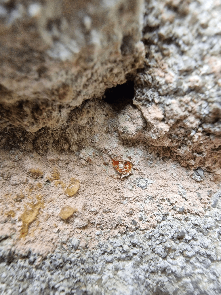
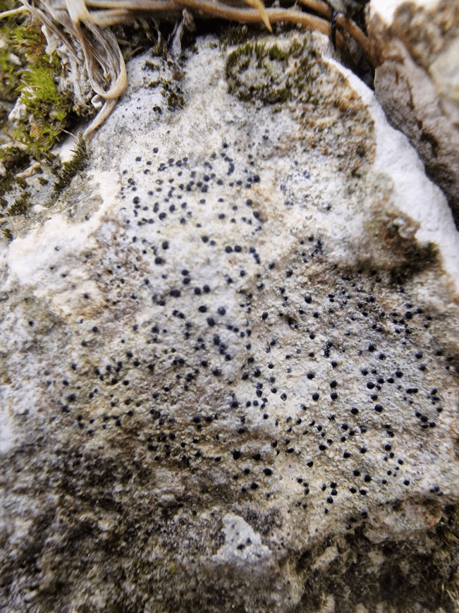
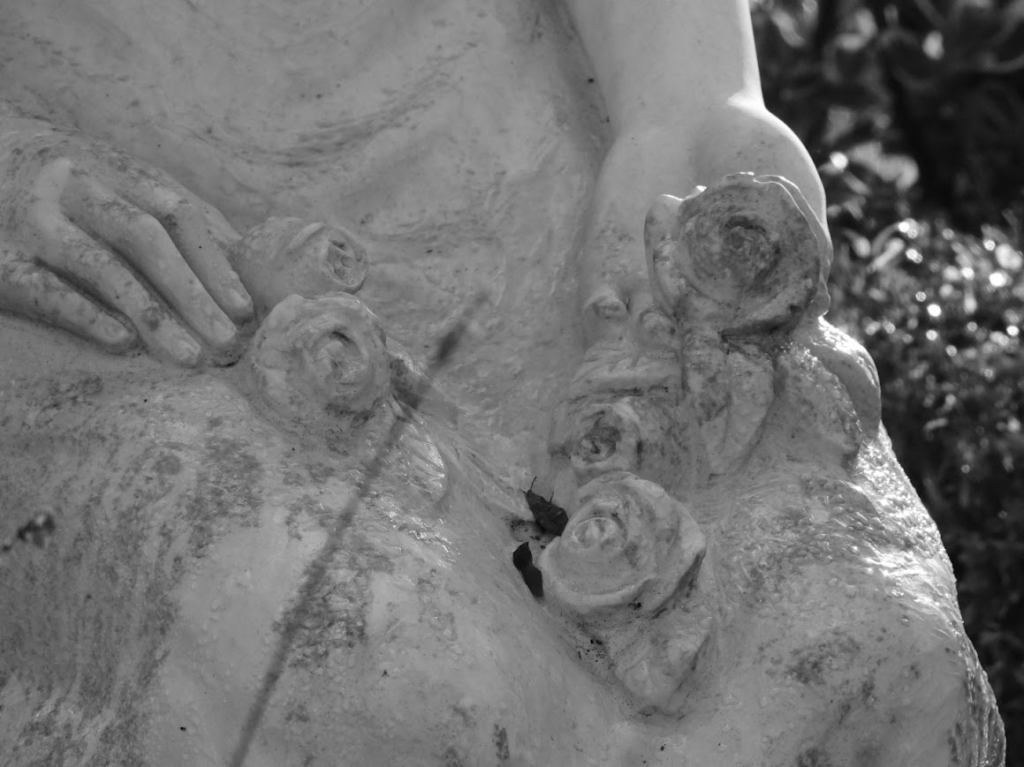
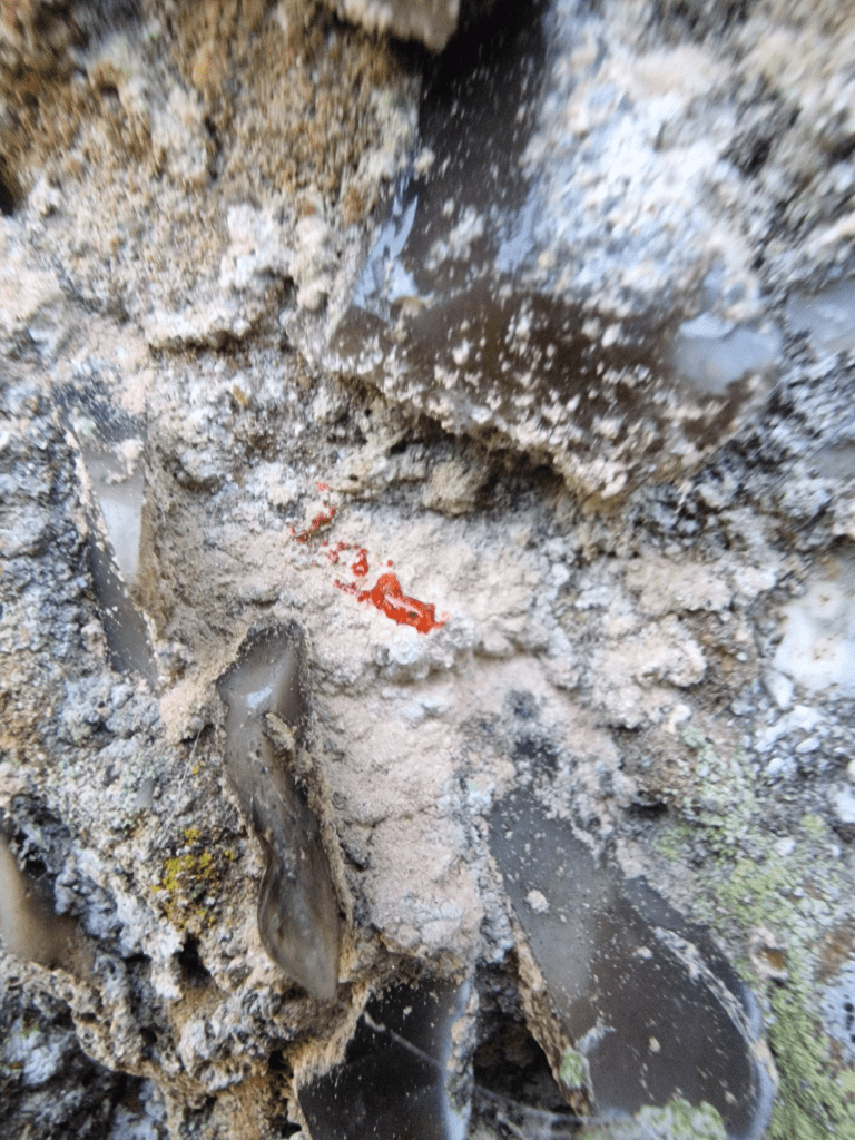
Ingaderia vandenboomii on north wall of church. Again not a species of chalk but a species of the far south. A Nationally Scare lichen but I find it quite often on the north walls of Sussex flint and mortar churches near the coast; I have seen it on the north walls of St Peter’s, Southease; St Thomas à Becket’s, Pagham; St Nicholas Church, Bramber; and St Mary the Virgin, Stopham. Identification of this lichen is by spot reagent chemical tests. It doesn’t react to potassium hydroxide (left drops on photo); but turns red immediately to sodium hypochlorite (centre drop on photo)
Lichens of Chalk Downland
Cladonia furcata. Not a species specifically of chalk, but one of the few Cladonia species found on chalk grassland.
Enchylium tenax Distributed throughout the British and Ireland but more common in the south. Not a lichen specific to chalk; but one of the few jelly lichens that grow on chalk
Verrucaria muralis Very widely distributed. Not a lichen specific to chalk; but one of the few lichens that grow on chalk pebbles, and is abundant on chalk pebbles. Oliver L. Gilbert (1993). The Lichens Of Chalk Grassland Lichenologist 25(4): 379-414 is one of the very few articles on lichens of chalk. This is a provisional identification as spore microscopy is required to confirm the identification; but its morphology and its abundance on chalk pebbles according to Gilbert make it highly likely that this is V. muralis
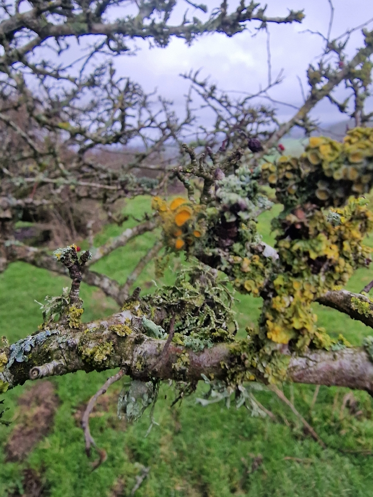
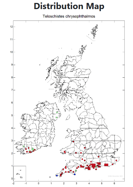
Teloschistes chrysophthalmusGolden-eye Lichen on Hawthorn. I see Golden-Eye frequently on Hawthorns of the South Downs, particularly on the downs north of Brighton and Lewes
None of these identifications were made by me; they were all made by Ben Bennat, Sue Rubinstein and/ Brad Scott
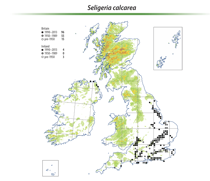
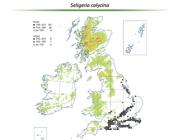
Seligeria calcarea Chalk Rock-Bristle orS. calycina English Rock-bristle – to be confirmed. on a shaded chalk bank in a holloway bostal
A Seligeria on chalk fragments in a sheltered place, such as a north-facing holloway bank or a woodland floor, is almost certainly going to be either this species or S. calycina. Because the plants are so small, this species pair is not always easy to separate in the field, unless dehisced capsules are present (usually March to April). Then you will easily see that the capsule of S. calcarea is widest at the mouth. Capsules of S. calycina characteristically narrow a little at the mouth when mature. Beware though – like many mosses, capsule shape does not develop fully until the spores are ripe.British Bryological Society Seligeria calcarea
Aloina aloides Common Aloe-Moss
Not solely chalk but A species of bare but not regularly disturbed ground and soil in a variety of situations, usually base-rich, but occasionally on ground that appears to be circumneutral. The most characteristic habitat is in old pits and quarries on chalk and limestone, growing on the floor or on earthy rock ledges, but it is also frequent in some districts on old or weathered mortar on walls and ruined buildings. .. It is occasionally found on bare patches in calcareous grassland and on soil on natural rock outcrops; other habitats include chalky and earthy banks by lanes, coastal slopes and cliffs, clay in brick pits, calcareous dune sand and gravel, and path edges and earthy rubble (here often only as a temporary colonist). British Bryological Society Aloina aloides
Pleurochaete squarrosa Side-fruited Crisp-moss
Grows loosely tufted or scattered and mixed with other plants on sandy or calcareous ground. Usually found in unshaded habitats in sand dunes, maritime grassland on cliffs, chalk and limestone grassland, and in chalk and limestone quarries.British Bryology Society Pleurochaete squarrosa
Orthotrichum anomalum Anomalous Bristle-Moss
OK! Not a chalk moss; but what a beauty; on a tomb stone in Sullington churchyard. more or less ubiquitous on concrete, gravestones, wall tops and other man made structures except in the most polluted parts of Britain. Also common on exposed limestone, but absent from chalk. British Bryology Society Orthotrichum anomalum
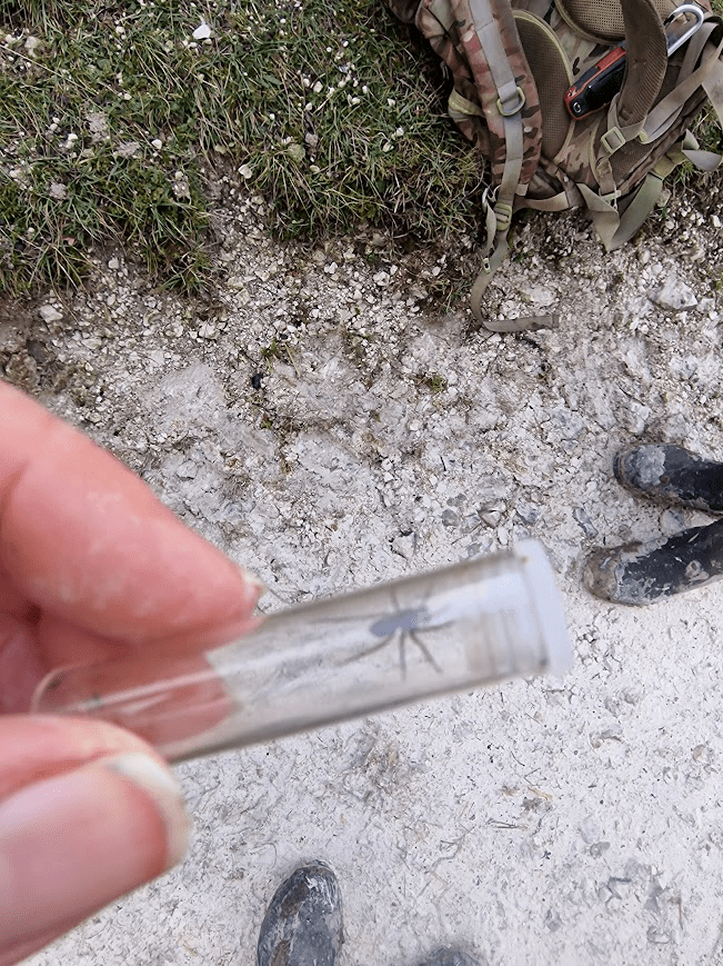
Invertebrates
All identified by Graeme Lyons
Cyphostethus tristriatus Junipers Shield Bug.
Formerly a southern shieldbug but has had a significant range extension of late. Formerly restricted to Juniper woods in southern England, the Juniper Shieldbug (Cyphostethus tristriatus) is now common across southern and central England, having colonised planted Junipers and Cypresses in gardens. It has also been recorded on native Juniper in northern England and Scotland.North West Invertebrates, Juniper Shieldbug
Although historically confined to the coasts of southern Britain, this species is now found inland throughout England and Wales as far north as Yorkshire. It is associated with a range of plants, and overwinters as an adult, the new generation appearing in August-September. Nymphs are yellow/red-brown in colour and also rather hairy.British Bugs Corizus hyoscyami
Music composed by David Fanshawe for David Gladwell’s film 1975 Requiem for a Village.
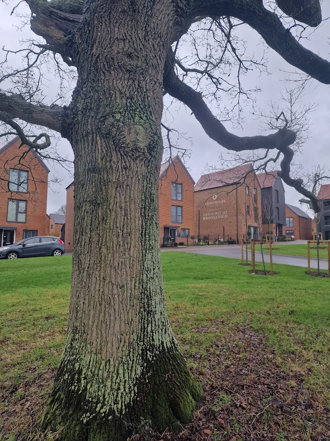
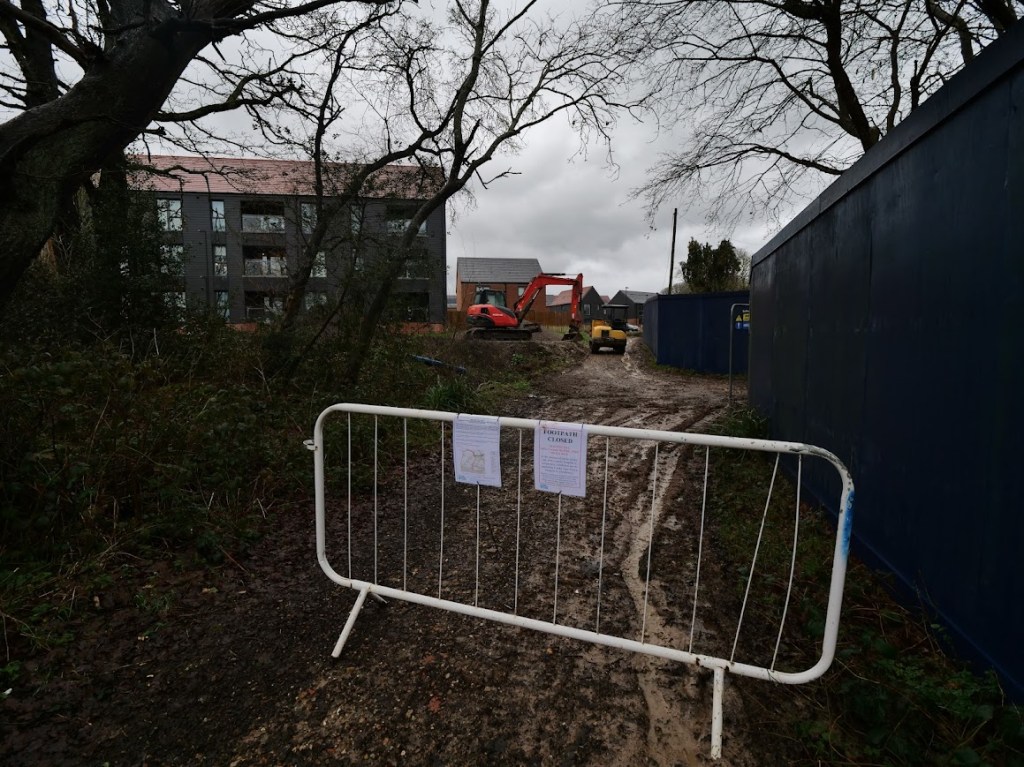
Tree felling (out of sight) at the Oakhurst (Countryside Homes, The Hill Group) building site, Freek’s Lane.
A Pedunculate Oak that has thus far survived the felling; right outside the information kiosk/show home. I don’t think it will be felled, as it helps Countryside Homes (The Hill Group) to delude people that they are not buying a house on a new estate that has destroyed Low Weald countryside; but they are buying a house in the countryside.
Lichens on this tree:
Oak trees have long had a reputation for supporting a lot of other species but until recently we had no idea just how many and what those species were. Recent work has listed 2300 species associated with oak, of which 320 are only found on oak and a further 229 species are rarely found on species other than oak.James Hutton Institute Decline of Oak
In the Oakhurst (Brookleigh, Countryside Homes, The Hill Group) information kiosk (in show home):
Me: how much is the cheapest house in Oakhurst?
Salesperson: £425,000
The average household income in Burgess Hill is £59,100 p.a. The cheapest house in Oakhurst is 7 x that; more than most mortgage lenders are prepared to lend. The average annual salary of agricultural worker in the South East of England is £25,000. The cheapest house in Oakhurst is 17 x that. In 2023, Andy [Hill, CEO of The Hill Group] remarkable achievements were recognised in the King’s New Year’s Honours List, in which he was awarded an OBE for services to affordable housing. https://www.aru.ac.uk/graduation-and-alumni/honorary-award-holders2/andy-hill#:
Me: I need to think about that.
Salesperson: You’d like it here; its like living in the countryside
The outline planning application was approved by Mid Sussex District Council in October 2019. Brookleigh will deliver approximately 3,500 new homes, 30% of which will be affordable. Delivering Growth & Prosperity, Burgess Hill
The Hill Groups accounts 2023-24
Turnover: Reached a record £1,145.9 million (compared to £716.1 million in 2022).
Profit Before Tax: A record £70.1 million (compared to £65.6 million in 2022).
Net Assets: Increased to £368.9 million as of March 31, 2024.
Net Cash: £86.4 million, with £70 million drawn from a £220 million revolving credit facility.
Operational Performance: Delivered 2,886 homes during the period.
David Gladwell’s 1975 film Requiem for a Village, a poetic meditation on how the modern world’s rapid acceleration buries the past and with it the traditions, skills and knowledge that were at the heart of British life and its relationship to the landscape and countryside. Frank Collins 2011 British Cult Classics – Requiem for a Village / BFI Flipside Blu-ray Review
The film is currently available from on BFI Player (subscription required)
The destruction of the rural landscape of the Low Weald started with the coming of The London & Brighton railway, resulting in large population growth. The building of the railway started in 1838 and cut through several farms including Peppers Farm in Lye Lane (Leylands Road), Yew Tree Farm, Anchor Farm and Burgess Hill Farm. Between 1850 and 1880 the area changed from a relatively quiet rural backwater into a country town with a population of about 4500. … From 1952, when Second World War (1939-1945) controls on building were lifted, and strict planning and building regulations came into force, large scale expansion once more began. This process has continued with no significant break to the present time. The population almost doubled to 14,000 between 1951 and 1961. Much of Burgess Hill’s residential housing dates from this timeHistory of Burgess Hill, Burgess Hill Town Council retrieved 23.01.2026. Of late, the amount of development in the countryside around Burgess Hill has accelerated greatly, and will increase further with Labour’s obsession that empowering private developers to build, build, build, will produce affordable housing. It has not done so but Labour has facilitated building property developers; profits.
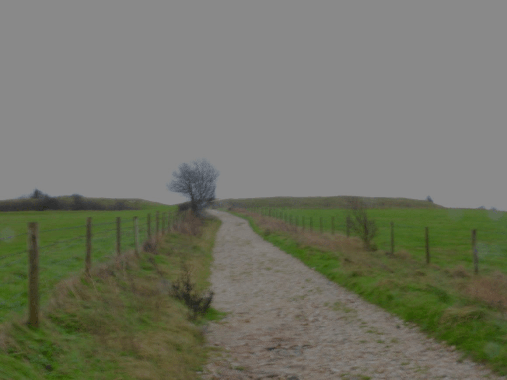
Today I walked along Freek’s Lane to the Oakhurst Estate; currently being built with some show homes open to view. But I could only get so far as the footpath (right of way), a former Roman Road – lined with hedgerow with superb ancient Pedunculate Oak – was closed to facilitate the building of the estate.
A restored barn nearby at Lowlands (formerly Freeks) – a name derived from the local rough woodland or Ferghthe as it was spelt when the land was first settled in the Anglo-Saxon period.
All the land on the east part of the town, east of Keymer Road and Junction Road, was … . all part of the great wood of Frekebergh which stretched north to what is now Worlds End. It was privately owned and actively managed by the lords of Keymer and Ditchling manors. The earliest farms they allowed (from around 1250 onwards) were on either side of Folders Lane and along the edge of Ditchling Common. The rest remained as woodland and coppice for much longer. A small farm lay at its northern end, its land reaching up as far as Janes Lane, which the lord of the manor kept in hand. It was mentioned in 1580 as having ‘a little house’ in it and its old well is still there in two front gardens in Stirling Court Road. This connection with the lord of the manor gave rise today to the local school name, ‘Manor Field’. Old hedgerow oaks, remnants of this once enormous wood of Frekebergh are still a strong feature within the St. Andrew’s Road housing estate. A small brick and tile business had grown up by the early 1700s on a site near the top of Cants Lane – at a slight remove from where the Keymer Brick and Tile Company was later developed.Burgess Hill Heritage and History History Association: Earlier History
The are only a few fragment of the Frekebergh Wood left; one being the Bedelands LNR Big Wood (which is a minuscule fragment of the Anglo-Saxon wood). Until recently much of the area around Freek’s Lane was woodland and wet meadow. Now much of the land around the lower part of Freek’s Lane is homogenous, hideous, unaffordable housing for the rich
The housing developments that are currently being undertaken around Burgess Hill include:
Oakhurst at Brookleigh (Countryside Homes): Features 2, 3, and 4-bedroom homes designed for modern, energy-efficient living.
Brookleigh (Northern Arc): A massive, long-term development on the north side of town, incorporating new schools, community infrastructure, and road improvements.
Fairbridge Way (Places for People/Ilke Homes): A 307-home development focusing on sustainable, factory-built
Kings Way (Persimmon Homes): A 480-home site in development with 30% affordable units,
Kings Weald (Croudace Homes): Located at the former Keymer Tiles site, this 475-home project is well advanced, with phases 1 and 2 completed and phase 3 in progress.
Templegate (Thakeham): Located between Keymer Road and Folders Lane, offering 2-4 bedroom homes
The Ordnance Survey Map, for 1872-1914 shows the former woodland and farmland around the railway line. Reproduced with the permission of the National Library of Scotland https://maps.nls.uk/
What was left of farm and woodland around 20 years ago
Surviving relicts of this wooded landscape:
Medieval hedgerow with Hornbeam, Pedunculate Oak and Wild Service trees. (Bedelands LNR)
Bedelands retains a little of what has been lost.
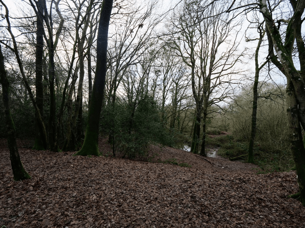
Bedelands and Freek’s Farm’smeadows, lags (wet meadows), ancient woods, riverine hangars and glades have magic most of all where the Roman road fords the young Adur, TQ 316 211. It is just as the Romans would have known it, though the only emperors to be seen are Emperor Dragonflies, with red and blue damsels, and Beautiful and Banded Demoiselles.
Heavy, May-scented Wild Service blossoms overhang the almost-stilled little river that is guarded by steep, wooded clay banks above grassy riverside plats. It only lacks Wild Boar prints in
In Freek Farm Wood, TQ 316 210, overlooking the fording, the Wild Service Tree is the most frequent remember seeing it, clustered along the bank top. All around in the wood are very tall Sessile Oak poles. I am used to seeing Sessile Oak woods in the High Weald… but here? in the Wealden clay vale? The wood has been managed for its Oaks, though there are remnants of struggling coppice of Hazel, Hornbeam and Holly. It is a shady, tranquil wood of Bluebell and Anemone with many other old woodland plants, like Field Rose on the boundary with Freek’s Farm meadow, TQ 316 209, which is archaic and colourful,
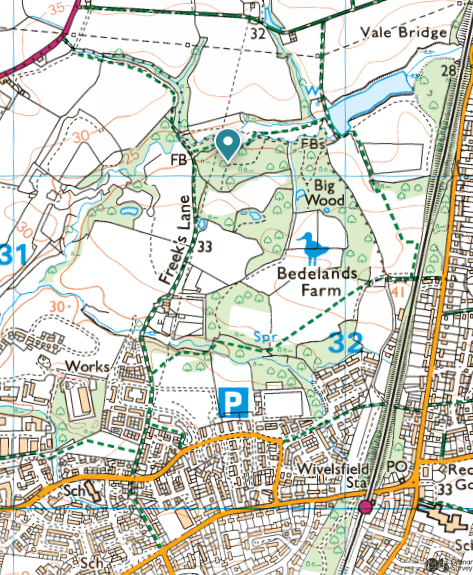
Big Wood, Watford Wood, Long Wood, and Leylands Wood, all on the neighbouring Local Nature Reserve, have many of the qualities of Freek Farm’s woods, but benefit from the management of the District Council and the Friends of Burgess Hill Green Circle. The Bluebells of Big Wood are a wonder.
It is the farmland to the west of Freek’s Lane that is being built upon. The ancient woodland of the Big Wood (Bedelands Farm LNR) and Freek’s Farm Wood (marked with a flag) will be squeezed between the existing housing east of the railway line and the new development west of Freek’s Lane
Woodland around the top of Freek Lane; Freek’s Farm Wood
MID SUSSEX DISTRICT COUNCIL DISTRICT WIDE PLANNING COMMITTEE 4 OCT 2018 extract
The Councils Ecological Consultant goes on to state “There is likely to be a need for protected species licensing from Natural England for a range of species. However, subject to appropriate mitigation design then, if MSDC considers there to be an overriding public interest case for granting consent (including reasons of a social or economic purpose), then it is likely, in my opinion, that licences will be obtainable.” Given the fact that this site is allocated for housing development this is a clear case where there is an overriding public interest in granting consent.
The Councils Ecological Consultant has advised that there will be additional visitor pressure on Bedelands Local Nature Reserve and that mitigation for this may need to include financial contributions to assist in its management and monitoring of visitor pressure. It is considered that this could be properly controlled by a planning condition that requires details of a management plan to be submitted to the LPA for approval. If the management plan requires off site works at Bedelands Local Nature Reserve (which might involve financial contributions) there should be no reason why these can’t be carried out because the District Council is the landowner of Bedelands.
The Councils Ecological Consultant concludes by stating that in his opinion, there are no biodiversity policy reasons for refusal, subject to conditions. Your officer has no reason to dispute his conclusions. It is considered that a suitably worded condition can ensure that the necessary ecological protection, mitigation and compensation measures are provided thus complying with policies DP37 and DP38 in the DP and the aims of the SPD’s in the Masterplan.
So even if you disregard the value of the farmland to be built on, the development will impact upon protected species and will add visitor pressure on Bedelands Nature Reserve (an island of ancient woodland in the middle of urbanization) but according to Mid Sussex District Council this is a clear case where there is an overriding public interest in granting consent.
What is the public interest in building homes that no-one in Burgess Hill can afford and enrich already rich property developers at the expense of nature and farm land? If the state itself was building social housing for social rents there may be a public interest to build on farmland.
Local and central government disregard for nature was written about by Larkin in 1972
Going, Going, Philip Larkin, 1972
I thought it would last my time – The sense that, beyond the town, There would always be fields and farms, Where the village louts could climb Such trees as were not cut down; I knew there’d be false alarms
In the papers about old streets And split level shopping, but some Have always been left so far; And when the old part retreats As the bleak high-risers come We can always escape in the car.
Things are tougher than we are, just As earth will always respond However we mess it about; Chuck filth in the sea, if you must: The tides will be clean beyond. – But what do I feel now? Doubt?
Or age, simply? The crowd Is young in the M1 cafe; Their kids are screaming for more – More houses, more parking allowed, More caravan sites, more pay. On the Business Page, a score
Of spectacled grins approve Some takeover bid that entails Five per cent profit (and ten Per cent more in the estuaries): move Your works to the unspoilt dales (Grey area grants)! And when
You try to get near the sea In summer . . . It seems, just now, To be happening so very fast; Despite all the land left free For the first time I feel somehow That it isn’t going to last,
That before I snuff it, the whole Boiling will be bricked in Except for the tourist parts – First slum of Europe: a role It won’t be hard to win, With a cast of crooks and tarts.
And that will be England gone, The shadows, the meadows, the lanes, The guildhalls, the carved choirs. There’ll be books; it will linger on In galleries; but all that remains For us will be concrete and tyres.
Most things are never meant. This won’t be, most likely; but greeds And garbage are too thick-strewn To be swept up now, or invent Excuses that make them all needs. I just think it will happen, soon.
Larkin predicts the Grey Belt; not an actual policy until Labour invented it: Labour’s “grey belt” policy, introduced in 2024, identifies low-quality, “under-utilised” areas within the protected Green Belt—such as disused car parks, neglected scrubland, and petrol stations—for accelerated housing development. This strategy aims to deliver up to 200,000 homes by easing planning restrictions on these specific sites.BBC 8 July 2024 What is the ‘grey belt’ and how many homes could Labour build on it?
In practice, the government’s “grey belt” policy has not been about building on petrol stations but an existential threat to the protections of the Green Belt. Our latest research shows that the policy is vague, subjective and misleading to the public. Its lack of clarity has been good news for large housebuilders but bad news for everyone who loves the countryside. Council for the Protection of Rural England
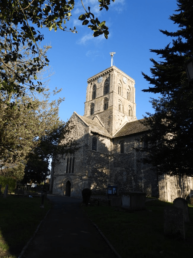
The church of Mary de Haura [de havre; of the harbour] was built built between ca. 1125 to ca. 1219, with funds from the 2nd Baron of Bramber, when he returned from the First Crusade Sussex: West, Pevsner Architectural Guides, The Building of England revised (2019) by Williamson, Hudson, Musson & Nairns. The de Broase were the Barons of Briouze in Normany, made Barons of the Norman Rape of Bramber by William the Conqueror. The port fees from Shoreham harbour, built by the First Baron of Bramber also funded the long building of St Mary de Haura
The exterior of the church:
The port was of great importance to the new Norman rulers as Shoreham was one of the main ports for Normandy. As a consequence, the Adur valley is aid to have been one of the three most densely populated parts of England (G Standing p93). …, the river silted up and a new port was built on the coast, protected by the de Braoses of Bramber. Its church … was granted to Saumur in 1096 (VCH 6(1) p168) to which the de Braoses had links through their foundation of Sele priory at Upper Beeding.
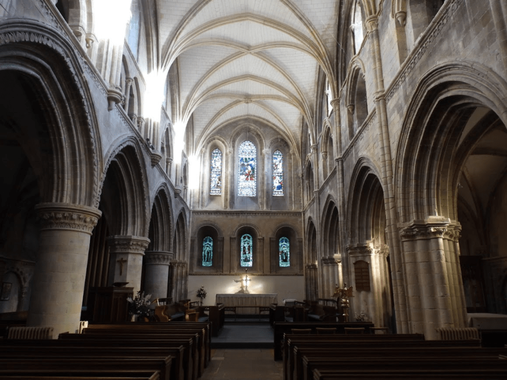
The transepts, crossing and lower tower were built between about 1125 and 1140, followed by a mid-C12 nave of which less than a bay remains [most of the nave was demolished]. The upper tower followed shortly after and the choir was rebuilt, probably between 1180 and 1210. Despite many puzzles, it contains some of the finest work of the period in England. Shoreham Sussex Parish Churches Mary de Haura, New Shoreham, retrieved 02.12.26.
The sculptured foliage which this post focusses on, are mainly in the choir. When I revisited St Mary de Haura in December 2025 (I have visited the church many times) what really struck me, was the sheer abundance of carved foliage in the choir.
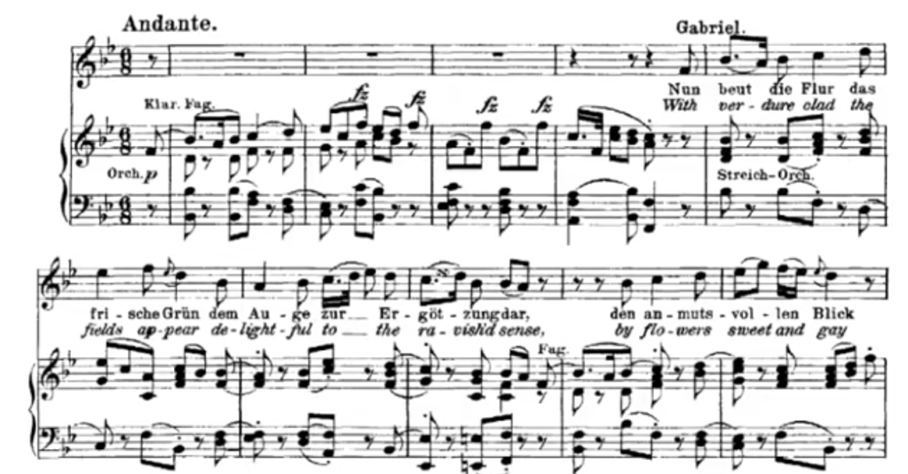
The lyric with verdure clad from Haydn’s oratorio The Creation, popped into my head. The availability of that lyric to my memory was probably because discussion of the origins of the lyrics of The Creation formed a large part of my A level music lessons (1978-80) at Brighton and Hove VIth Form College as The Creation was one of the set compositions for the examination. The Creation was written between 1796 and 1798 and celebrates the creation of the world. The original English libretto by Johann Peter Salomon was given to Haydn in 1795. It is derived from the Book of Genesis (King James Version) and Milton’s Paradise Lost. The original English libretto was translated into German by Baron Gottfried van Swieten for Haydn. But the common English version sung today is a re-translation from that German translation, which leads to some clunky language e.g. with verdure clad the fields appear and straight opening her fertile womb, the earth obeys the word, and teems with creatures numberless, in perfect forms and fully grown. Cheerfully roaring, stands the tawny lion. With sudden leaps the flexible tiger appears.
The aria With verdure clad the fields appear is sung by the archangel Gabriel (typically by a woman a soprano soloist). It describes the creation of plant life on the third day, celebrating the beauty and abundance of nature, including fragrant herbs, healing plants, and fruit-laden boughs
With verdure clad the fields appear delightful to the ravish’d sense; by flowers sweet and gay enhanced is the charming sight. Here vent their fumes the fragrant herbs; here shoots the healing plant. By load of fruits th’expanded boughs are press’d; To shady vaults are bent the tufty groves; The mountain’s brow is crown’d with closed wood. Retrieved from The Choral Art Alliance of Missouri. Haydn’s Creation Lyrics 03.01.26. You can listen to Emma Kirby’s performance of the aria with The Academy of Ancient Music conducted by Christopher Hogwood at https://www.youtube.com/watch?v=IqKGFtTGUXY&t=16s
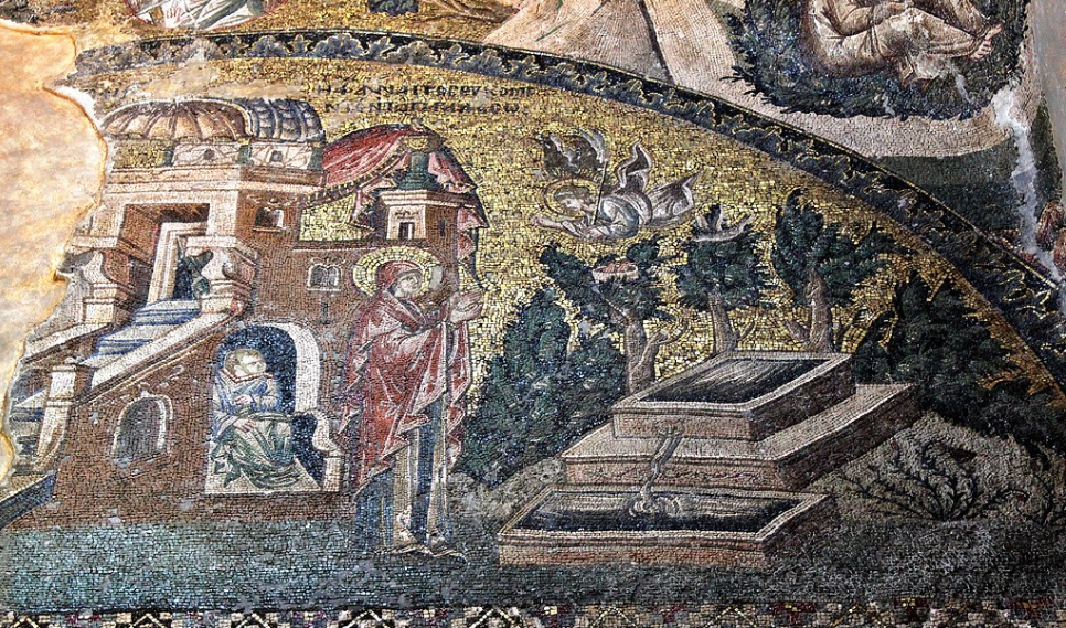
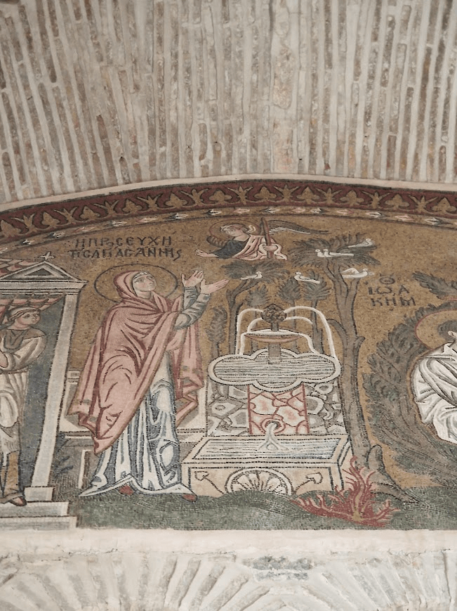
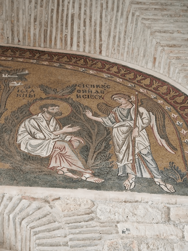
My interest in how landscape and botany are represented in medieval churches was engendered by taking a module on Byzantine art during studying for an MA in History of Art at the University of Sussex, 2003-2005. This module was not about landscape or botany; it was about the iconology of Byzantine art and production techniques, particularly mosaics, but because I was always always interested in landscape (I did A levels in Geology and Geography as well as Music, and spent a lot of time walking round the countryside of Sussex on A level field trips, and walking on the Downs at weekends with my Grandfather, an agricultural labourer on a farm in Rottingdean). I ploughed a lonely furrow researching the representation of gardens and wildernesses in the 1316-1321 mosaics of the Annunciations to St Anna and St Joachim in the narthex (entrance area) in the Church of the Chora Monastery, as when I took my MA, little research on landscape in Byzantine mosaics has been undertaken. The Chora Monastery is in Constantinople (now Istanbul). The Annunciation to St Anna and St Joachim is part of the cycle of representations of the life of the Theotokos (mother of god) and life of Christ that appears in all Byzantine (Greek Orthodox) churches. This scene is not typically depicted in western art, as its story derives from the apocryphal Protoevangelion of James, i.e. a text not accepted as canonical in western Christianity. In Byzantine iconology, Joachim is always presented in a wilderness (dessert) and Anna is shown in walled garden (a symbols of virginity in Medieval art).
The Church of the Chora Monastery is renowned … for its well-preserved mosaics and frescoes. It presents important and beautiful examples of East Roman painting [and mosaics] in its last period [the Palaiologoi dynasty, 1259 to 1453]. … The name “Kariye” (Turkish …: village) originated from an ancient Greek word “Chora“ (χώρα) [which] means “in the fields” or “in the countryside” because the old church and monastery remained outside the walls of Constantinople. [The] Theodosian walls [were] built in 408-450. [T]he fact that the word Chora is written along with the names of both of them on the mosaics depicting Jesus and Mary inside the church shows that it has a mystical meaning too. [The] Chora Church was originally built in the early 4th century as part of a monastery complex … during the reign of Emperor Iustinianos [Justinian] in the 5th century. Kariye Mosque retrieved 03.01.26.
The Annunciation of Mary’s Birth to Anne, The Greek inscription in the scene reads “Saint Anne is praying in the garden”
Photo from my visit to the Chora Monastery in Istanbul in 2014
I looked hard at how plants were represented in this mosaic version of the Annunciation, but I was unable to demonstrate any connection between plants in the Chora’s countryside location and the nature of the flora depicted; although The Protoevangelium of James sates that Anna went down to the garden to walk. And she saw a laurel, and sat under it, New Advent, retrieved 03.01.26. There also appears to be no connection between the carved foliage in St Mary de Haura and “real” flowers around Shoreham or anywhere. Flora in medieval religious art are not a representations of particular botanical species; flora, instead, symbolically represents core aspects of Christian belief; e.g. God’s creation, purity, resurrection, and eternal life. Some specific species did have set significations, e.g. Lilies of the Valley represented the Virgin and virginity. Although specific species were only rarely depicted in the medieval period; they become common in Western religious art in the Early Modern period of the Renaissance e.g. by Van Eyck, see Paul Van den Bremt (2011) translated by Lindsay Edwards A Garden Full of Symbols. Flora in the Paintings of Van Eyckretrieved 03.22.26
I am an atheist and do not believe in a creation of nature by god nor do I believe that plants have any religious meaning. However, I am very interested in how people construe nature in art. Symbolic religious interpretations of nature are part of the history of ideas in the religious art of both Western and Eastern Christianity. Christian symbolic motifs are very important to understanding the decoration of Medieval churches, in the eyes of those who designed and built them and worshiped in them.
Before Christmas, I went holiday to Athens with my husband; our first holiday abroad for 11 years. We went to the Monastery of Daphni, whose mosaics were created ca. 1100 during the Byzantine Komnenoi dynasty
Again the plants in this mosaic are not identifiable as specific botanical species. The trees look a bit like Allepo Pines, Pinus halepensis, common in Athens suburb, more than Laurel, as mentioned Protoevangelion of James. The birds, Sparrows, are named as Sparrows in Protoevangelion: And gazing towards the heaven, she saw a sparrow’s nest in the laurelNew Advent, retrieved 03.01.26. They do indeed look like sparrows; but it is impossible to determine whether they are House Sparrows, Passer domesticus or Tree Sparrows, Passer montanus; both common in Greece and the Levants; but when the Protoevangelion was written (mid-2nd century AD) a distinction between Domestic and Tree Sparrows may not have been known
Joachim’s wilderness bush:
could be Olive trees, Olea europaea, which are a ubiquitous feature of the landscape of the eastern Mediterranean
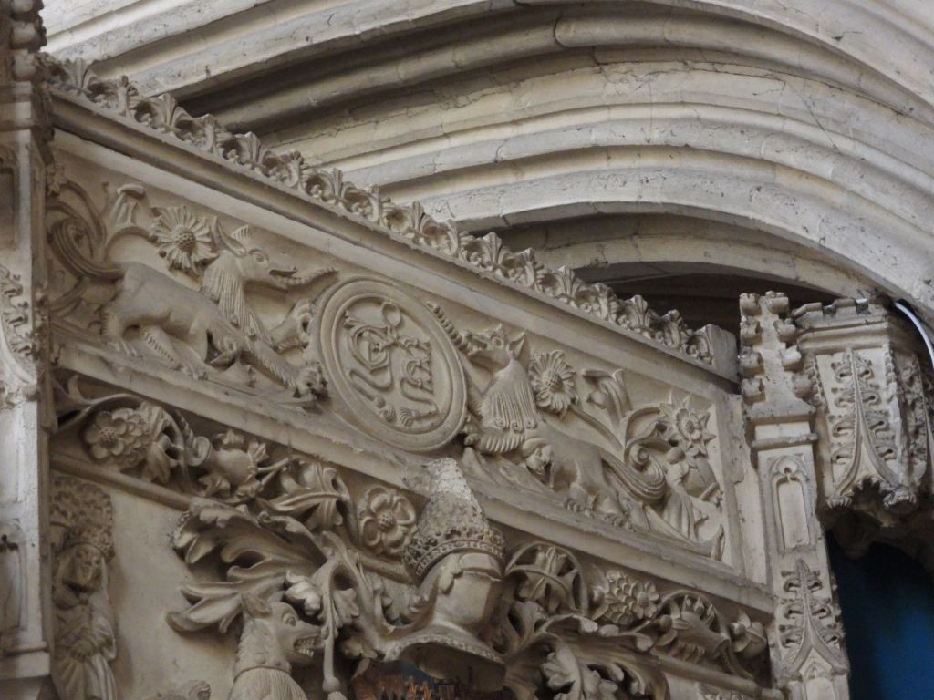
Sussex carved stone representations of foliage in C12 and early C13 Shoreham seem quite primitive compared with Byzantine mosaics of foliage in C12 Athens; but this is not an entirely fair judgement; mosaics partially look more sophisticated because they are made of brightly coloured glass and carved stone is grey; but it is only grey now because its original painting has been lost. In C12 and C13 churches, sculptures would have been painted in bright colours, see Tysoe Heritage Research Group. The recently repainted corbel heads in Boxgrove Priory Church, West Sussex nr. Chichester, give an impression of how colourful Sussex churches may have looked in Norman, Plantagenet and Tudor times, before Henry VIII’s reformation
However, to some degree Byzantine C12 mosaic foliage is more sophisticated than English sculpted foliage; as Byzantine mosaics attempt to represent specific plants (and specific people) figuratively (even if what they represent is mythical rather than real); whereas Norman masons crafted mostly decorative generic foliage patterns in English C12 not representation of specific plants, although they did produce foliate heads (Green Men), which attempt to represented mythic figures. However, both the generic foliage of the west and specific plants in the east signify ,same theological concept: purity, resurrection, the beauty of “Gods creation”.
James Kellaway Colling asserted in 1874 that Early English Foliage [in churches] probably culminated about the middle of the thirteenth century, but many excellent examples are as early as the end of the 12th century. It was evidently progressively developed from the foliage of the Norman era. … By the Perpendicular period [C14-C16 the final period of English Gothic Architecture]greater scope was given to sculpture than foliage, especially in large works. Shields and heraldic emblems were commonly used, and grotesque animals often took the place of foliage, but seldom, as heretofore, mixed with foliage. The beautiful richness of foliated surfaces, so charmingly begun in the Norman, was completely lost.
However closely we endeavour to trace the origin of Decorative Art, we find that it constantly originated in forms taken from Natural Foliage. No doubt simple cutting, or notching with a knife or other sharp tool, preceded the imitation of natural form, and for this reason the zigzag and its simple combinations were the earliest forms of ornamentation invented by man. The zigzag is found in the primitive work of nearly all nations — shewing that it was the first natural step in the attempt at ornamentation although no people ever developed its capabilities so much, or adhered to it so long, as the Normans. As soon as tools improved, and primitive workmen felt they were able to go beyond simple notches, they began to imitate natural objects ; and consequently the most simple leaves and flowers which were growing around them, as well as the forms of the animals with which they were familiar, were soon rendered by them and adapted to the decoration of their works. Now as this facility of imitation varied among different people, so their renderings from nature varied; and as early artists also copied from one another, these diverse manners of following nature became more confirmed and stereotyped as time advanced. Thus arose that highly conventional treatment of natural forms which appears so conspicuously in early works, giving great distinctness of character, and shewing marked difference in the manner of rendering even the same natural objects by various nations at different periods in the world’s history. p. 24
….in the transitional piers at New Shoreham church the abacus is round, and the foliage begins to assume the Early English type p.55 James Kellaway Colling F.R.LB.A., (1874) Examples of English Medieval Foliage and Coloured Decoration, Taken From Buildings Of The Twelfth To The Fifteenth Century: With Descriptive Letterpress. B. T. Downloadable at https://archive.org/details/examplesofenglis00coll, retrieved 10.12.25
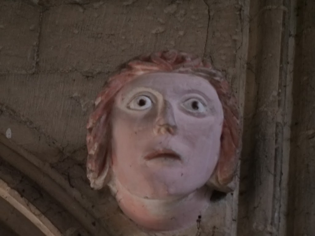
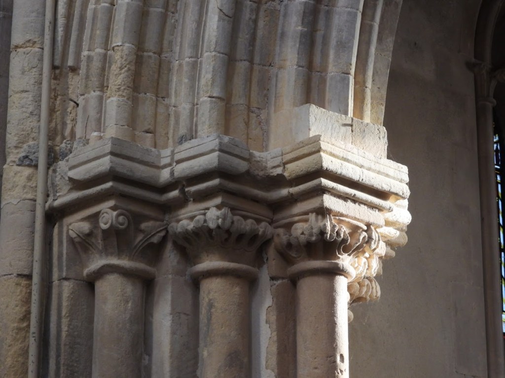
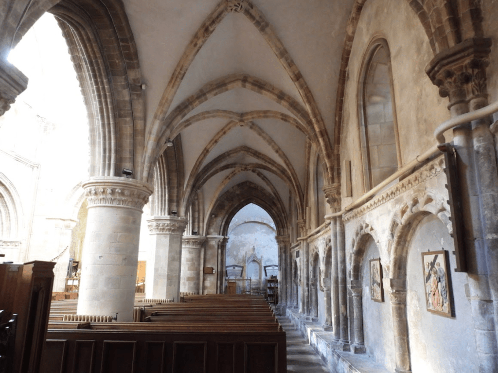
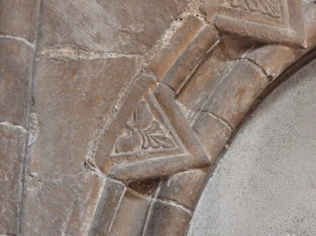
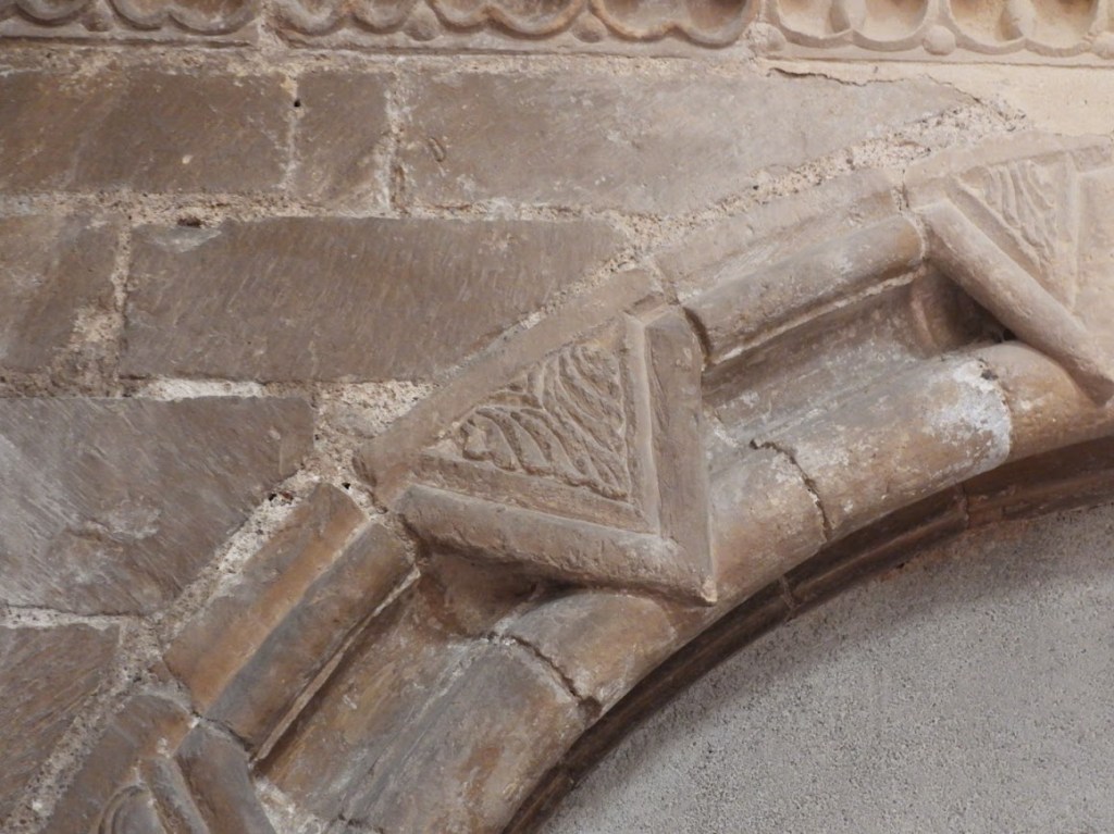
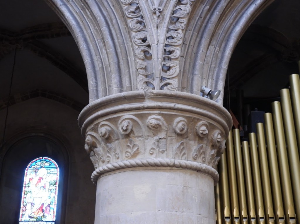
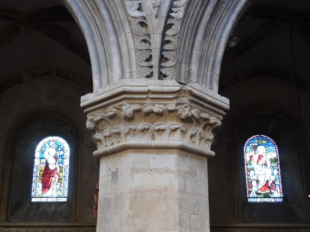
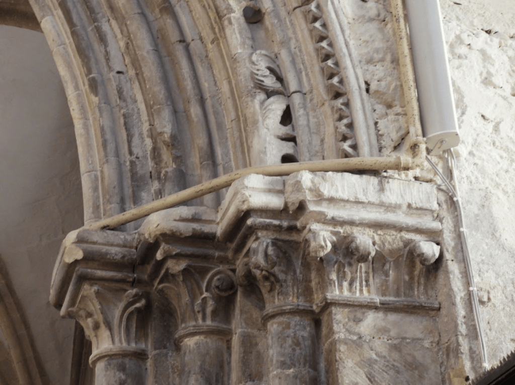
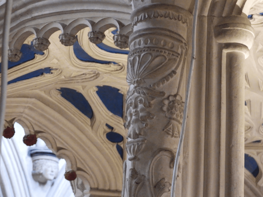
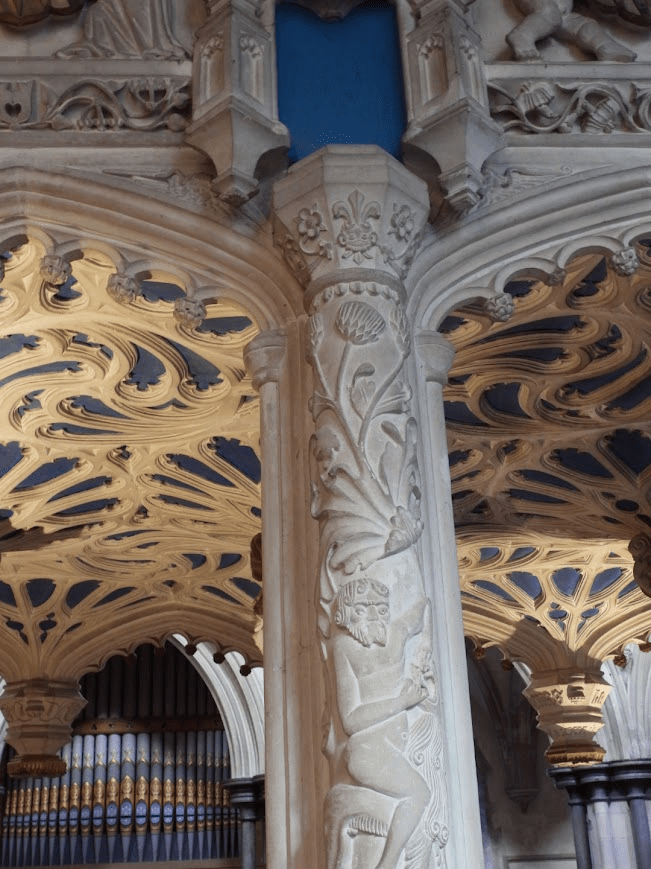
The choir of St Mary de Haura is a riot of vegetation; a paradigmatic example of the importance of vegetation in Romanesque (C11-C12) churches; before vegetation was replaced by other imagery in the Perpendicular period.
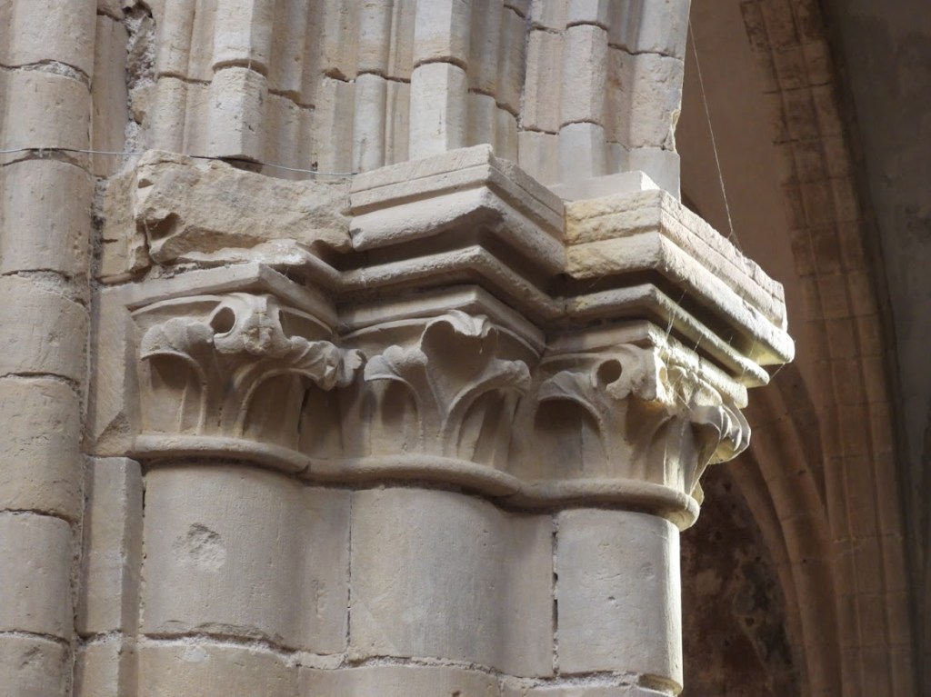
The quadripartite aisle vaults, with roll-moulded ribs and small foliage-bosses (including three with a green man in the south aisle), may have been complete before the upper parts [of the church] were started. … The triple shafts on the outer walls, with stiff leaf capitals, also look late C12 and are closest to the lower parts of the arcades. The stiff leaf capitals on the alternating round and octagonal piers of the north arcade, with an outer order of foliage, recall Canterbury. Either they were the work of masons from there or there was influence from Chichester, where Canterbury masons are known to have worked… The mouldings of the pointed arches are finer than those of the south arcade, where the piers have clustered shafts, each with a stiff leaf capital. The innermost ones rise to the vault and, as the date differs little from the north arcade, despite the differences, are further confirmation that a vault was intended from the start.
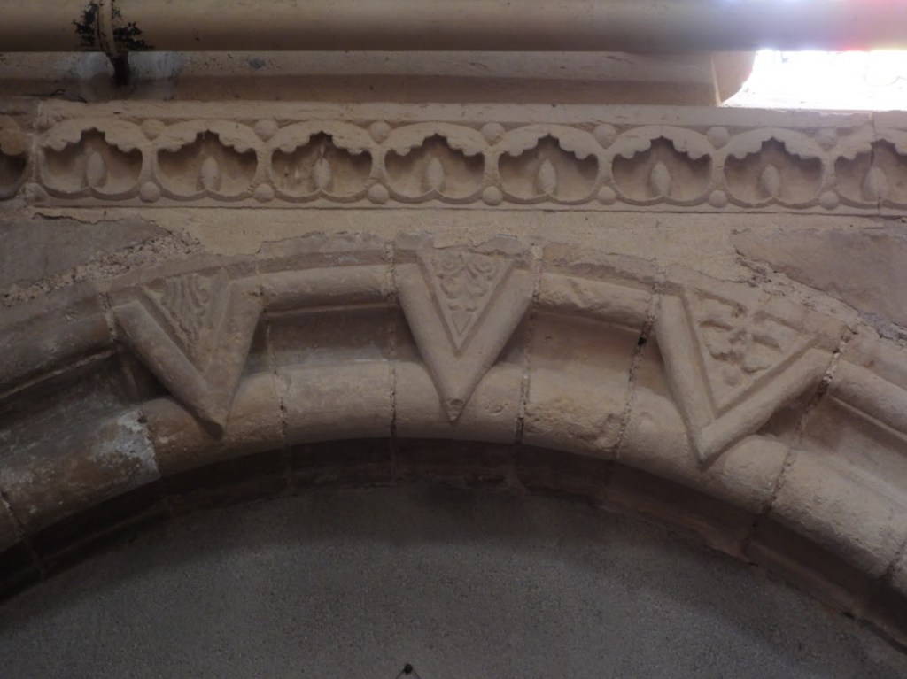
The variation of forms characteristic of New Shoreham is most evident in the gallery, beneath which is a continuous band of quatrefoils that does not vary. Earliest are the single eastern bays on the north side, which have moulded trefoiled heads and shafts with more stiff leaf. The remaining three bays have double openings. Like the openings of the south side, they have hook-corbels at the outer corners. These are a New Shoreham characteristic; not perhaps the happiest of designs, it is commoner in Normandy than England. Here, they contrast with the inner capitals, which have foliage, and there are two more at the springing of the vaulting shafts on the north side. Sussex Parish Churches Mary de Haura, New Shoreham, retrieved 02.12.26
A quatrefoil is a symmetrical design with four overlapping, leaf-like lobes, resembling a four-leaf clover or a four-petal flower, derived from Latin for “four leaves”. Popular in Gothic architecture for windows and tracery, it symbolizes good luck, harmony, and the four Gospels in Christianity, appearing in art, heraldry, and luxury goods globally, from ancient Islamic art to modern fashion.In Christianity, the symbol was adopted to represent the four gospels of the bible: Matthew, Mark, Luke, and John, as well as also seen as a representation of the cross. In Native America, the quatrefoil is a representation of their ‘Holy four corners of the Earth- North, East, South and West’Quatrefoils: A Closer Look at this Superb Architectural Element accessed 04.01.26
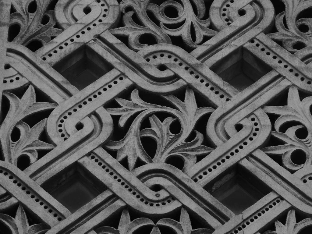
The leaf capitals of the componde columns of the choir
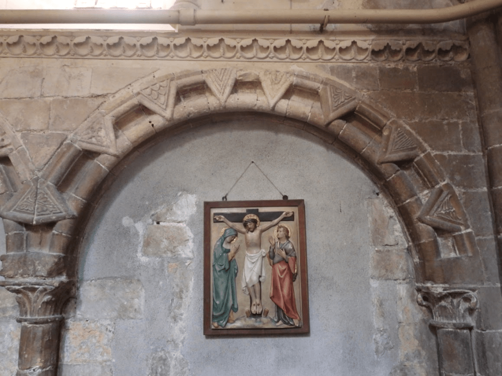
The blind arcade of arches (arches against a wall – decorative rather than structural) decorating the south wall of the choir (a typical feature of Romanesque architecture).
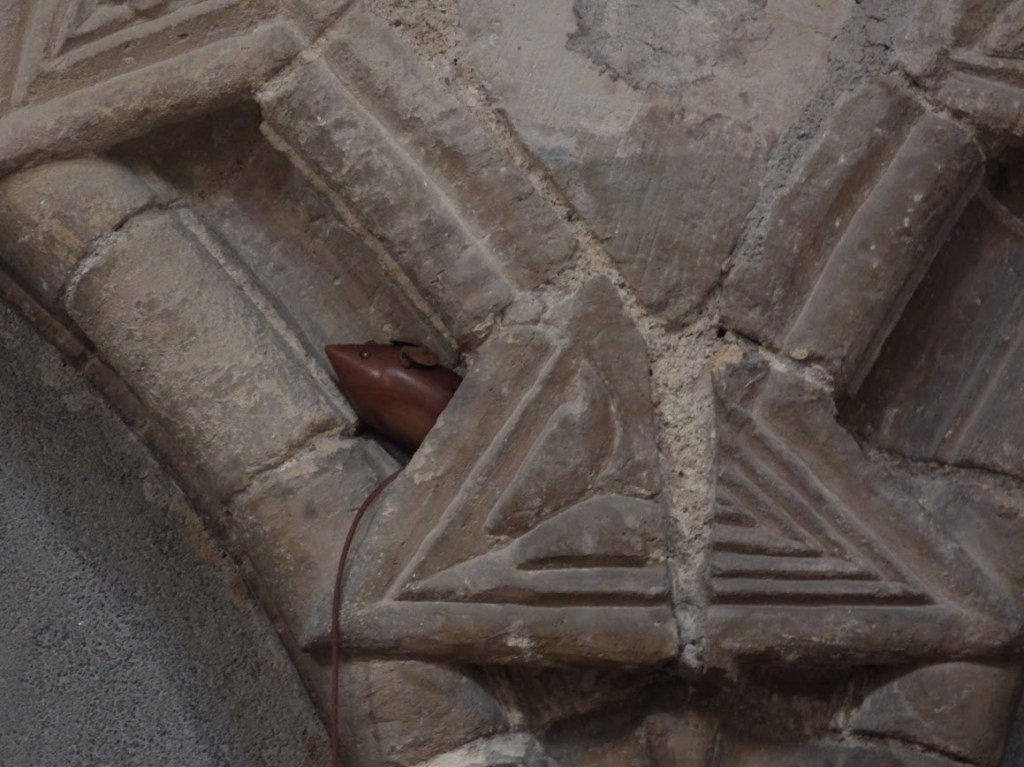
The voussoirs (wedge-shaped stones) of the blind arches are decorated with leaves – but each one leaf is different; showing remarkable creativity by the
Examples of leaf vosiers
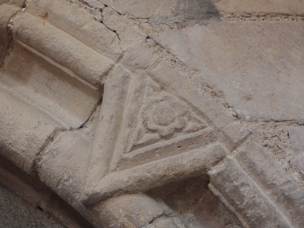
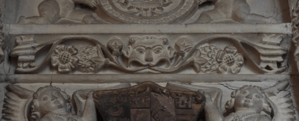
The frieze across the blind arcade of the choir is also foliate
The capitals of piers of north arcade some round, some hexagonal, show a rich variety of geometrical foliage, as do the arches that the piers support.
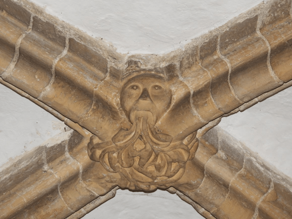
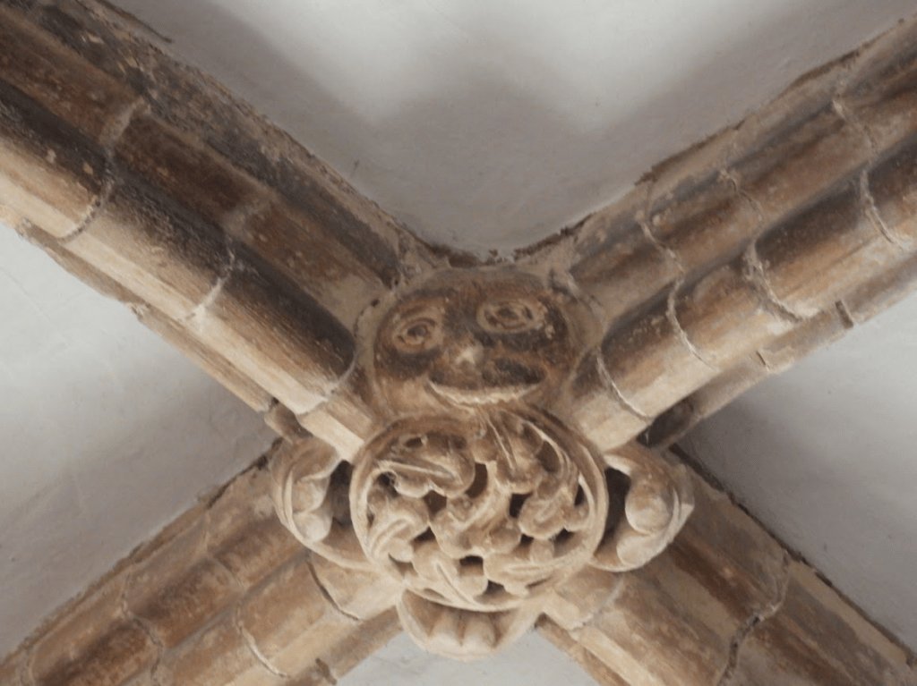
Two of the bosses of the ribbed vault of the south aisle of the nave are decorated with foliated head (often called Green Men)
Green Men stir deep associations with the land and pre-Christian pagan worship of nature, but to use the phrase Gredn Men to describe these bosses is historically anachronistic as the label was coined by the folklorist Lady Raglan, Julian Somerset, in her 1939 article, “The ‘Green Man’ in Church Architecture.” Folklore, vol. 50, no. 1, 1939, pp. 45–57. JSTOR, http://www.jstor.org/stable/1257090. Accessed 4 Jan. 2026.
Whilst I would love to believe that foliate heads demonstrated a persistence of pagan beliefs (fertility cults etc.) in Christian spaces; I think it is much more likely that masons thought of foliate heads as Christian symbols. Kathleen Basford, a botanist and folklore historian, in 1978 book, The Green Man – the first academic monograph of Green Men – suggests that foliate heads had previous pagan symbolic significance; but when used in churches it is likely that foliate heads symbolize Christian themes. They represent a sort of vernacular Christianity according to Stephen Winick, a folklorist at the American Folklife Center of the Library of Congress, who suggests, in The Green Man, Vernacular Christianity, and the Folk Saint (Library of Congress blog 2022) accessed 04.01.23 that foliate heads symbolize the rebirth of Christ and the promise of eternal life; connection to the Tree of Life growing from Adam’s mouth and life’s cycle: the continuous cycle of nature, death, and renewal. Winick notes that more general sense, the idea of greenness, verdure, or viriditas has been part of Christian philosophy at least since the writings of Gregory the Great, specifically his treatise Moralia in Job, circa 580-595 CE. As Jeanette Jones has shown, Gregory posits greenness (viriditas) and plant growth in the book of Job to be a metaphor for the coming of Christ. It is probably this notion that underpins the use of green foliate ornamentation in Norman churches.
Foliate capitals of the quadripartite pillars supporting the cross of the choir, aisle and transects; thick so they can old up the tower above. Highly complex foliate forms made possible by the function of pillars: weight bearing.
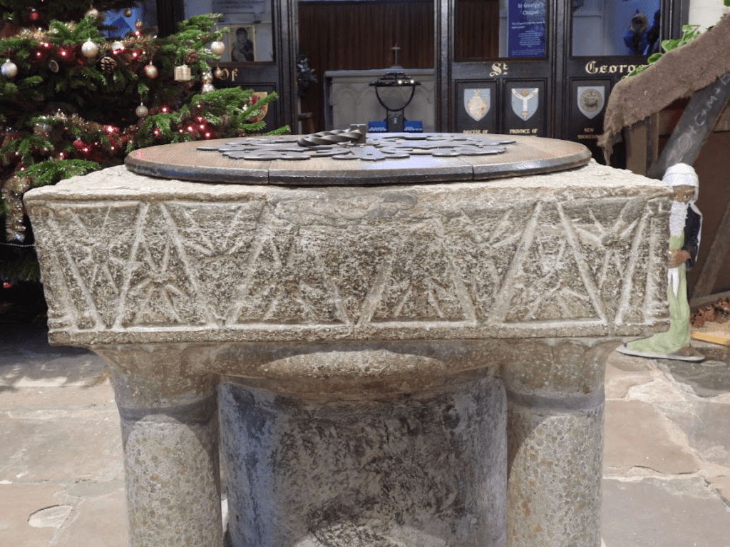
The south side of the Norman font depicts stars, another aspect of the natural world. English Romanesque, Norman, architecture and art is known for its robust construction and distinctive ornamentation, including geometric patterns like the zigzag (chevron) and stars or rosettes.
But perhaps these are more than just patterns? Patterns are seen on the doorways of village churches, throughout greater churches and in secular buildings. Pattern-making was typical of traditional art, while geometry, symmetry and order were considered by theologians to reflect heavenly perfection. It is suggested that geometric patterns, sometimes described as rosettes, diaper, zigzag, scale and arcading, were used in English Romanesque sculpture in a coherent series to build up a cosmographic diagram. The comprehensive building programme that followed the Conquest allowed the language of geometric patterns to be used more intensively in England than appears to have been the case on the Continent. Wood, R. (2001). Geometric patterns in English Romanesque sculpture. Journal of the British Archaeological Association, 154(1), 1-39. Abstract
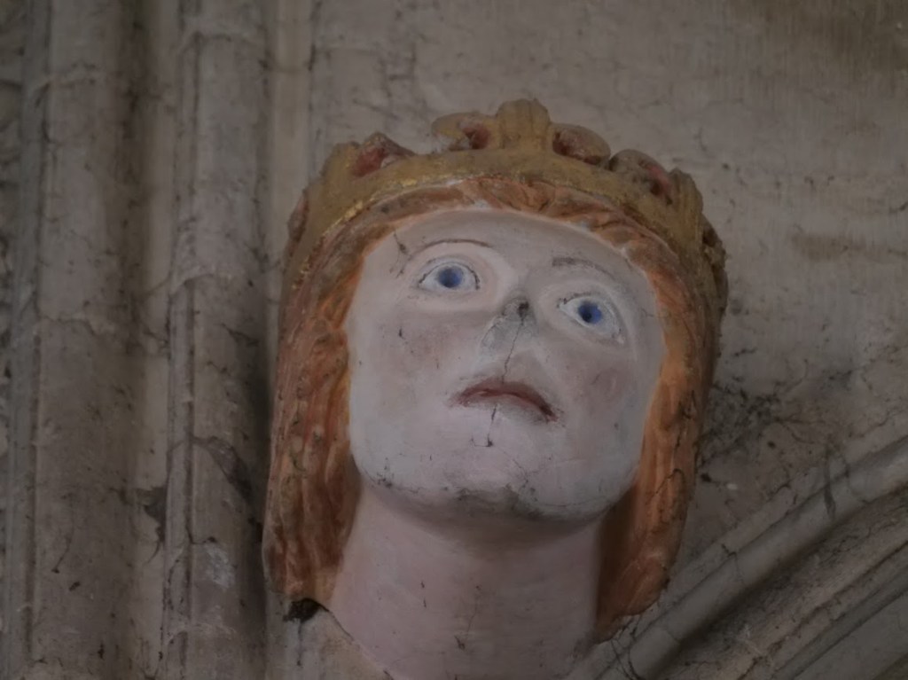
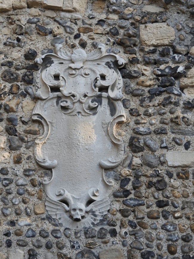
Whist foliage in the broadest sense symbolises life, in contrast, a memorial plaque (cartouche), on the west exterior wall of the church, signifies bodily death. The name of the person memorialised has eroded away by the salty westerly winds of the Channel. But its baroque style and the helmet suggest that this is a memorial to a now unknown C18 peer of the realm
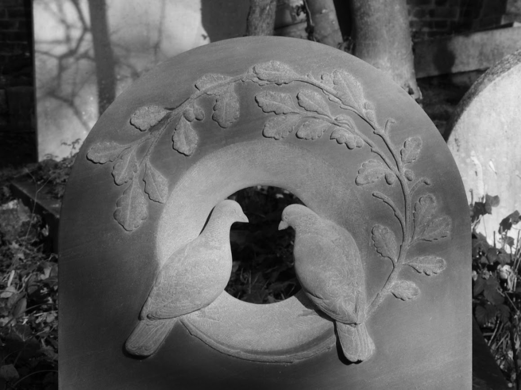
I reached Highgate Cemetery by taking the tube (Victoria Line) to Archway and then walking up Highgate Hill through Waterlow Park. You need to book a ticket to visit Highgate Cemetery, see: https://highgatecemetery.org/
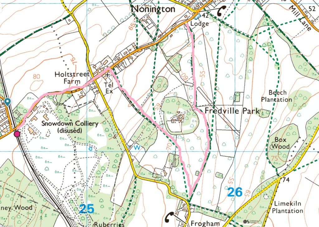
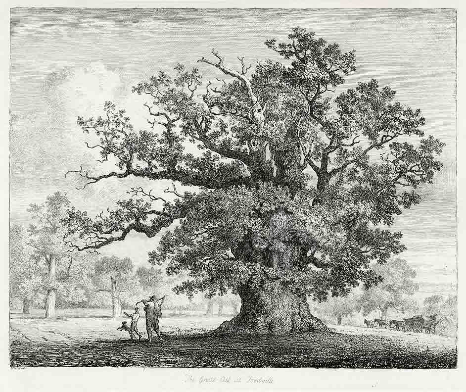
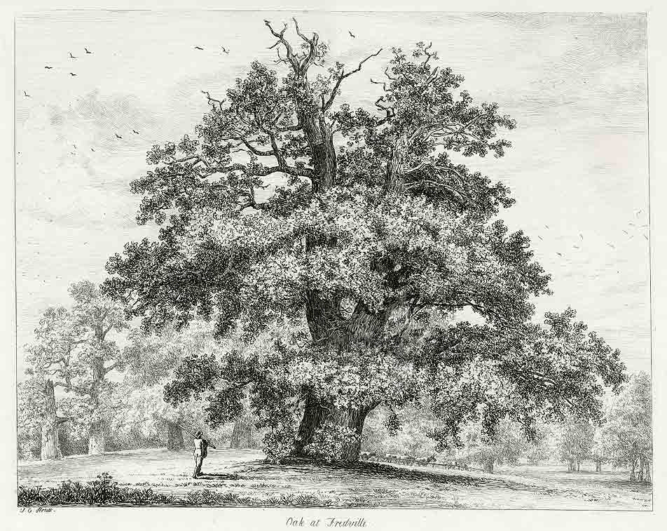
I reached Fredville Park from Brighton by train (4 trains: Brighton to Hamden Park, Hamden Park to Ashford International; Ashford International to Dover Priory, Dover Priory to Snowdown); three and half hours journey time. But it was well worth it; this is an outstanding medival deer park now ornamental parkland.
Originally given to Odo, Bishop of Bayeau and warrior knight, by William of Normandy (King William I, The Conqueror); it has been passed from aristocratic family to aristocratic family. It is still in private ownership. The fact that huge parts of England are still owned by the landed gentry, who inhereited or bought it from Norman Barons who were given land that wasn’t theirs, and they still prohibit the public from much of this land, is a national disgrace.
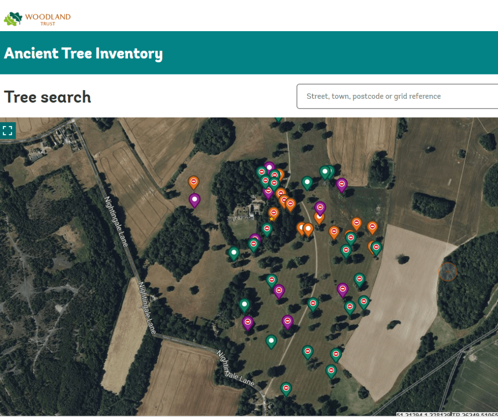
On the Woodland Trust Ancient Tree Inventory map all but the trees next to the footpaths are marked as “no public access” but except for the woodland around Fredville House, which is fenced, I roamed freely off the the paths and got close to many of the trees that the Woodland Trust says has no public access. Toward the end of the afternoon a stream of 4x4s drove up the road into Fredville House. They were a hunting party, of shootists and game keepers (as I had heard shotguns being used all afternoon, close by, but not in Fredville Park); none of them challenged me and I was clearly off the public footpaths.
It is not possible to see the three large ancient oak trees, “Majesty”, “Stately”, and ”Beauty”probably 500 years old, including “Majesty” or “The Fredville Oak”, believed to have the largest girth in England, because they are in the fenced of grounds of the former mansion. This is another example of precious natural assets that should be viewable by the public, being shut off to the public.
Fredville Park has many parkland trees. ,,, Not far from the former mansion are the remains of a Spanish chestnut avenue, planted at least 250 years ago. Many of these trees are still in very good condition (2017).
The boundary of the C18 pleasure ground enclosure is intact and encompasses the remaining historic structures including the walled kitchen garden, stables and ice house as well as potential archaeological remains of the mansion.Of particular note, within the immediate grounds of the former mansion, are three large ancient oak trees, probably 500 years old, and a mid-late C19 Wellingtonia. One of these oaks, named “Majesty” or “The Fredville Oak”, is believed to have the largest girth in England.
The origin of the name “Fredville” is not known for certain. Traditionally it is believed to be derived from the Old French: freide ville, meaning a cold place, vecause of its cold, wet, low position. It could, however, be derived from the OldEnglish: frith, meaning the outskirts of a wooded area, plus vill, meaning a manor or settlement, giving “a manor next to the wooded area”.
Fredville House and park was originally part of Essewelle Manor. It is recordedin Domesday that in the time of Edward the Confessor it was held by a woman,Molleve, but in 1086 it was held by Ralph de Courbepine from Bishop Odo. DeCourbepine’s holdings passed to the Maminot family and in the late 1100’s to the Barony de Saye. By 1250 Essewelle had been divided into Esol and Freydevill.The spelling varied over the centuries: Frydewill (1338), Fredeule (1396), Fredevyle (1407), Froydevyle (1430), ffredvile (1738).
Hasted lists the families who held Fredville from the Colkins, in the reign of Edward I, to the Boys, in the reign of Richard III. William Boys’ descendant, Major Boys, had many of his estates confiscated for being a Royalist, but Fredville remained in the Boys family until two of his sons sold it to Denzill, Lord Holles in 1673 in order to pay debts. In 1745, Thomas Holles sold it to Margaret, sister of Sir Brook Bridges, baronet of Goodnestone, which is nearby. Margaret Bridges married John Plumptre, a wool merchant of Nottinghamshire, in 1750, but they had no children. The estate passed to John Plumptre through the marriage. Margaret died in 1756 and her husband remarried in 1758 and had a son. John Plumptre rebuilt the manor as a Georgian house. Sir Brook Bridges’ daughter, Elizabeth, married the author Jane Austen’s brother, Edward.
Jane Austen’s letters (1796-1814) show that she was a regular visitor to the Bridges’ estate at Goodnestone and later to Edward’s new home at Godmersham. She was well acquainted with the Plumptres of nearby Fredville (Jane Austen letters to her sister Cassandra, September – October 1813 and March 1814). John Pemberton Plumptre was for a time a suitor of Jane’s niece Fanny. Jane Austen wrote “Anything is to be preferred or endured rather than marrying without Affection; and if his deficiencies of Manner &c &c strike you more than all his good qualities, if you continue to think strongly of them, give him up at once.” (Jane Austen letter to Fanny November 1814).
Fanny rejected John Pemberton. In the late 19th century the house was greatly enlarged, its 50 bedrooms accommodating the family of 11 children and the necessary staff. In 1921 Henry Western Plumptre built the much smaller “Little Fredville” nearby in the park as the family home and Fredville mansion was abandoned. It was requisitioned during WWII and occupied by a Canadian tank regiment. A fire destroyed most of the house in 1942 and after the war J H Plumptre, son of Henry Western, decided to demolish the building. Only the clock tower and some converted outbuildings now stand. The site remains in private ownership.
The visible trees of Fredville Park in the order that I saw them:
The parkland west of the wood surrounding Fredville House from outside the park
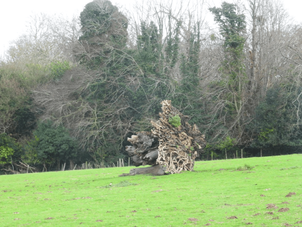
Roots and lower trunk of a felled Pedunculate Oak
Rotting felled Pedunculate Oak
Texture of its bark
Fallen chestnut
With deliquesced Chicken of the Woods, Laetiporous sulphureus
An ancient Beech
Notable Oriental Plane
Fallen Pedunculate Oak
The fungus Hypholoma fasciculare and the mosses Ptychostomum capillare and Grimmia pulvinata, and unidentified lichens, on this tree’s decorticated trunk
Yew, London Plane and Pedunculate Oak
Oriental Plane
Fruit and leaf of Oriental Plane
Hawthorn
Pedunculate Oak in front of two Sweet Chestnuts
Ancient Sweet Chestnuts
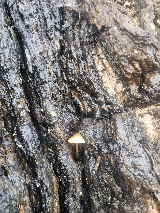
A Mycena sp. mushroom on the bark of one og these chestnuts
Ancient Sweet Chestnut
Ancient Yew
Hard to identify this as an ancient Yew, Taxus baccata, at first. It’s shape is nothing like the Yews of its native strongholds: chalk scarp-face woodland. It’s a pasture woodland Yew, sculpted by nibbling deer. Deer can tolerate Yew.
Pedunculate Oak
Lodge to Fredville Park
Historic England listing: Lodge to Fredville Park 11.10.63 II Gate lodge. Early C19. Painted brick with thatched roof. One storey and garret on plinth with dogtooth cornice to half-hipped roof with pierced bargeboards. Central stack with double polygonal flues. Single storey gabled porch with elliptical openings on all 3 sides, that to front with label hood. Arched 2 light wooden casements with label hoods either side of porch, with central four centred arched door with Gothick tracery. Canted bay with Gothick windows on left return front
A postscript
Right next to Fredville Park is the remains of the closed Snowdown Colliery.
The miners were on strike in 1984-85 and I remember well Brighton Trades unions collected food outside supermarkets to send to them. The strikers knew, as did we, that they were fighting the ruling class under Thatcher who wanted to close the pit. Forty years later, in 2025, a merchant banker has persuaded many working people in Kent that their enemy is migrants; but its the Tory ruling class that has impoverished them. The decline in class awareness and the ability of the ruling class to spin false narratives that are believed I find very sassy. Wake up people.
Weather: 10 degrees; overcast; southerly wind of 35mph.
8.28 km; 3:24 hours; elevation gain: 186m
‘Puck’ or ‘Pook’ is a Sussex dialect word, derived from the Saxon word ‘Puca’, meaning a Goblin or Fairy.
East Lavant, or Loventone in the Domesday Book (1086), which along with Mid Lavant and West Lavant, make up the village of Lavant.
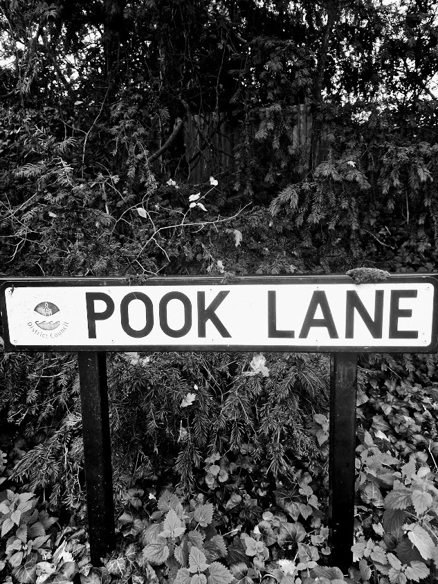
The River Lavant is a chalk stream winterbourne (a river that is dry during the summer months). It rises from a spring at East Dean and flows to Chichester. From east of Chichester its natural course was south to the sea at Pagham, but the Romans diverted it to flow around the southern walls of Chichester. Currently there is no water in it, there should be, as the draught from February to October of this year has lowered the water level in the chalk aquifer,
The Trundle is an Iron Age hillfort on St Roche’s Hill. It was built on the site of a causewayed enclosure. There was a chapel dedicated St Roche within the hillfort. It was demolished some time in the C16. A windmill, which burned down in 1773, is known to have existed on the hill. There was an open-air masonic lodge that included the Duke of Richmond, the Duke of Montagu, and Lord Baltimore which met at the top of the hill between 1717 and 1757. There was at one time a gibbet on the Trundle.
East Dean is in a valley in the South Down. In AD 689, Nunna, King of the South Saxons, gave 20 hides of land at “Hugabeorgum and Dene” to Eadberht, Bishop of Selsey. “Dene” has been identified as East Dean. In his will of AD 899 King Alfred the Great left East Dean to his youngest son Æthelweard (AD c. 880 – 920 or 922). The remains of a small deserted Medieval settlement have been found in East Dean Park. The buildings were 14th- and 16th-century.
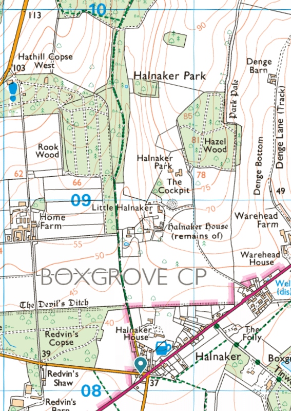
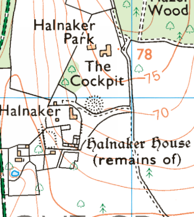
On a recent trip to the parish of Boxgrove, I walked up the footpath to the west of Halnaker Park, an ancient deer park. Most deer parks have mostly pollarded Oaks, but this one has mostly Sweet Chestnuts. Some other deer parks have Sweet Chestnuts too; such as Bushy, Richmond and Petworth; but in these Oaks domiate; at Halnaker Sweet Chestnut dominates. The Sweet Chestnuts in the park are magnificent; but close-up examination of those by the path revealed them to be in a parlous state.
The Park of Halnaker possibly originated in a grant of free warren made in 1253 to Robert de St. John for his demesnes at Halnaker, Goodwood, and elsewhere, outside the limits of the forest. An inquiry as to the recent enlargement of the park by 60 acres was ordered in 1283, and it was said to contain 150 acres in 1329, and to be 2 leagues round in 1337. Hugh, elder son of Lord St. John, had licence in 1404 to inclose 300 acres of land and wood within the lordship of Halnaker and make a park, according to the metes begun by his father, but possibly did not avail himself of it, as the licence was renewed to Thomas and Elizabeth West in 1517. This may be the origin of Goodwood Park, which first appears in 1540, when it was part of the Halnaker estate, as it was also in 1561. In 1570 Halnaker Park was estimated to be 4 miles in compass and supported 800 deer. It continued to descend with the manor, but Goodwood Park was sold in 1584 by Lord Lumley to Henry and Elizabeth Walrond, who transferred it in 1597 to Thomas Cesar; he conveyed it in 1599 to Thomas Bennett, who in 1609 sold it to Sir Edward Fraunceis. The Earl of Northumberland in 1657 sold it, with ‘the house lately erected therein’, to John Caryll, who conveyed the park and mansion house to Anthony Kempe in 1675, and it subsequently came to the Comptons of East Lavant, from whom it was bought, about 1720, by the Duke of Richmond. from: http://www.british-history.ac.uk/ Quoted on https://boxgroveparishcouncil.gov.uk/about-boxgrove/halnaker/#:~:text=The%20PARK%20of%20Halnaker%20possibly,fn.
The importance of ancient deer parks is outlined in the University of Oxford’s Ancient Oaks of England Project Deer Parks: After the Norman conquest of England in 1066 deer parks became a ‘craze’ among the new nobility, who had taken over almost all the land held before by the Anglo-Saxons. While the Domesday Book in 1086 only recorded 37 deer parks, by around 1300 there may have been as many as 3,000. Every nobleman wanted a park and many had one, while great magnates and some bishops owned 10 or more and the king could boast as many as 80 to 100. It was all about hunting deer and having venison available for feasts. To be able to present guests with this ‘noble’ meat instead of the plain beef and pork that common people (sometimes) had was a serious matter of status.
A deer park was usually created in an area of the manor that was not under cultivation or occupied by hayfields or woods managed as coppice. It was called ‘waste’ (we would now say nature reserve) and often consisted of some open rough grassland or heath and pasture woodland. There were wild growing native trees, mainly oaks. These and some underwood or shrubs were necessary to provide for winter food and shelter. This became especially important with the introduction by the Normans of fallow deer from southern Europe to stock the parks. These animals would not survive the English winter otherwise.
The park was surrounded by a park pale, a ditch on the inside and an earth wall on the outside on top of which was a pale fence of cleft oak. The deer could not scale such a barrier from inside the park, but ‘deer leaps’ could lure them in from outside, a clever construction. … Also inside was usually a park or hunting lodge and if this building was moated we can often still recognize this moat as well as lines of the park pale in the form of lanes, field boundaries or even the earth wall of the park pale. We now know where most of these parks were even if few of these traces remain. By analyzing the position of ancient oaks in the landscape we can find out if they stood in a medieval deer park.
My research has established that medieval deer parks were by far the most important form of land use associated with ancient and veteran oaks in England. Some 35% of all oaks in England with a girth >5.99 m are associated with medieval deer parks and of 115 oaks with >9.00 m girth 60 once stood in those ancient deer parks. Of 23 ‘most important sites’ for ancient oaks I have so far identified, 20 were deer parks and 16 of these were medieval. There are many other landscape associations with ancient oaks and for a significant number of these trees the historical context remains unknown, lost in the mists of time. But the medieval deer parks are the main reason why England has so many of these venerable oaks.https://herbaria.plants.ox.ac.uk/bol/ancientoaksofengland/Deerparks
Typical location [of Sweet Chestnut]: Parkland, designed landscapes, fields, woodland (often found as coppice) and wood pasture. Occasionally avenues, street trees and gardens. Age: Sweet chestnut may be able to live for 1,000 years, although 600 may be more typical on many sites. All sweet chestnut will be ancient from 400 years onwards, although many will have ancient characteristics from around 300 years.Woodland Trust Sweet Chestnut
Jarman identifies seven types of British ‘sweet chestnut landscape’: ancient inclosures; ancient coppice woods; historic boundaries; historic gardens; historic deer parks and designed parklands; historic formal avenues; and more recent high forest and production coppice. R.A Jarman (2019) Sweet chestnut (Castanea sativa Mill.) in Britain: a multi-proxy approach to determine its origins and cultural significance; unpublished PhD Theses. University of Gloucester. https://eprints.glos.ac.uk/7484/1/Robin%20Jarman%20PhD%20Thesis%20Sweet%20chestnut%20in%20Britain.pdf retrieved 01/12/25 p. 2
Sweet Chestnuts Outside of woodland habitats, sweet chestnut performs a different ecological role, as in wood pastures and historic parklands, where stands of single or groups of ancient trees, stubs and stools support many veteran tree features (Lonsdale, 2013). Such trees sustain a wide diversity of scarce and sometimes endangered invertebrate and other animal species; and host a specialised flora, notably lichens, bryophytes and fungi. These trees and their associated communities are typically many centuries old and provide sites of high ‘ecological continuity’ (Rose, 1974 and 1976) in landscapes where these are rare. Johnson op. cit. p. 45
In that context of ecological continuity and antiquity, cultural significance is not a separate concept – humans can be considered as part of nature, and the ‘sweet chestnut scapes’ that were discovered and surveyed during this research reflect that: ancient inclosures, ancient coppice woods, historic boundaries, historic gardens, historic deer parks and designed parklands, historic formal avenues, and high forest and production coppice are all artefacts of management. Johnson op. cit. p.47
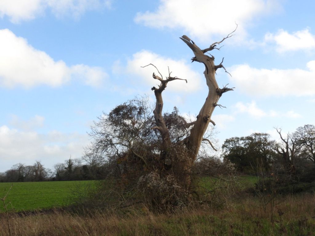
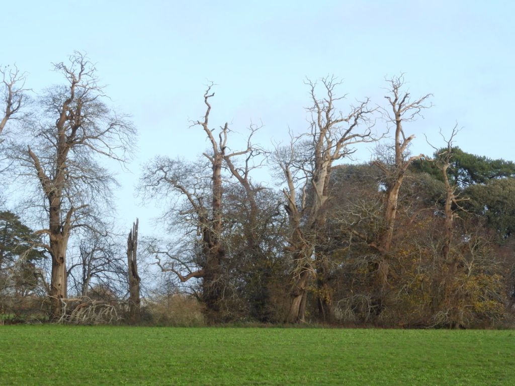
The Sweet Chestnuts in Halnaker Park are ca. 400 years old; they look very unlikely to make it to 600 years, let alone 1000 year.
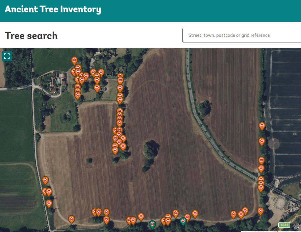
The Sweet Chestnuts are listed by the Woodland Trust Ancient Tree Inventory as all ancient.
They are pollarded, as was typical for trees in deer parks. These ancient Sweet Chestnuts are one of the most important natural assets of the parish of Boxgrove, West Sussex. These Sweet Chestnuts are biologically important and a benefit to the landscape.
(The 18th, 19th and 29th century practice of replanting semi natural ancient woodland with Sweet Chestnut, which was then coppiced for timber, was not a benefit to landscape of Sussex; but it was profitable.)
(Parks & Gardens UK is the leading online resource for historic parks and gardens. It is an essential resource across multiple fields, from heritage preservation and academic research to personal enrichment and professional garden design).
The most impressive feature of the landscape [of Halnaker] is the mature Sweet Chestnut Trees. In essence, the landscape of Halnaker Park has changed little in 370 years, with the exception of changes in land use. More of the park is now under arable cultivation rather than grassland and pasture (as indicated by the field names in 1629). …
The most impressive feature of the landscape is the mature Sweet Chestnut Trees. There are 74 in total distributed along the lower southern boundary, in a block to the south-west of the ruins, in a long row to the south-east of the gate house entrance, and as isolated trees in the lower park. The trees are all in a poor state, with die back and bark loss. They are clearly very old. One has a girth of more than eight meters.….
… [T]he names and location of woodland blocks in 1629 are similar to the current situation, that is: Haflewoode coppice (1629) = Hazel Wood Winkinge Woode = Ladys Winkins; Hoke Woode = Rook Wood; Harthill Wood = Hathill Copse West; Saley Coppice = Seely Copse
The gap or ride through the woodland to the northern boundary, apparent on maps of 1778, 1813, 1880 is still evident as Halnaker Gallop. The shape of the woodland blocks are almost identical to the 1880 map and very similar to the 1778 map. Many of the parkland trees and clumps on the 1880 map are still present today.
In essence, the landscape of Halnaker Park has changed little in 370 years, with the exception of changes in land use. More of the park is now under arable cultivation rather than grassland and pasture (as indicated by the field names in 1629).
The greatest threat to the historic landscape in the short term is the loss of the Sweet Chestnuts in the lower park. All the trees are showing signs of severe stress mainly due to agricultural activities, for example spray drift, ploughing too close to the tree base, or ring barking due to mechanical damage from equipment.
This has not be done. The Lower Park is owned by the Goodwood Estate. All of the chestnuts are on their private land and there is no permissive access.
It is possible that the Goodwood Estate has not taken seriously the preservation of the precious natural assets of the Chestnut-planted deer park because of a prejudice against non-native trees, but as Jarman, et al., point out in (2019) Landscapes of sweet chestnut (Castanea sativa) in Britain – their ancient origins. Landscape History, 40(2), pp.5-40, there is a general consensus on the ecological importance of sweet chestnut in Britain. It can be concluded that, irrespective of whether it is ‘native’ or ‘alien’, the species performs an important ecological function in specific types of ancient semi-natural woodlands, notably in southern Britain where it does behave like the ‘honorary native’ that Rackham (in Rackham, O. (1980). Ancient Woodland) observed it to be. Johnson op. cit. p.47
What the Goodwood Estate says about stewardship: Nestled in the heart of rural West Sussex, the Goodwood Estate spans 11,000 acres, and has a great responsibility to protect, maintain and enhance its distinctive character and landscape. Ensuring that future generations can cherish Goodwood as we all do today..Goodwood Sustainability
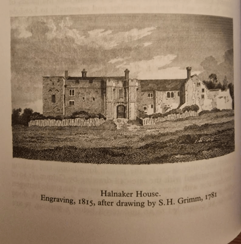
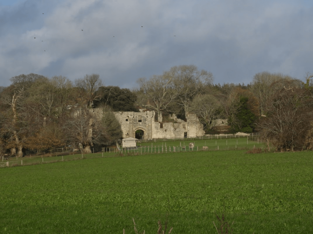
To the north are the remain of Halnaker House, again private with no permissive access. From Elizabeth Williamson, Tim Hudson, Jeremy Musson, Ian Nairn, Nikolaus Pevsner (2019) Sussex: West (Pevsner Architectural Guides: Buildings of England) pp. 409-401:HALNAKER HOUSE (ruins). Halnaker and Cowdray (q.v.) have remarkably similar history. Both were medieval houses given a wholesale remodelling in the C16 by owners who used up-to-date Renaissance ornament. Both became ruined about 1800. But where Cowdrav still impresses as architecture, too much has gone at Halnaker to make it more than a pretty, picturesque group of walls. This is not only the fault of the weather. Details were transplanted wholesale to Chichester, … It is a pity, for the complete Halnaker would have been very impressive.
It was begun by the de Haye family, the founders of Boxgrove Priory and came by descent into the hands of the St John and Poynings families and eventually to Lord de la Warr. The site faces south at the exact point where the Downs begin to rise out of the coastal plain, and consists of an irreg-lar retaining wall enclosing separate hall and chapel ranges. Closed at the south end by a nearly symmetrical C14 gatehouse and wings, achieving a semi-fortified, semi-regular effect which suited both the political climate and the visual inclinations of the C14. Halnaker was the type of Stokesay, not Bodiam. In the C16 the hall range was extended by a solar range that linked it to a chapel: work mainly done for Thomas West, Lord de la Warr (of the Renaissance chantry at Boxgrove and the Renaissance tombs at Broadwater …). The house became redundant when Goodwood was built but was not fully abandoned until the C19.
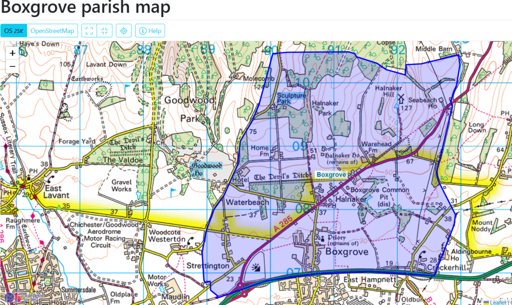
When you walk around the parish of Boxgrove, West Sussex, history collides in the landscape and the built environment; with extraordinarily diverse and interesting physical evidence of building and other human activity from the Neolithic, Iron Age, Roman Occupation, Norman, Plantagenet and Tudor periods.
The landscape of the Downs, itself formed by human activity – human introduced sheep grazing – is stunning beautiful; as are the ancient chestnuts of the Halnaker medieval Deer Park (which gets its own post). The importance of sheep to the creation of the South Downs, and the medieval economy of Sussex, is referenced in the name of the Boxgrove Priory Church: St Blaise is the patron saint of wool carders.
Sheep were vital to the medieval economy of Sussex, providing the primary raw material for the region’s thriving wool and cloth industry, which was the backbone of the national economy. Beyond wool, sheep provided other valuable resources like meat, milk, and manure, and their management was integral to the agricultural practices that made the area one of the wealthiest in England. P.F. Brandon (1971) Demesne Arable Farming in Coastal Sussex during the Later Middle Ages Agricultural History Review
The pinnacle of its built environment is the Plantagenet and Tudor Boxgrove Priory Church with the De la Warr Chantry being of international art historical importance.
It is a magical church full of echoes of French influence along the Sussex coast. Its crossing is a mystery of light and dark and the great chancel is alive with Tudor roses and heraldry. The De La Warr chantry contains beautiful early French motifs from a Book of Hours. These must be some of the best renaissance carvings in any English church. They make Boxgrove very special. Sir Simon Jenkins
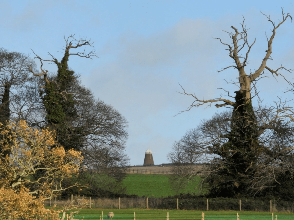
There are later building of historical importance too, specifically the 18th century tower Wind Mill on Halnaker Hill (1740) and Sir Edwin Lutyens’s Halnaker Park, built in 1938.
On Halnaker Hill is a neolithic (10000 BC – 2200 BC) causeway enclosure. Below Halnaker Hill. is the late Iron Age Devil’s Ditch; it dates probably from the late Iron Age (ca. 100 BC – AD 43). The Ditch terminates where it meets Stane Street. The Roman Stane Street may have been built shortly after the Devil’s Ditch in the first decade of the Roman occupation of Britain (as early as 43–53 AD). There was an Anglo-Saxon church at Boxgrove (recorded in the Doomsday Book) but there are no physical remains of it. Over it was built an early Norman Benedictine Priory, completed ca. 1170.; its nave is now ruined but the Priory Church of St Mary and St Blaise remains, with the addition of a C14 porch and a C15 vestry, and the addition of outstandingly beautiful C16 C De la Warr chantry (ca 1530).
One of the ancient Sweet Chestnuts; now is very poor condition.
Halnaker Hill’s Windmill from the Deer Park – in this perspective its looks dwarfed by the ancient Sweet Chestnuts!
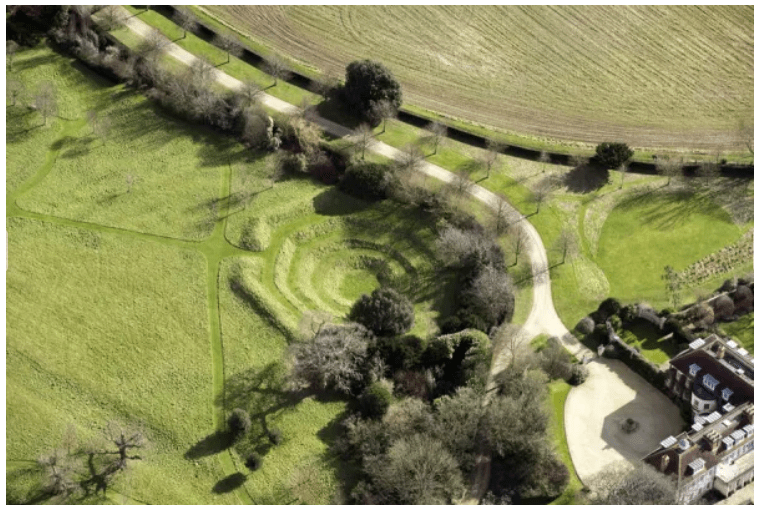
A fascinating man-made feature of the parish is the octagonal reservoir in the Halnaker House. This is not accessible publicly. The OS map calls it a cockpit; but it may not have been.
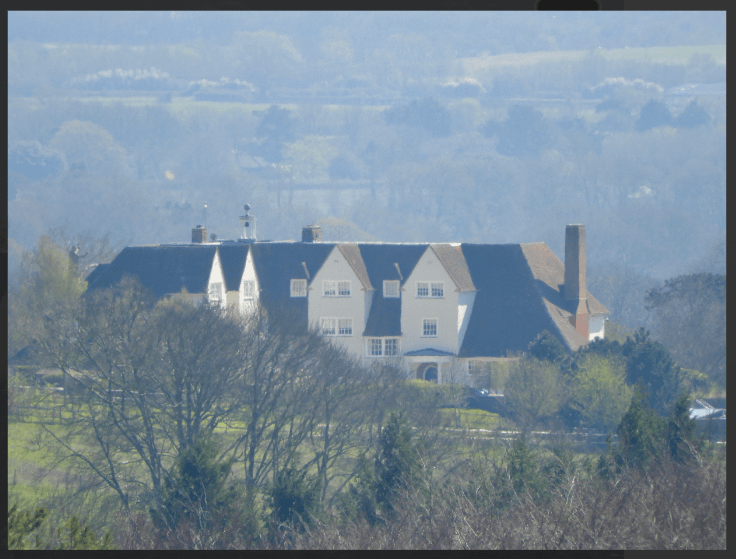
A later and important part of the landscape is house of Sir Edwin Lutyens, built in 1938, see Historic England Halnaker Park but this listed building is invisible from roads and public footpaths and is hidden from view by the trees of the medieval deer park in which it is located; and it is private.
The occasion of the Second World War added to the historic melange of Boxgrove Parish’s Halnaker Hill concrete and octagonal brick structures which formed the base of searchlight emplacements. All that remains of these structures is parts of the bases; this are particularly ugly but are of historical importance and are listed by Historic England However, the brick and concrete does provide a substrate for some beautiful lichens e..g the very common Lecanora campestris which I photographed there on 07/12/2024
There are some interesting sixteenth to nineteenth century vernacular houses in the parish; these are excellently described, with photographs, by John Bennett and Beryl Bakewell, available at January 2021 – Boxgrove and Halnaker Listed properties
Halnaker Hill Causeway Enclosure
The oldest feature of the landscape is the neolithic Causeway Enclosure on the top of Halnaker Hill, close to the Halnaker Mill. Between 50 and 70 causewayed enclosures are recorded nationally, mainly in southern and eastern England. They were constructed over a period of some 500 years during the middle part of the Neolithic period (c.3000-2400 BC) but also continued in use into later periods. They vary considerably in size (from 0.8ha to 28ha) and were apparently used for a variety of functions, including settlement, defence, and ceremonial and funerary purposes. However, all comprise a roughly circular to ovoid area bounded by one or more concentric rings of banks and ditches. The ditches, from which the monument class derives its name, were formed of a series of elongated pits punctuated by unexcavated causeways. Causewayed enclosures are amongst the earliest field monuments to survive as recognisable features in the modern landscape and are one of the few known Neolithic monument types. Due to their rarity, their wide diversity of plan, and their considerable age, all causewayed enclosures are considered to be nationally important.Historic England Causeway Enclosure, World War II searchlight emplacements and associated remains on Halnaker Hill
The Devil’s Ditch consist of a banked ditch, the bank being wooded mostly with Pedunculate Oak and Field Maple
The Devil Ditch forming the south boundary of the Halnaker Deer Park:
Butchers Broom in the ditch.
The bank and ditch of the Devil’s Ditch is continuously wooded mostly with Pedunculate Oak and Field Maple. Butcher’s Broom is an ancient woodland indicator species ; so the Devil’s Ditch has biological importance as well as historic importance,
The earthwork is denoted by a bank and a ditch, which grows fainter as it heads east. It runs west to east, forming a boundary at the northern edge of Redvins Copse, passes north of Oak Cottage and Stanefield house before it ends at Stane Street Roman Road. At the eastern end it forms the southern boundary to Halnaker Park. Towards the western end, the bank is about 2.5m above the bottom of the ditch, which is about 6m wide. At the eastern end, near Stane Street, the ditch is wide and shallow indicating that it may have been recut at a later date and possibly used as an early trackway.
The Devil’s Ditch in Sussex has been documented by antiquarians since at least the 18th century. It is part of a group of linear earthworks on the gravel plain between the foot of the South Downs and Chichester Harbour. The entrenchments run from Lavant to Boxgrove and appear to enclose the area of the coastal plain to the south. It has been suggested that these marked out a high status, proto-urban tribal settlement (or ‘oppidum’) preceding the Roman invasion. The Devil’s Ditch is thought to date to the Late Iron Age (about 100 BC – AD 43) but was recut and extended in places during the medieval period. The name of the entrenchment is derived from a local tradition, which holds that the ditch was the work of the devil in an attempt to channel the sea and flood the churches of Sussex. Historic England Devil’s Ditch, section extending 1730yds (1580m) from Stane Street to NW end of Redvin’s Copse
Stane Street and the Halnaker “Tree Tunnel”
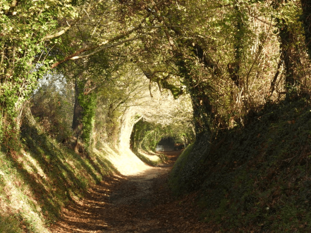
Stane Street linked London (Londinium) to Chichester (Noviomagus Reginorum); and runs through the South Downs. Stane is an old spelling of “stone” (Old Norse: steinn) which was used to differentiate paved Roman roads from muddy native trackways. At Halnaker Hill, Stane Street becomes a “tree tunnel”; which is famed on social media, with may photographs like mine below. There are far better photos of the tree tunnel than mine; just Google Halnaker Tree Tunnel and you will see them. Whilst the Halnaker Tree Tunnel is beautiful, from my experience of walking in Sussex there are far more beautiful and historically significant sunken trackways (hollow-ways) in Sussex than this tree tunnel; but for some reason Halnaker Tree Tunnel has “gone viral”; which shows how social media can distort public attention to what is important in the country side.
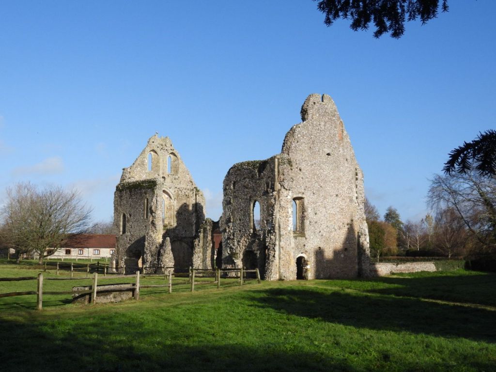
Remains of the Priory
The small Benedictine priory of Boxgrove in West Sussex was founded in about 1107, originally for just three monks. In a beautiful setting at the foot of the South Downs, the principal remains include a fine two-storey guest house, roofless but standing to its full height at the gable ends. The eastern parts of the priory church became Boxgrove’s parish church after the Suppression of the Monasteries.English Heritage Boxgrove Priory
The importance of the ruins as a picturesque spectacle drew tourists, artist and antiquarians throughout the 18th and 19th century; perhaps enhanced by William Gilpin, who in the eighteenth century wrote essays that explored the picturesque as a new aesthetic concept
Starting in the 18th century, the history of the priory and its ruins attracted the attention of antiquarians and artists. The latter included Samuel and Nathaniel Buck, who in 1737 published an engraving of the church and surviving portions of the roofless monastic buildings. English Heritage Boxgrove Priory
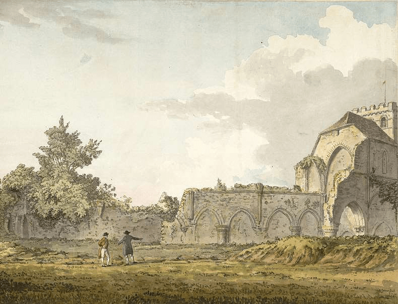
Below, a watercolour view of the ruins of the nave of Boxgrove Priory, seen from the churchyard, by Samuel Hieronymous Grimm, 1781
Samuel Hieronymus Grimm (18 January 1733 – 14 April 1794) was an 18th-century Swiss landscape artist who worked in oils (until 1764), watercolours, and pen and ink media. Grimm specialised in documenting historical scenes and events; he also illustrated books such as Gilbert White’s The Natural History and Antiquities of Selborne. Tate Samuel Hieronymus Grimm
The decorations by Lambert Barnard of the choir vault and the sculpture of De La Warr Chantry are of international art-historical importance.
On the choir vault there are decorations by Lambert Barnard for Lord de la Warr (Croft-Murray p112), probably linked with his chantry. Naturalistic foliage, interspersed with the arms of de la Warr and relatives.Sussex Parish Churches Boxgrove Priory Church. Lambert Barnard (d1567/68) did much work for Bishop Sherburn (1508-38), notably in Chichester cathedral. Little is known of his life, but stylistically, if not by birth, he had Netherlandish links. E Croft-Murray: Lambert Barnard: an English Early Renaissance Painter, AJ 113 (1957) pp 108-25Sussex Parish Churches Architects and Artists B
It is hard to know what particular species the flowers depicted on the C16 ceiling painting, commissioned by Thomas West, the 9th Lord de la Warr, are intended to be. They are described as a “delightful mix” of various local plants; but I think it more likely that they are a symbolic representation of the importance of flora to Thomas Wests beliefs; with their decorative pattern being more important than close observation of actual flowers. Botanical accuracy in botanical art was a feature of 17th and 18th century still lives and botanical illustration for florae. The flowers on this 16th century ceiling were probably not meant to be accurate representations of local plants, even if they were inspired by them; they are more symbolic than representational. The symbolic religious use of flowers as symbols of God’s creation was common in medieval churches, as I reminder that all of creation praises God, and perhaps representing the Garden of God, Eden, or the beauty of heaven. Considering that 9th Baron De La Warr was expecting to be buried in this church, it is likely they he wanted them to represent his ascent into heaven.
The chantry in the choir was built by Thomas, Lord de la Warr for himself and his wife between 1530 and 1535 and led to a major internal alteration. … [A chantry is a chapel or area within a church where a priest who would say daily masses for the donor’s soul] The chantry is more a piece of architecture than a monument in any conventional sense. Ironically, … de la Warr was buried at Broadwater in 1554. This was probably because he fell out of favour and was compelled by the King [Henry VIII] to exchange the manor of Halnaker in Boxgrove for Wherwell in Hampshire in 1540 and thus had no further link with Boxgrove, …. Added to this was the abolition of chantries in 1547, which meant that by the time of de la Warr’s death this could only have functioned as a tomb.
The plan is rectangular with two bays on the long sides, each with pairs of cusped arches separated by pendants, which are also present on the vault inside – the short ends have none. The base is essentially gothic, decorated with shields within lozenges. The upper part, especially the corner-shafts and those between the bays, is covered in Renaissance ornament of shallow incised figures and foliage, some based on Paris woodcuts of c1500 The canopy also combines such decoration with gothic elements – pairs of angels and putti hold shields with straight heraldic decoration. Tiered niches for statues, if ever filled, are now empty. Inside, the reredos has more empty niches, either side of a blank space intended for a carving. Each side of the reredos is an opening, of which that to the main nave of the church served as a squint. The purpose of the recess to the south was probably to provide symmetry. A small opening on the south side but lower down is too small for a piscina and its purpose is uncertain. The painted interior is mostly restored and the iron gates survive. Sussex Parish Churches Boxgrove St Mary and Saint Blaise
Foliage is a key aspect of the iconography of the chantry It is believed that the animals (real and fictious) come from a French Book of Hours (which one not known); but there are other sixteenth century resources that could be a source for the sculptured imagery e.g. Master of Claude de France’s Book of Flower Studies (ca. 1510–1515); some of the studies can be viewed on-line from the Metropolitan Museum of Art collection in New York see Book of Flower StudiesMaster of Claude de France ca. 1510–1515
The flowers above these imaginary beasts look very similar to the marigolds
but that does not mean that the anonymous sculpture of the De La Warr used this study as a pattern, as images of all flowers in the 16th century are very stylised; the idea could have come from many manuscripts depicting flowers
The marigold was nicknamed “Mary’s Gold” due to several legends linking it to her. One story claims that when Mary’s purse was stolen on the flight to Egypt, all the thieves found were petals, so early Christians left marigold petals around her statues as a substitute for coins.Jonathan Hoyle, Society of Arts, Medieval Natural Symbols
Heaven is often depicted as a return to the garden of Eden in Medieval and Early Modern manuscripts. So the intent of the artist in including much foliage in the chantry may have been to suggest that heaven was where Thomas, Lord de la Warr would go after death. The Tudor roses on the Chantry show Thomas’s allegiance to Henry VIII; opponents of Henry often had their earthly lives shortened by judicial or extrajudicial execution
The flowers on to the left of this beast may be chicory
they are similar to Master of Claude’s chicory. Pre-reformation church sculpture was typically polychrome, often painted painted in gaudy colours but the colour wears away over the years; the colour of sculptured plants would make it easier to assign to possible specific botanical species
The plant’s ability to thrive along roadsides in difficult, disturbed soil, coupled with its strong, deep taproot, made it a symbol of Christian perseverance and resilience in the Middle Ages. The plant’s steadfast nature, even through cold winters, linked it to the endurance of faith. Riklef Kandeler, Wolfram R. Ullrich, Symbolism of plants: examples from European-Mediterranean culture presented with biology and history of art: NOVEMBER: Chicory, Journal of Experimental Botany, Volume 60, Issue 14, October 2009, Pages 3973–3974, https://doi.org/10.1093/jxb/erp248
Here is some Chicory I photographed at Singleton; close by Boxgrove, in 2024. Chickweed was grown for its seed; and it is common in Sussex as a arable weed.
Though C. intybus was formerly regarded as a native, at least in England and Wales, doubt is now cast on that status in most counties, and it is almost always treated as a relic of cultivation. Historically, it was cultivated for its seed (subsp. intybus) British and Irish Botanical Society Plant Atlas 2000 It would have been common in the arable fields around Boxgrove in the C16
There are foliate heads. often called Green Men;, carved in the chantry, although the second of these images looks more like a foliate head of an animal or mythical beast. Lady Raglan only coined the name Green Men in 1939; it has no historical heritage
There is voluminous writing on the Green Man motif representing a pagan mythological figure, as proposed by Lady Raglan in 1939 Raglan, Lady. “The Green Man in Church Architecture.” Folklore, vol. 50, no. 1, 1939, pp. 45–57. doi:10.1080/0015587x.1939.9718148 but her view is not supported be the evidence. Many folklorists believe that foliate heads indicate a perseverance of pagan beliefs after the Christianisation of England. However, as De La Warr had gone to great expense to have the chantry built and have priests pray for his soul (although did not happen because of Henry VIII’s reformation) he would hardly have risked his salvation with what might have been be perceived as pagan imagery. It is far more likely that foliate heads in churches were Christianised symbols of resurrection, as I J B S Corrigan (2019) points out in The Function And Development Of The Foliate Head In English Medieval Churches. Unpublished theses, University of Birmingham accessed 30.11.25 https://files.core.ac.uk/download/pdf/323305511.pdf, which includes consideration of the Boxgrove foliate heads.
This appears to be a thistle
Master of Claud’s thistle
Thistles are associated with the Virgin Mary, It is impossible to say which form of thistle is sculpted on the Chantry but Milk Thistle, Silybum marianum, Also known as the Marian or Mary Thistle, the species name Marianum comes from the Latin and refers to a legend that the milky white streaks on the spiny leaves of this species of thistle came from the milk of the Virgin Mary nursing her child whilst fleeing to Egypt.Bolton Castle Plants
Whether the foliage painting and carvings are attempts at botanical verisimilitude or are entirely symbolic – or something in between – does not bother me – as all you need to do to enjoy the art of Boxgrove Priory Church is visit and look at its art yourself.
A Footnote
Boxgrove Priory Church not only has outstanding Renaissance ceiling painting and Chantry carving, it has some cracking lichens on its external walls, including Ingaderia vandenboomii, which is deemed a “Nationally Scarce” by the British Lichen Society. But it is not that scarce on the north walls of old (mostly Saxo-Norman) coastal churches in Sussex.
Ingaderia vandenboomii has a pink thallus i.e body (the red is a reaction to a chemical reagent spot test used to confirm its identity.