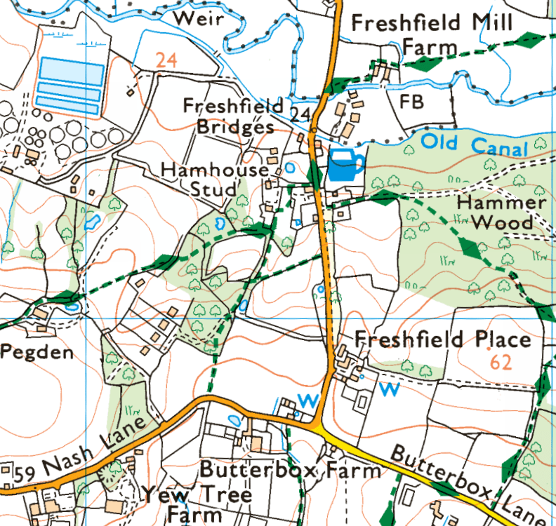
I took the Compass 121 bus to Newick from Lewes (having got to Lewes on a Brighton and Hove 29 bus) and from Newich I walked through Newick Common, Fletching Common, Lane End Common, Warr’s Wood, an unnamed wood, Wapsbourne Wood, Hammer Wood, Hamshaw Wood .Scayne’s Common, and Costells Wood to Scaynes Hill. At Scaynes Hill I took the Compass 31 bus to Uckfield, and retuned to Brighton on the 29.
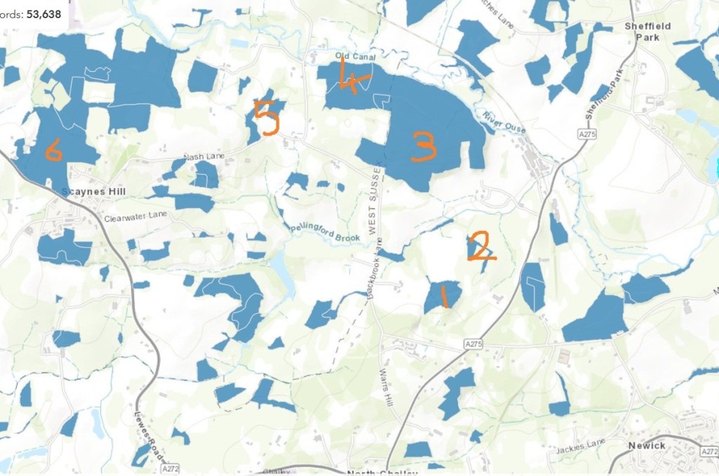
Warr’s Wood (1); the unnamed wood (2); Wapsbourne Wood (3); Hammer Wood (4); Hamshaw Wood (5), and Costells Wood (6) are all listed as ancient woodland by Nature England
Most of the walk was in the Low Weald, but Costells Wood [and Wapsboune Woods], is just within the southern boundary of the High Weald National Character Area (NCA), where it meets the Low Weald NCA. Woodland Trust Costells Wood Management Plan
Extract from Nature England National Character Area High Weald Context Map showing the boundary between the High and Low Weald. In reality, here is no hard and fast boundary between High and Low. Warr’s Wood clearly has a low weald biological and landscape character and Costells Wood has a high weald biological and landscape character with its ghyll; Wapsbourne Wood, although technically feels more interstitial
Low Weald character: Land use is still predominantly agricultural, and largely pastoral owing to the heavy clay soils … Most grassland has been agriculturally improved, but fragments of unimproved, floristically rich meadow and pasture are still present.
Fields are generally small and irregular, many formed by woodland clearance or ‘assarting’ in the medieval period and often bounded by shaws or formed from cleared land along woodland edges. Many of the especially species-rich hedgerows in this area may be remnants of larger woodland and often follow the pattern of medieval banks or ditches. …
Like the High Weald, the Low Weald is densely wooded … [with] Numerous and extensive blocks of ancient, semi-natural coppiced woodland … Oak is the principal tree and, despite centuries of clearances for settlement, transport and agriculture, significant areas of ancient woodland survive. Low Weald – National Character Area Profiles
Natural England on-line map of Ancient Woodland: Ancient Woodland (England) | Natural England Open Data Geoportal
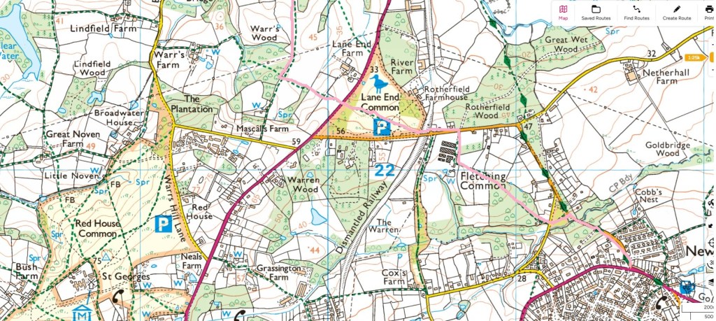
Route taken from Newick to Warr’s Wood (pink line) OS online maps: Detailed maps & routes to explore across the UK | OS Maps
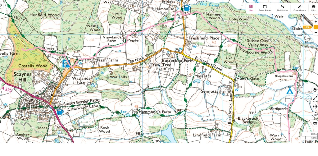
Route taken from Warr’s Wood to Scaynes Hill (pink line)
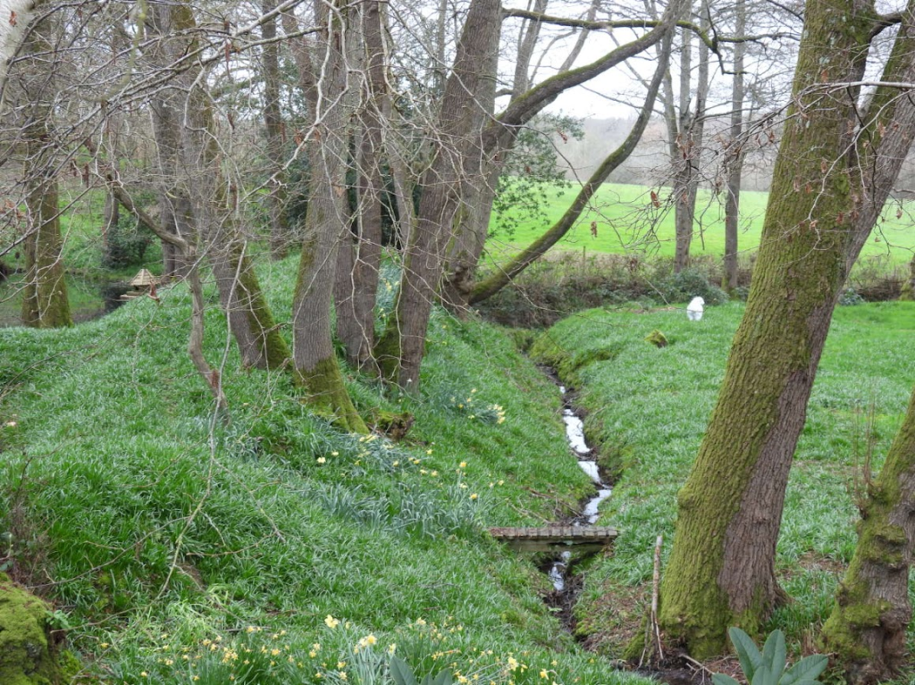
When I am walking I pay attention to whatever takes my eye so whilst this route was planned around visiting certain woodlands commons, I found interesting things on the paths between these.
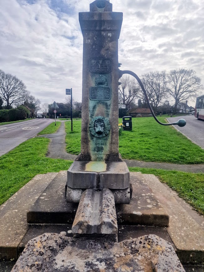
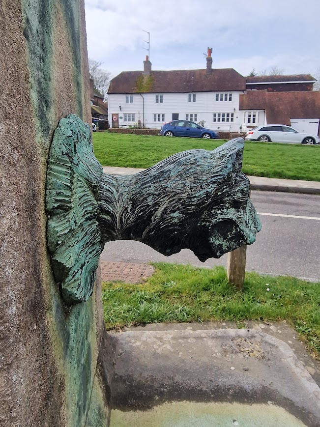
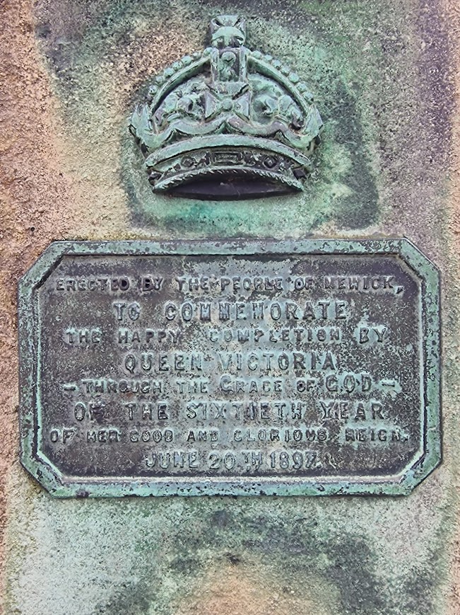
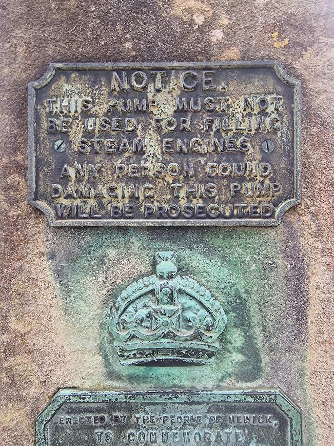
Newick
The Newick C19 Water Pump.
Newick Common
Current OS Map Detailed maps & routes to explore across the UK | OS Maps
Not named on the map, Newick Common is the small lime-yellow triangle of land. Lime-Yellow in wooded areas of OS maps indicates areas of public access land. This may be National Trust, Woodland Trust or Forestry Commissions land, or it may be privately own land where there are still rights of common.
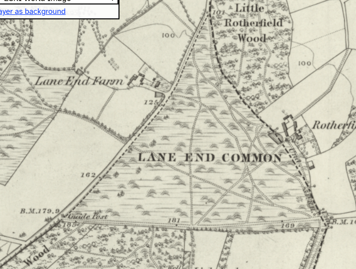
OS Six Inch Map 18302-1860 Georeferenced Maps viewer – Map images – National Library of Scotland Showing Newick Common as considerably larger than 2026
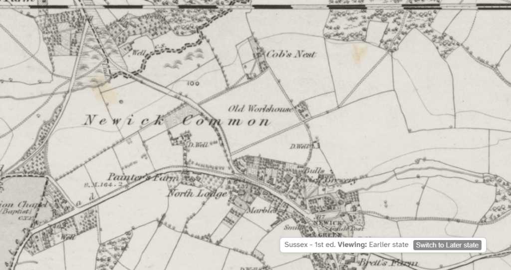
Newick Common is the triangle of land located between Newick Hill and Jackies Lane (outlined in red on the map below). It was originally much larger in extent, including a lot of the land between Jackies Lane and Western Road, but development over the years has meant that it has been reduced to its current size. A lot of small trees and scrub have grown up in this area, but we know from talking to people who grew up in the village that 50-60 years ago it used to be much more open. In conjunction with the Lewes District Council rangers, we are therefore trying to remove some of the trees and scrub, to restore a more varied habitat and increasae biodiversity Newick Rootz: Newick Common
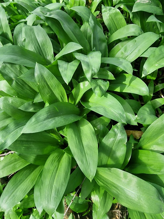
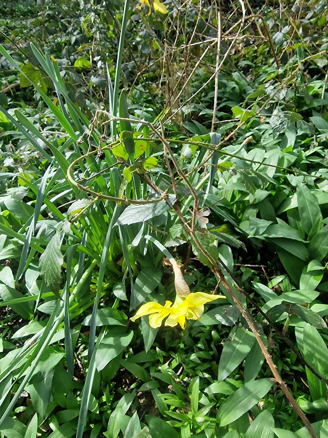
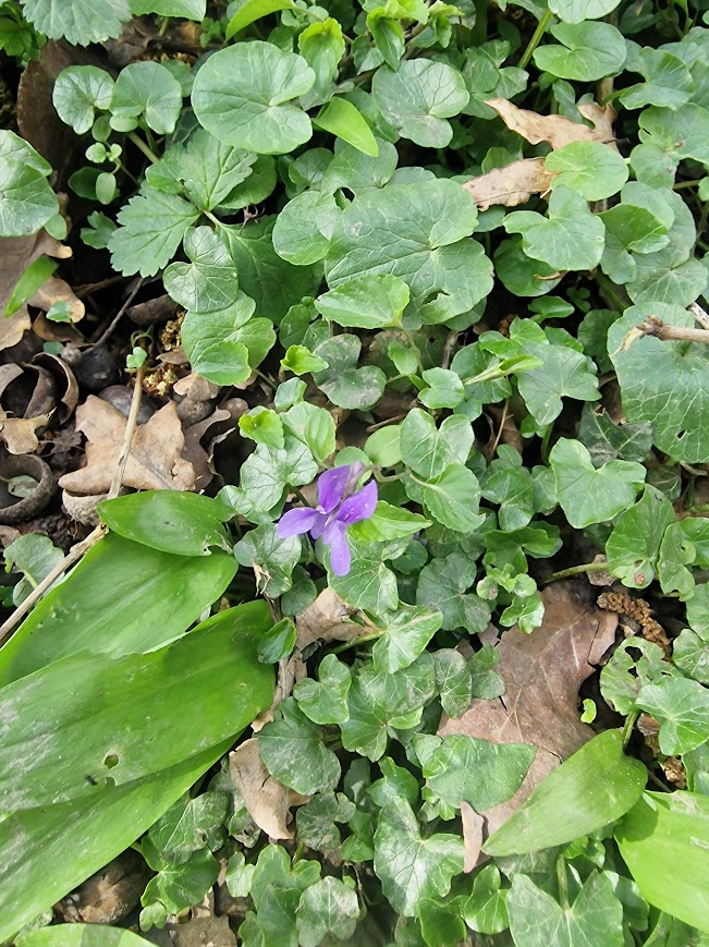
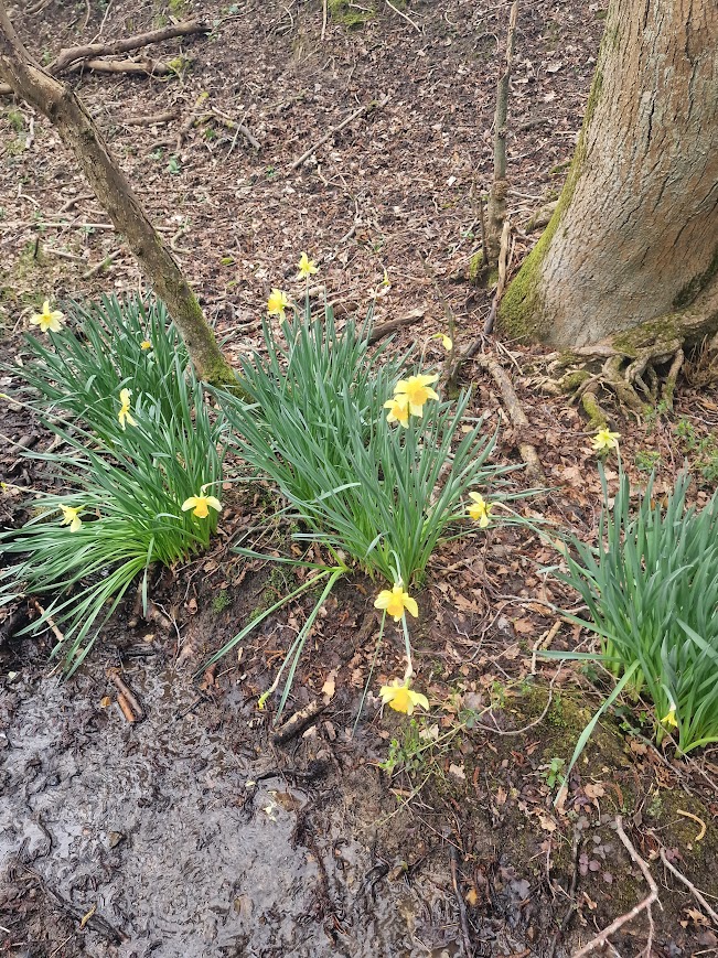
On the common, there was Wild Garlic. Wild Daffodils and Early Dog Violet; that are often associated with ancient woodland
Fletching Common
I can find little on the history of Fletching Common. It is now continuously wooded. Part of it now a campsite, Wyld Wood Campsite, part of it is just woodland. The trees in the woodland were previously managed; as their are many old coppice hazel stool, and pollarded Pedunculate Oak and, curiously, coppiced Pedunculate Oak, some which appear to have no main trunks.
Interestingly Fletching Common is listed on the Government’s database of commons Copy_Common_Land_CPHs.xlsx but Newick is not; but on the OS maps, Newick is marked as public access land but Fletching is not
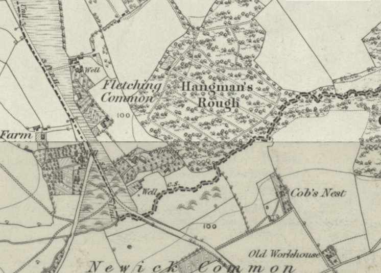
OS Six Inch Map 18302-1860 Georeferenced Maps viewer – Map images – National Library of Scotland showing the woodland of Fletching Common as Hangman’s Rough; here is no historic provenance for the name Wyld Wood; presumably the owners of it didn’t fancy a Hangman’s Rough Campsite!
Coppiced Oak
Pollarded Oak
What looks like an old Coppiced Pedunculate Oak with no main trunk:
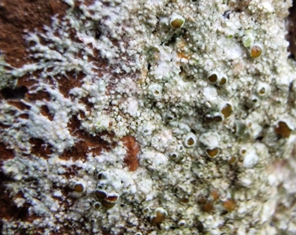
There was very limited ground flora. The lichen flora was the common lichens you would expect on Oak
Flavoparmelia caperata, Common Greenshield Lichen
Ramalina farinacea, Oak Moss Lichen
Between Fletching Common and North Lane Common
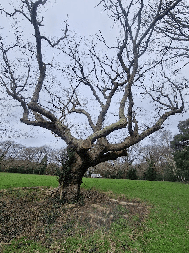
This stunning old Oak pollard was in a field. Often the most spectacular trees are not in woodlands but hedgerows and fields. Field old trees are possibly relicts of cleared woodland, when trees are left for shade for famed animals
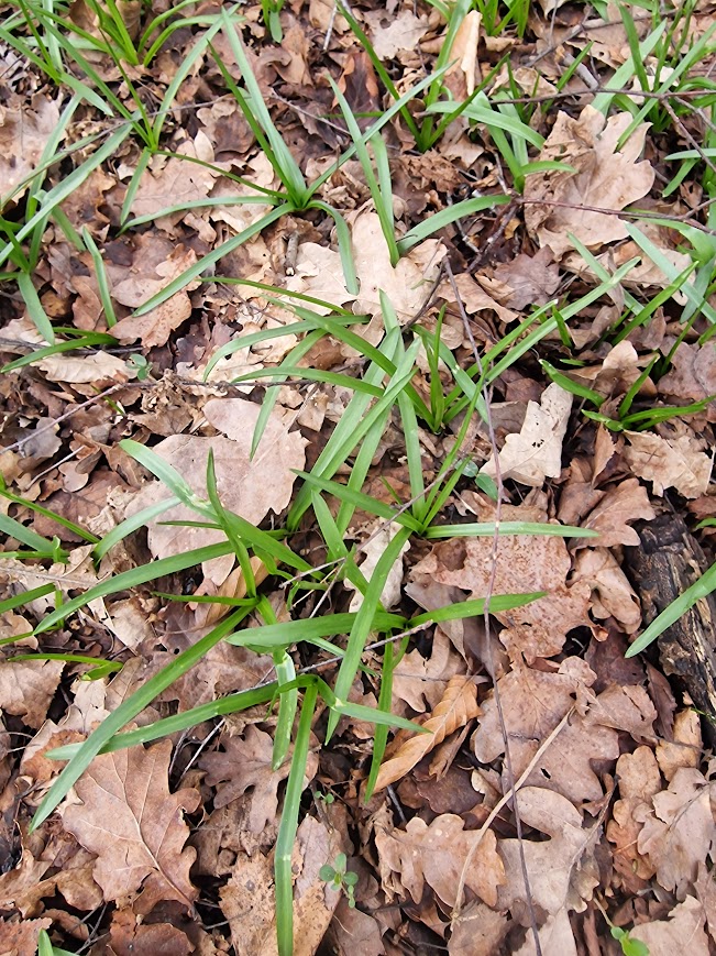
Lane End Common
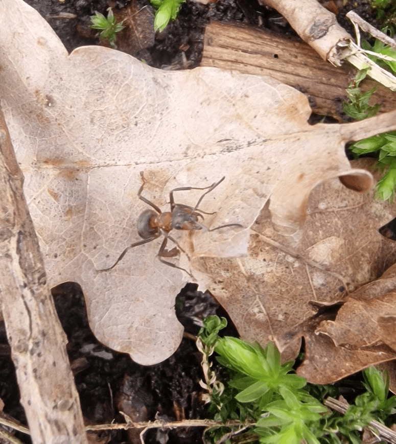
Lane End Common is one of the five Chailey Commons. A Compact and dry woodland heath rich in insects and wood ants. Chailey Commons Society Five Different Commons
Southern Wood Ant, Formica rufa
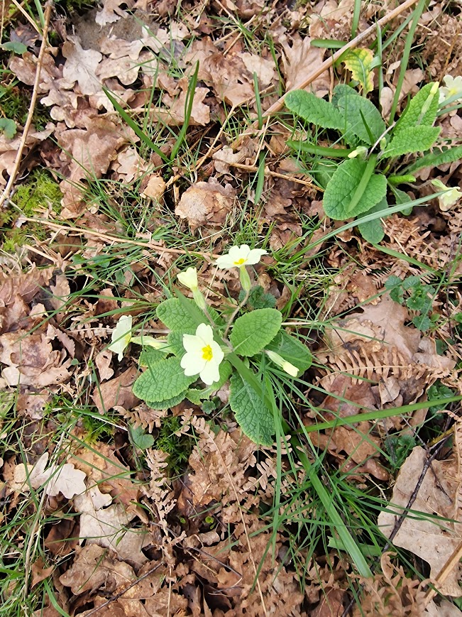
Whilst Lane End Common is not designated as ancient woodland, there were some ancient forest indicator species in the wooded parts of the common, including Primroses, Bluebells, Wild Daffodils and Honeysuckle
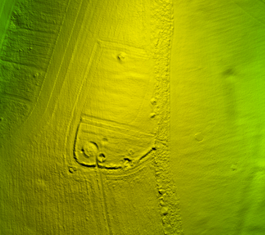
In North End Common there is a lot of archaeological interest, including the medieval route on the NE boundary of the Common – known in the 17th century as the ‘Lewes to Grinstead Way’, probably 14th century or earlier, shown on a 17th century estate map, and on 1st edition OS map running NW/SE on the NE boundary of the Common to the old Ouse crossing, thought to be between Wapsbourne and Sheffield Bridge. It runs SE to Red Gill, Jackies Lane, Oxbottom, Cockfield Lane and eventually to Lewes (known as the pack horse way) (GR TQ 404205) Chailey Commons Society – Archaeology
Other archeolgical featires of the common include:
- Sunken lanes/braided tracks – 5 x parallel banks and dips (running SE/NW), bisected by the railway cutting and are likely to be earlier than the Lewes to E Grinstead Way. Possibly animal migratory routes and post-medieval track-ways. Disappear in the mid-area of the Common, but emerge on the same axis in the Northern triangle point(GR TQ 405223).
- Boundaries on the NE edge show an established bank topped by overgrown multi stemmed hornbeam with signs of coppicing and pollarding, and a ditch on the Commons side.
- Ridge and furrow towards the West boundary opposite Lane End Farm – 6 or more parallel umbrella shaped ridges and furrow dips (N/S), medieval(?), manmade and possibly a system for managing the cycle for harvesting brakes, fern and ling and allocating in rotation? (GR TQ 402223)
- Sand quarry, indicated by sandy soil, a deep cleft and spoil heap on the S boundary W of the car-park. (GR TQ 402222) Chailey Commons Society – Archaeology
Theses relate to the ancient rights of common: rights to collect bracken, fern, twigs and ling (or matted heather) for thatching and fuel (discussed on earlier walks). Chailey Commons Society Archaeology
OS Six Inch Map 18302-1860 Georeferenced Maps viewer – Map images – National Library of Scotland seemingly showing the the SE-NW banks and dips; as well as the Lewes to Eeat Grinstead Way.
There were several attempts by landowners to enclose Commons and deprive Commoners of their rights. For example, in the mid 17th century ‘anger resulted in physical harm to persons, when inhabitants of Fletching pulled down the fences Sir Henry Compton had erected around part of Chailey Common. His stewards followed the men home and wounded one by gunfire. This dispute was settled in the Court of the Star Chamber.’ Brandon (2003) p121. Brandon P (2003) The Kent and Sussex Weald, Phillimore. Chailey Commons Society Archaeology
E.P. Thompson (1963) The Making of the English Working Class)described the parliamentary enclosure movement in 18th and 19th-century England as a “plain enough case of class robbery,” fundamentally transforming the relationship between land, law, and the working class.
Braded Trackways:
Huge Oak pollard:
Girth suggested an age of 300-400 years.
A completely decorticated dead Pedunculate Oak
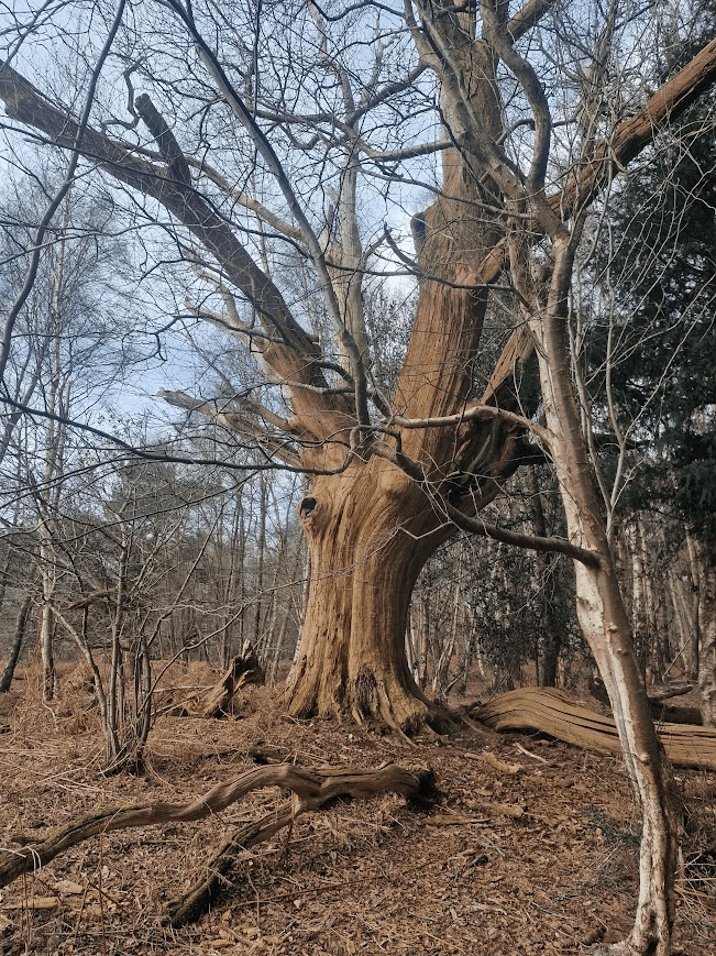
Now a home for invertebrates:
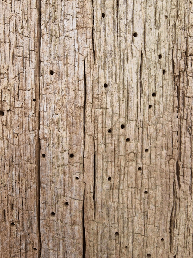
and Cladonia parasitica, a lichen of decorticated wood
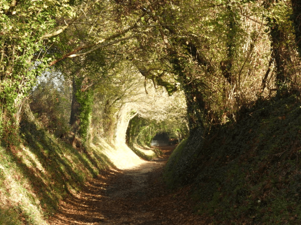
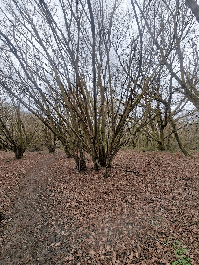
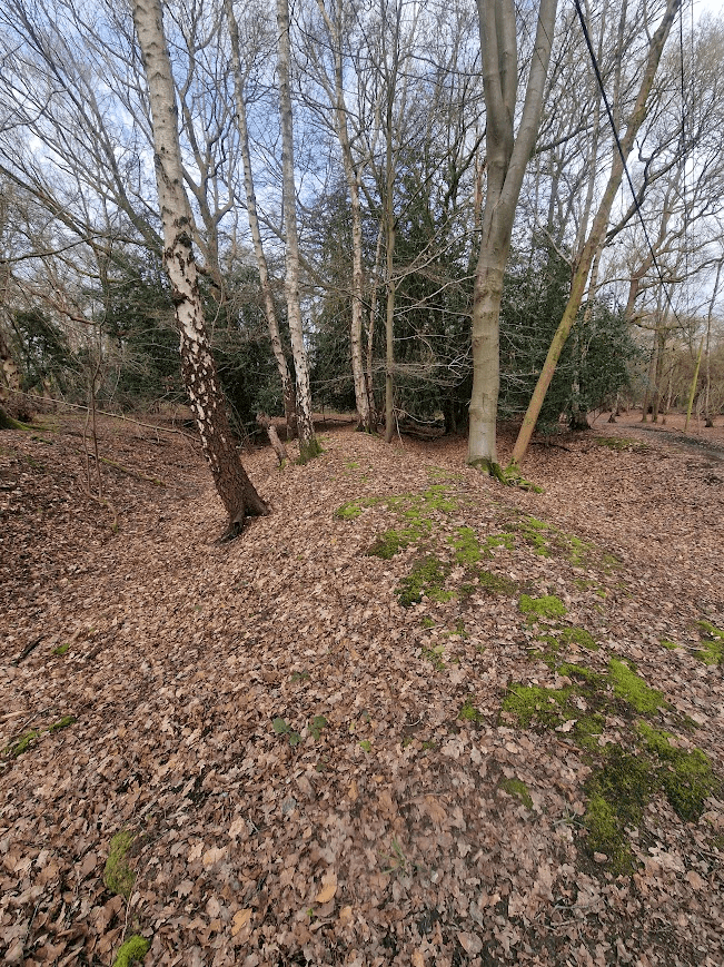
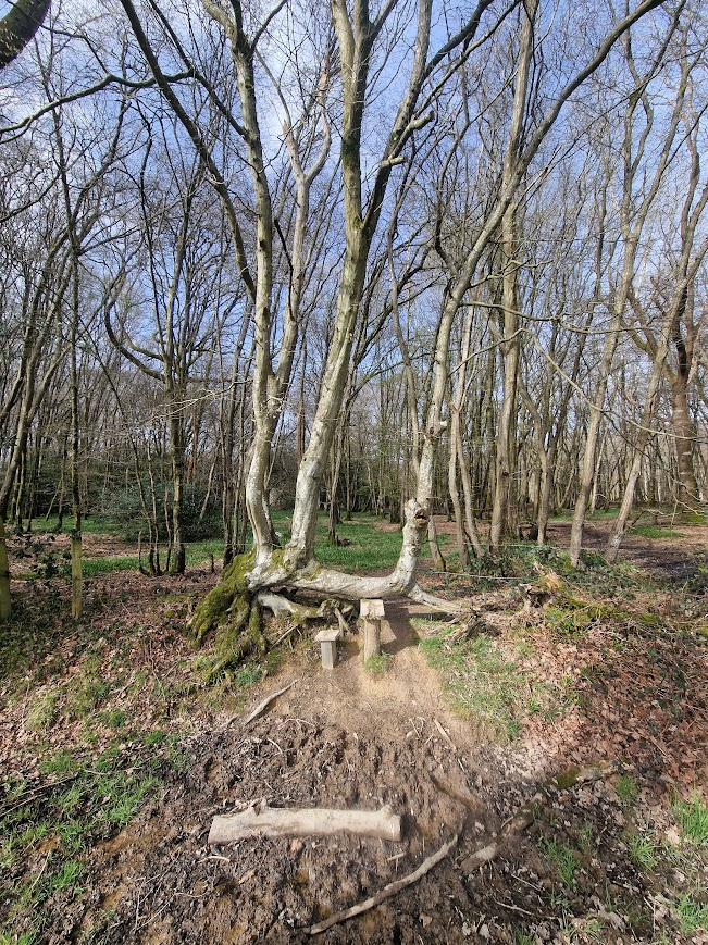
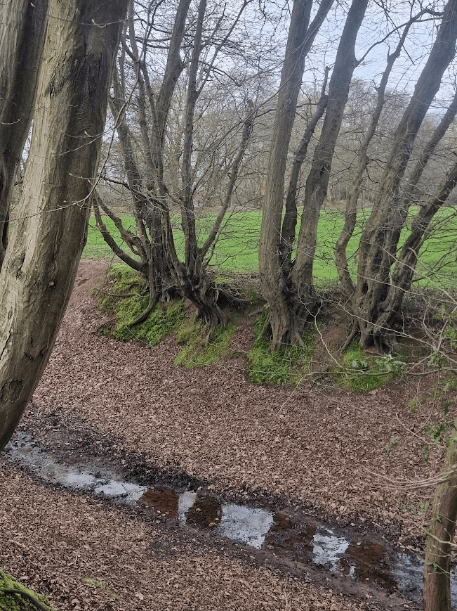
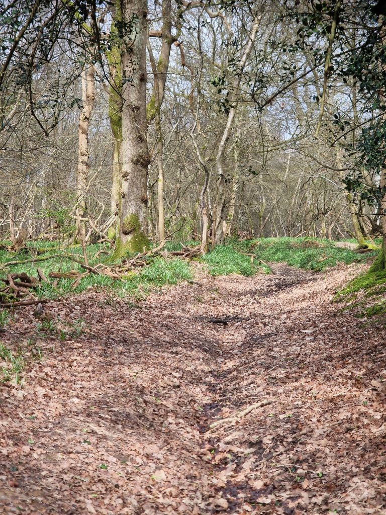
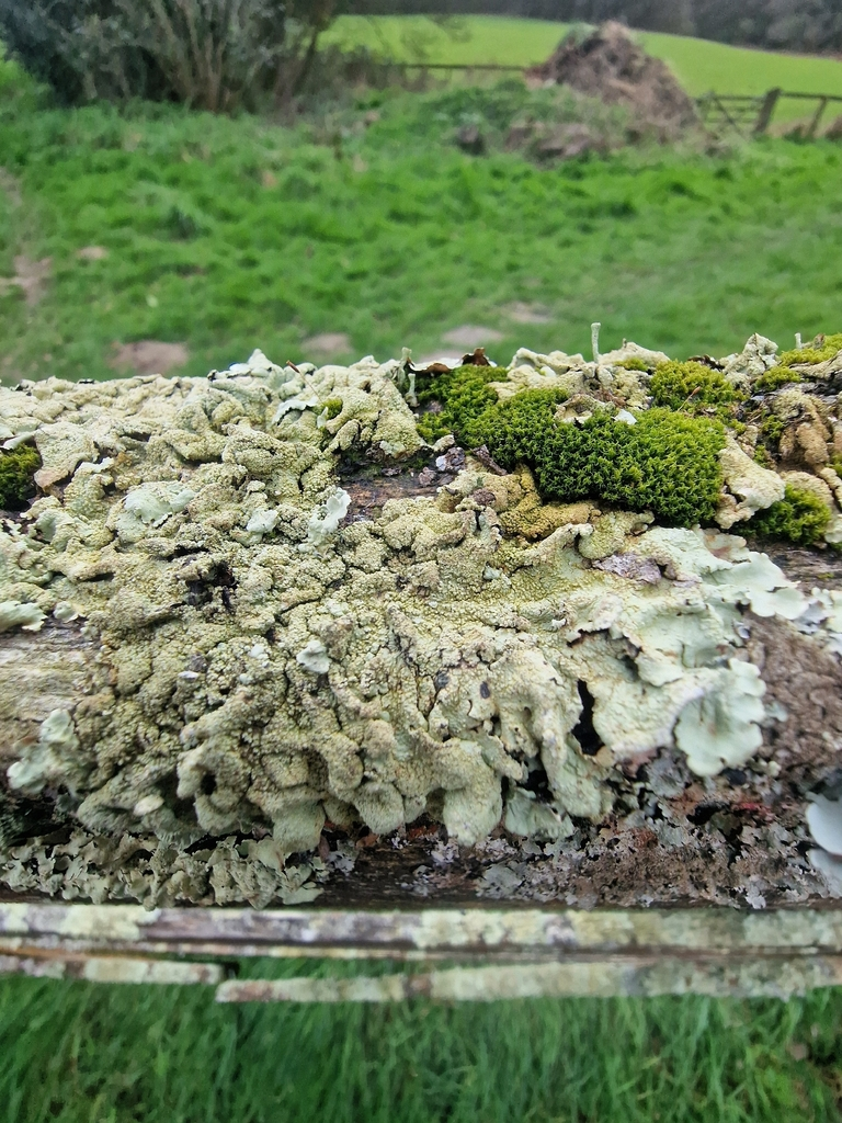
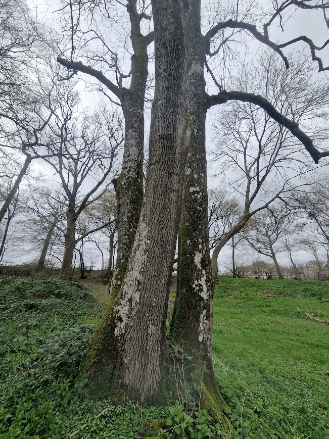
Warr’s Wood
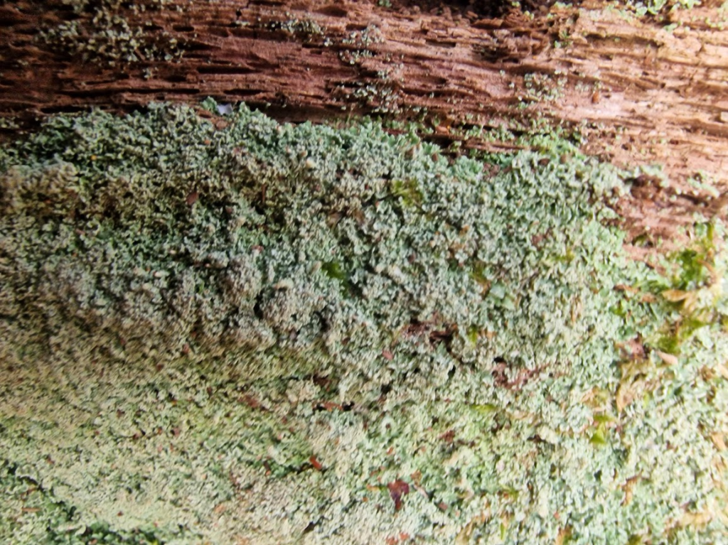
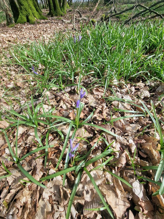
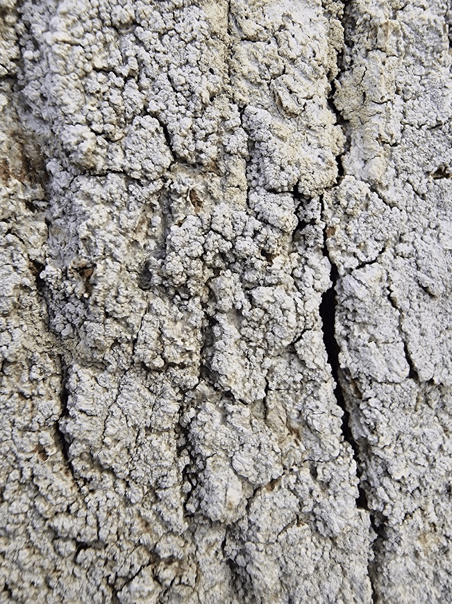
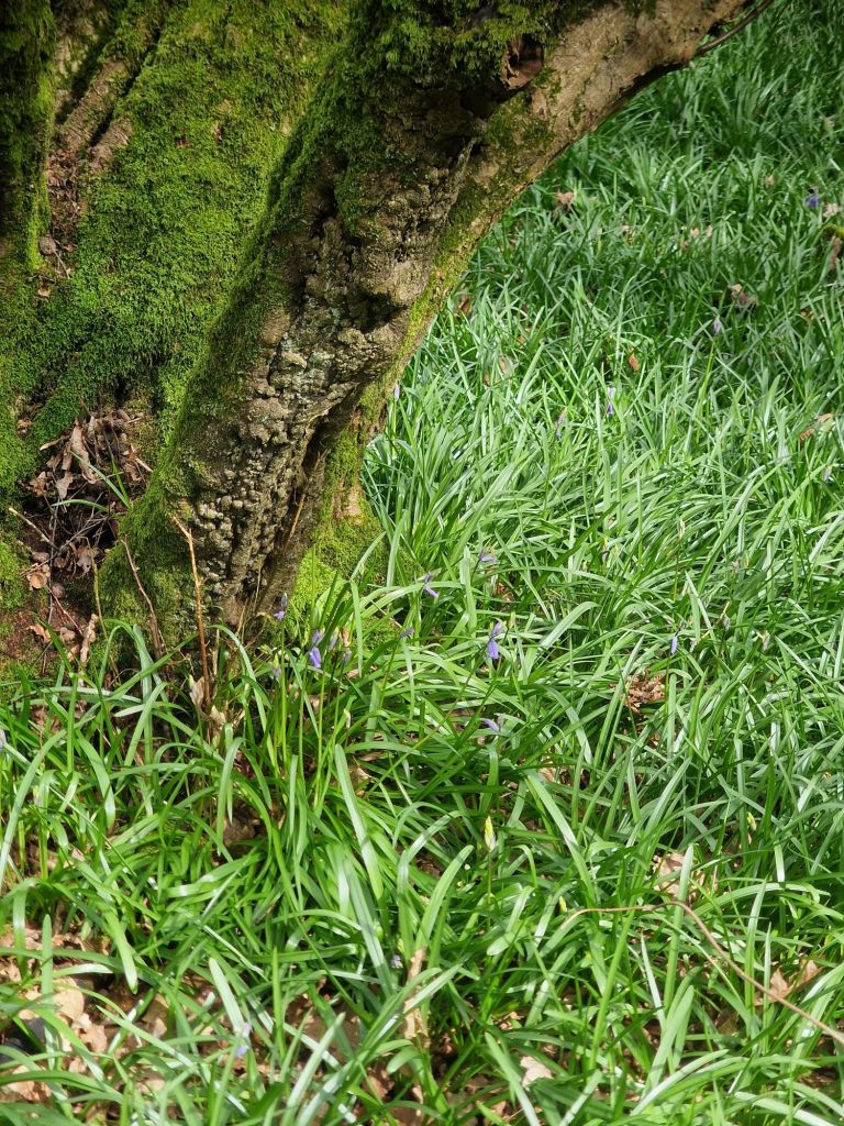
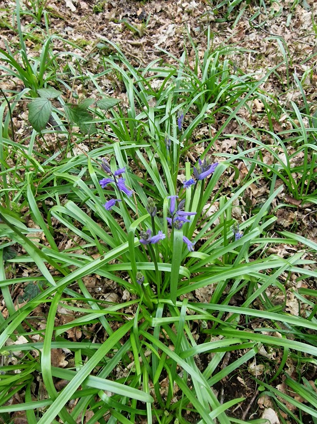
Warr’s Wood is an example of typical low weald coppiced Hornbeam ancient woodland with some Pedunculate Oak; a frequent type of low weald wood. The boundary bank around it has coppiced and pollarded Hornbeams. The ground flora (in spring) is dominated by Bluebells
Boundary Bank
Bluebells
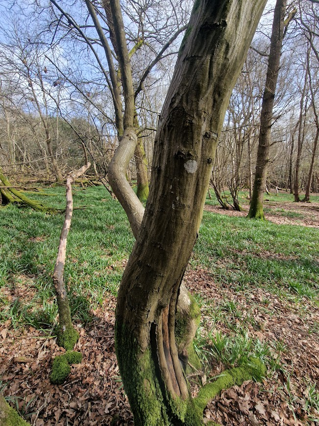
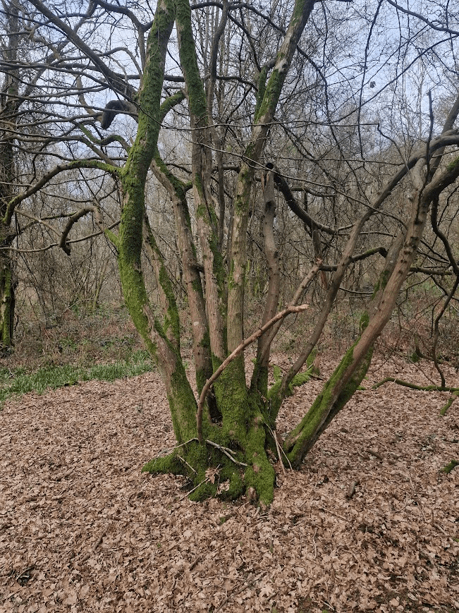
Coppiced Hornbeam
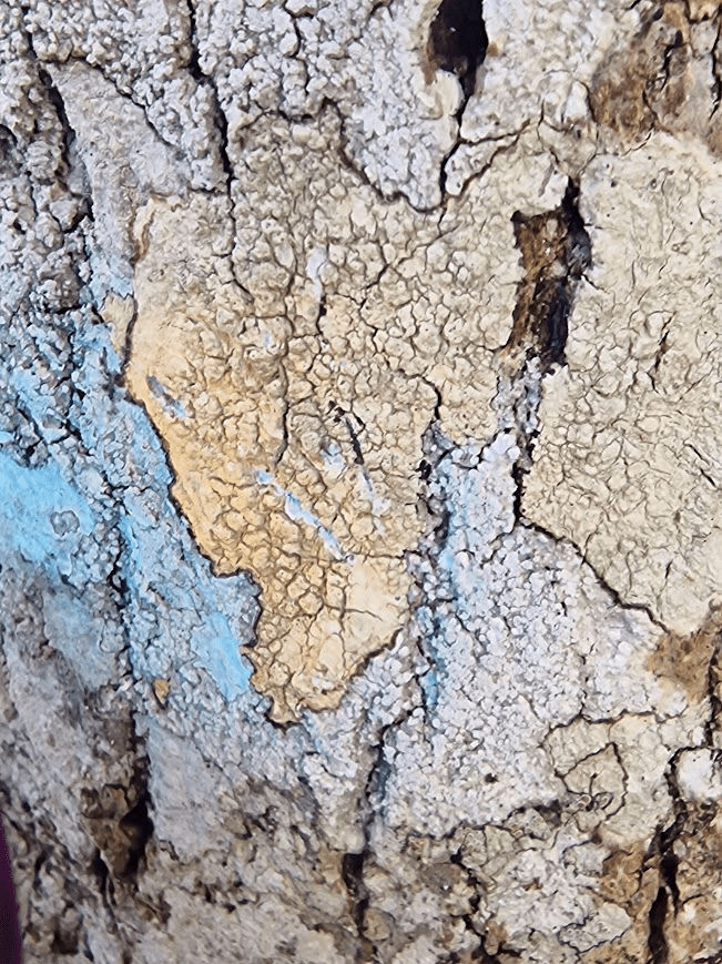
Lecanactis abietina, on Pedunculate Oak, an old woodland indicator lichen
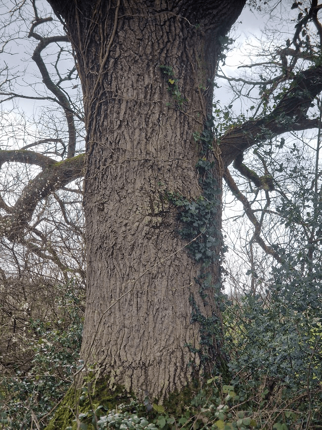
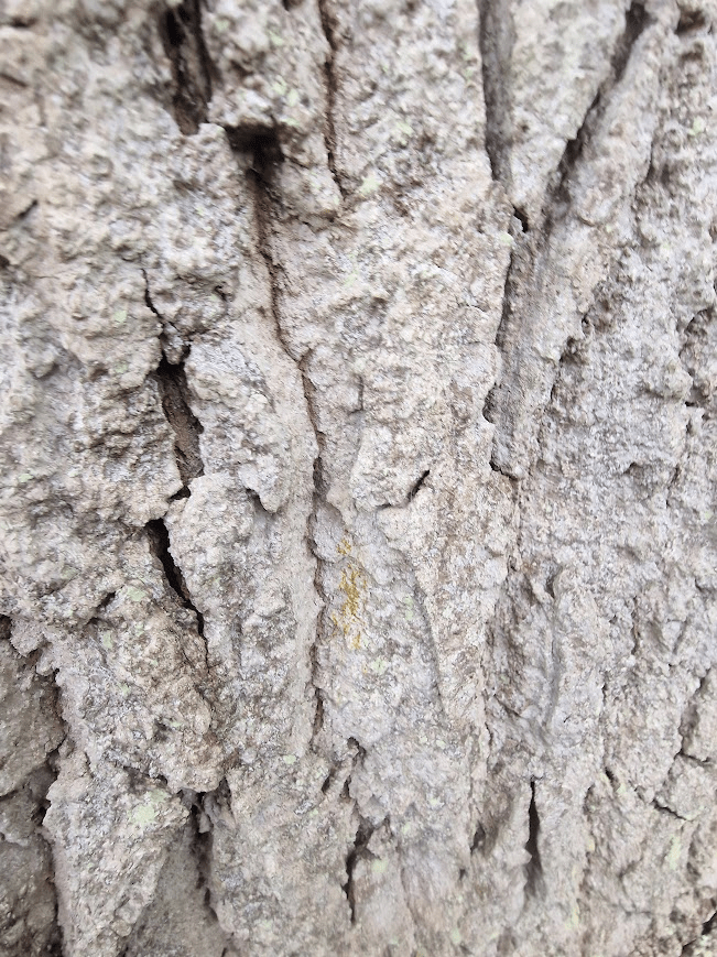
Un-named Wood
This is a tree on the edge of the wood.
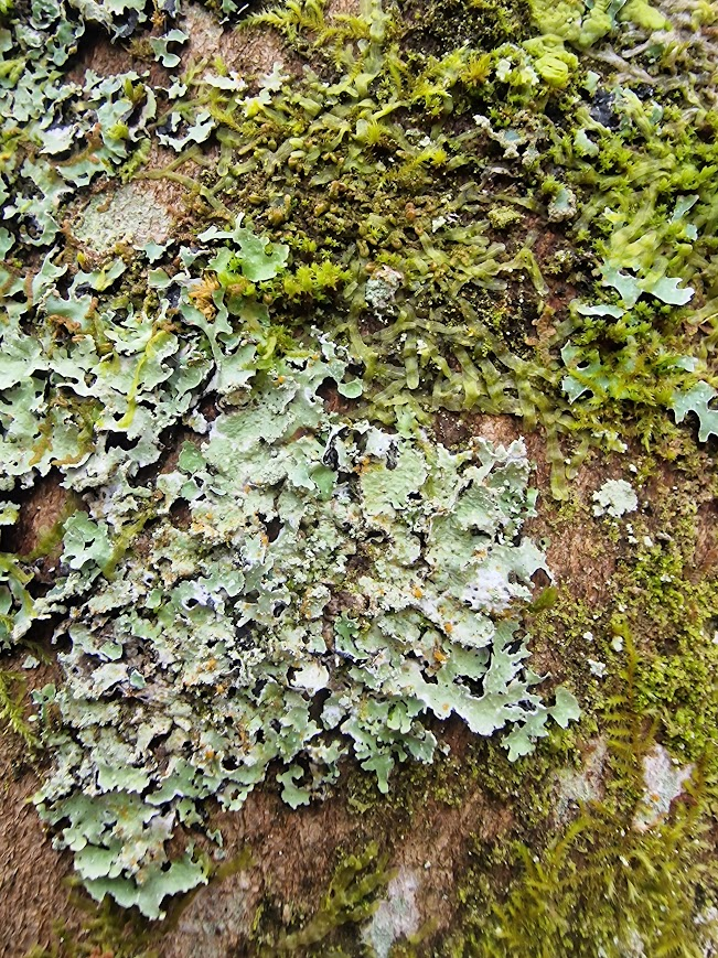
This tree shows lichens of the Mature Mesic Bark Community (Pertusarietum amarae) on Oak
The Pertusarietum amarae are shade tolerant communities on rougher bark, with Pertusaria species dominant. They are particularly characteristic of Beech and Ash, but also on less damp Oak bark. The basic community is composed of widespread species particularly Pertusaria s. lat. species: Pertusaria albescens, Lepra amara (Pertusaria amara f amara), Pertusaria flavida, Pertusaria hymenea and Pertusaria pertusa along with Phlyctis argena and Ochrolechia subviridis. This is a common community in drier areas but gets displaced by moss dominated communities in strongly oceanic areas. . British Lichen Society Lichen Communities
On this tree I saw Lepra amara (previously Pertusaria amara), Pertusaria hymenea and Pertusaria pertusa; all very common, plus others I didn’t have time to fully investigate. I used my UV torch to search for Pertusaria flavida, as it reacts to UV light with bright orange fluorescence. I only got the dull orange of Pertusaria hymenea and P pertusa. I also tested any likely candidates of Varicellaria hemisphaerica (previously Pertusaria hemisphaerica) with sodium hypochlorite spot tests; but I did not get the characteristic red reaction. I do these tests as I have found P. flavida and V. hemisphaerica on trees with Mature Mesic Bark Community elsewhere in Sussex
Pertussaria hymenea
Lepra amara
Pertusaria pertusa
Pertusaria pertusa biofluorescent dull orange with UV light
The blue florescent lichen(s) remains mysterious
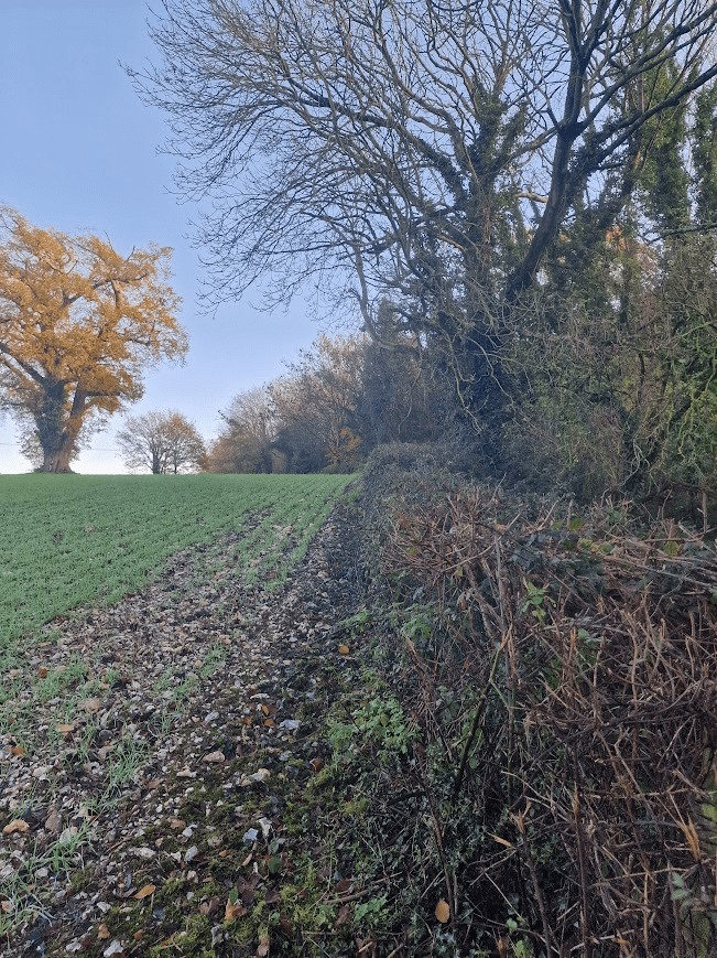
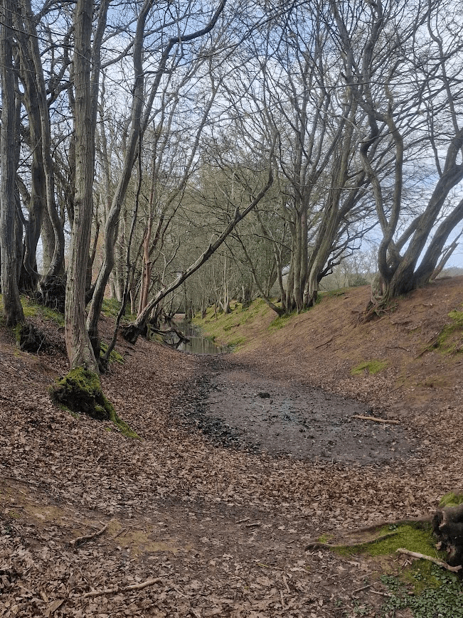
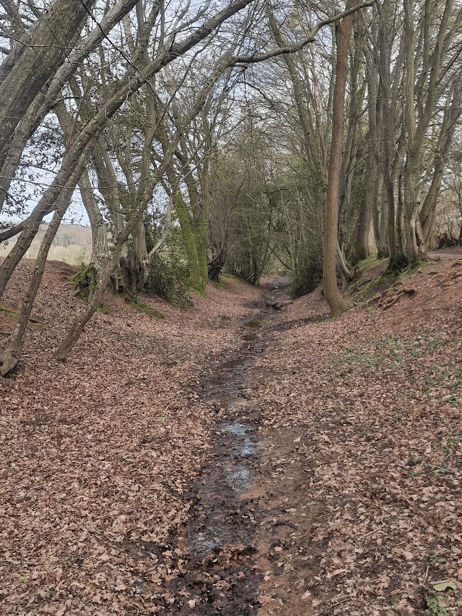
Between the unnamed wood and Wapsbourne Wood
Ditches bordered by coppiced Hornbeam. What are they?
They are on the land of the WoWo campsite, part of Whaspsborne Manor Farm see. The name Wapsbourne is the modern version of the older Sussex names of Whapplesbourne, Werpplesborne and other derivatives. The name means ‘a track by the stream’. This track leads you from Lewes to East Grinstead, right past the Elizabethan Manor house built in the late 15th C. Wapsbourne was once part of the Sheffield Park Estate, auctioned into private hands in 1953 when the estate of several thousand acres was broken up. The Farm – Wowo Campsite
On the WoWo site there is a camping space called “Lower Moat” in the central field surrounded by a moat, this field also becomes home to the ‘WoWo village’ in the summer months. Wowo Campsite, Uckfield, East Sussex – 2026 from £24/nt
But it is not a moat; it is a Pondbay and Overspill Channel.
The monument south-west of Wapsbourne Farm includes a short length of earthen bank, a low-lying area beside the bank and a long L-shaped ditch leading eastwards and then northwards from the bank. These are the remains of an iron-working site dating to the 16th-18th centuries and perhaps earlier, where already-smelted iron was heated and beaten using water power to drive the bellows and hammers. The remains were formerly misinterpreted as those of a medieval moated site. The most distinctive feature of the monument is the well-defined L- shaped ditch which measures 270m in total length and which averages 12m from side to side. It is embanked on the more northerly side. The purpose of the ditch was to carry floodwaters safely away from the principal industrial area and to prevent erosion of the dam itself by overflowing water. At the western end of the ditch is a 20m stretch of earthen bank 12m wide at its base which increases in height as the land slopes downward, so achieving a constant level at its crest. This is the southern end of the pond bay which formerly extended across the shallow valley, damming the stream and ponding back sufficient water to drive a water-wheel. The northern five-sixths of this pondbay, outside the scheduled area, has been flattened to allow the cultivation of the field. Where the stream cuts through the former pondbay there is a marked basin which probably indicates the location of the principal water-wheel. The 20th century culvert at the western end of the ditch and the field drain outlet to the south of it are both excluded from the scheduling. Post-Medieval Pondbay and Overspill Channel, Wapsbourne Farm., Chailey – 1013405 | Historic England
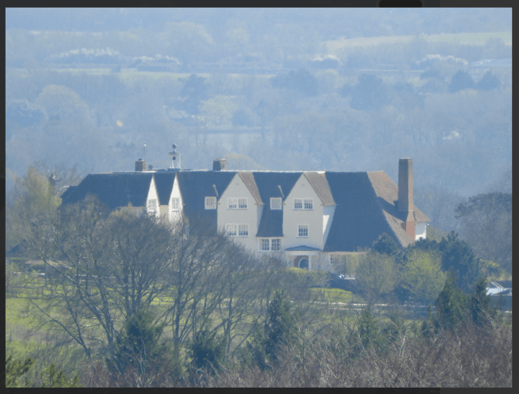
And just north of Pondbay and Overspill Channel, is the magnificent farm
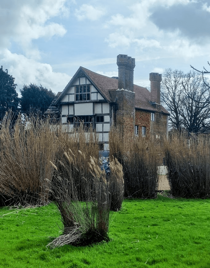
My photo does not do this building justice, so he is a photo from the WoWo website The Farm – Wowo Campsite
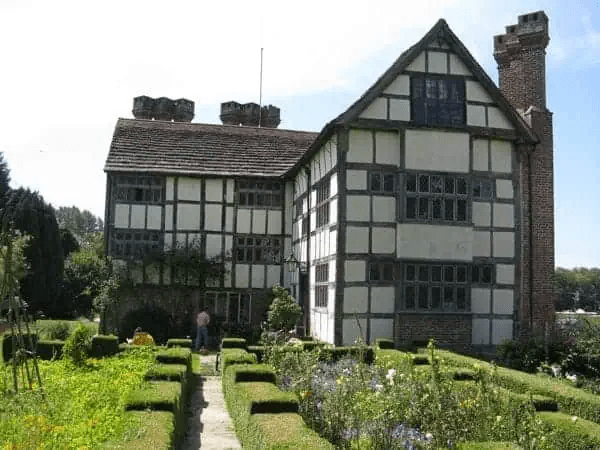
Probably the most interesting house in Chailey Parish. Early C17. The Victoria County History says that the date 1606 was once legible on the pendant of one of the gables. Tall L-shaped timber-framed building with squares of plaster infilling. The west and south walls are of red vitreous brick. Horsham slab roof. Casement windows with diamond-shaped leaded panes. The north gable end has a bay window on the ground and first floor, that on the first floor consisting of 2 tiers of 5 lights with old glass, and above an oversailing gable containing an attic window of 2 tiers of 4 lights. The east gable end has a carved pendant. The south wall has an immense brick projection consisting of 2 chimney breasts side by side, each with 3 diagonal brick stacks. These breasts were probably added in the mid C17. Three storeys. Not more than 2 windows to any front. Contemporary staircase. Wapsbourne, Chailey – 1352974 | Historic England
It is thought that there has been a building of some description on the site of Wapsbourne Farm since Anglo Saxon times. It was known at Domesday time as Werpesburn, which in Sussex vernacular later became Wapses Boorn. During the period known as the ‘second great rebuilding’ in the 17th century it was reduced in size and the timber framing on the South and West sides the weather fronts were covered with fine brickwork, with the magnificent chimney stacks erected. A notable feature of the chimney stacks is that they were constructed to present a corner angle to the prevailing wind. The Farm – Wowo Campsite For more information on the building see: The Manor House – Wowo Campsite
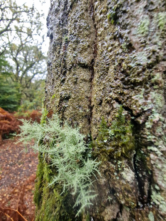
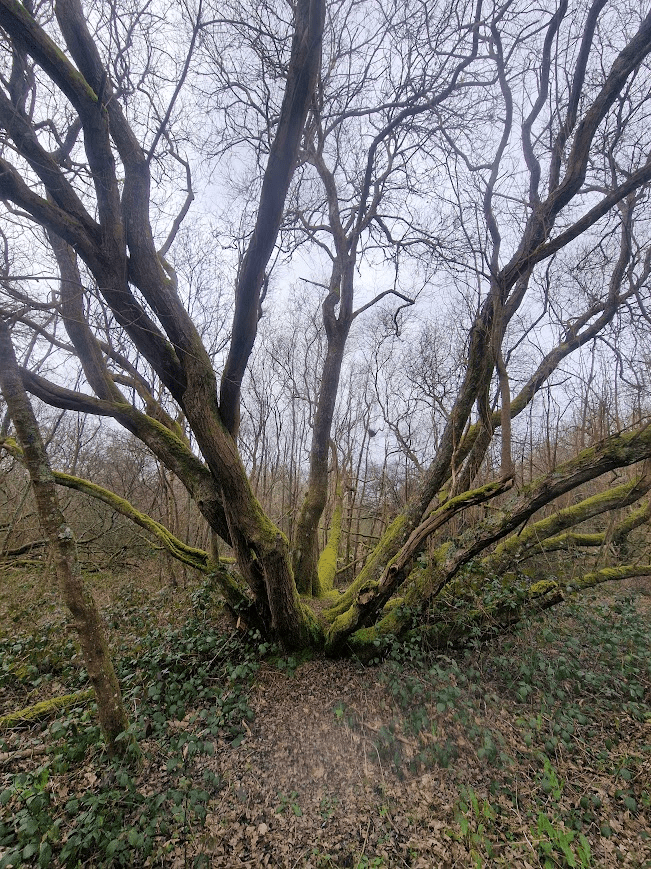
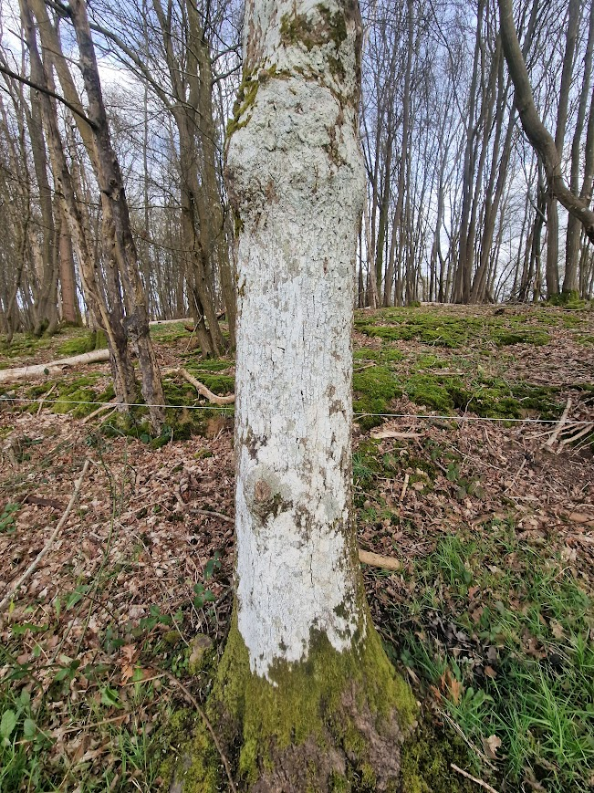
Wapsboune Wood
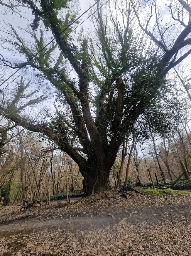
On entering Wapsbourne Wood, the feel of its ancient past remains; with some beautiful ancient Oaks
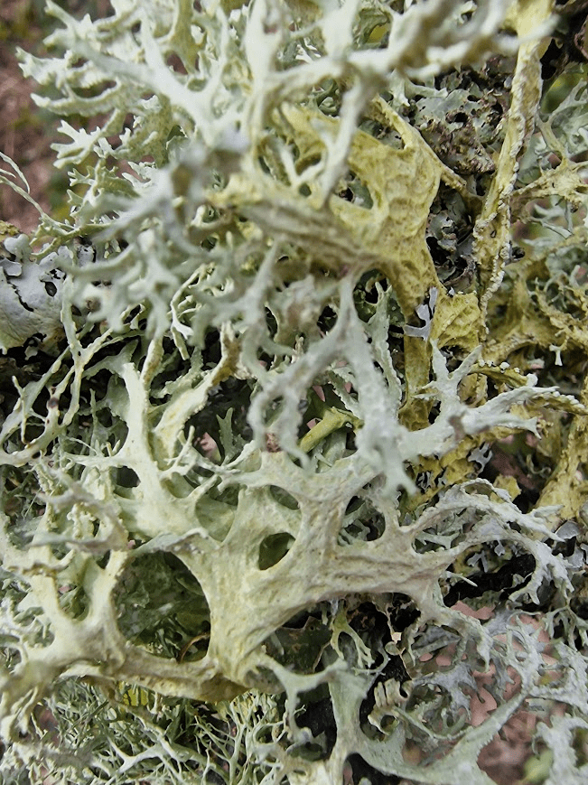
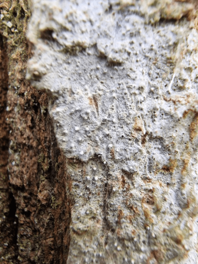
The mauve-grey of this Oak, is not the colour of its bark; it is the lichen Dendrographa decolorans
Dendrographa decolorans is the most widespread of a series of grey-brown to whitish usually sterile sorediate species that grown on dry bark in the south and west and probably depend on dew for a good deal of their water. These can be separated by subtle colour differences and by spot tests with Dendrographa decolorans lacking any positive spot tests. It is quite distinctive when younger, with mauve-grey to pale lilac-grey neat punctiform soralia on a slightly darker thallus. Dendrographa decolorans | The British Lichen Society It scatches Orange Photobiont: Trentepohlia (characterized by orange scars). Lichens marins – Dendrographa decolorans (Turner & Borrer ex Sm.) Ertz & Tehler = Schismatomma decolorans (Turner & Borrer ex Sm.) Clauzade & Vezda
The orange scratch test is not definitive as all the former Schismatomma genus lichens lichens scratch orange
Dendrographa decolorans was previously Schismatomma decolorans, the other former Scismatomma genera lichens i.e. Sporodophoron cretaceum; Snippocia nivea and Schizotrema quercicola, all scratch orand.
The only way to be 100% that this is Dendrographa decolorans would have been to use para-phenylenediamine spot test; it would have not responded But as para-phenylenediamine is mutagenic, allergenic and may be carcinogenic, I choose not to use it. I think trading off not being absolutely sure that this Dendrographa decolorans with potentially getting a cancer is a good trade off.
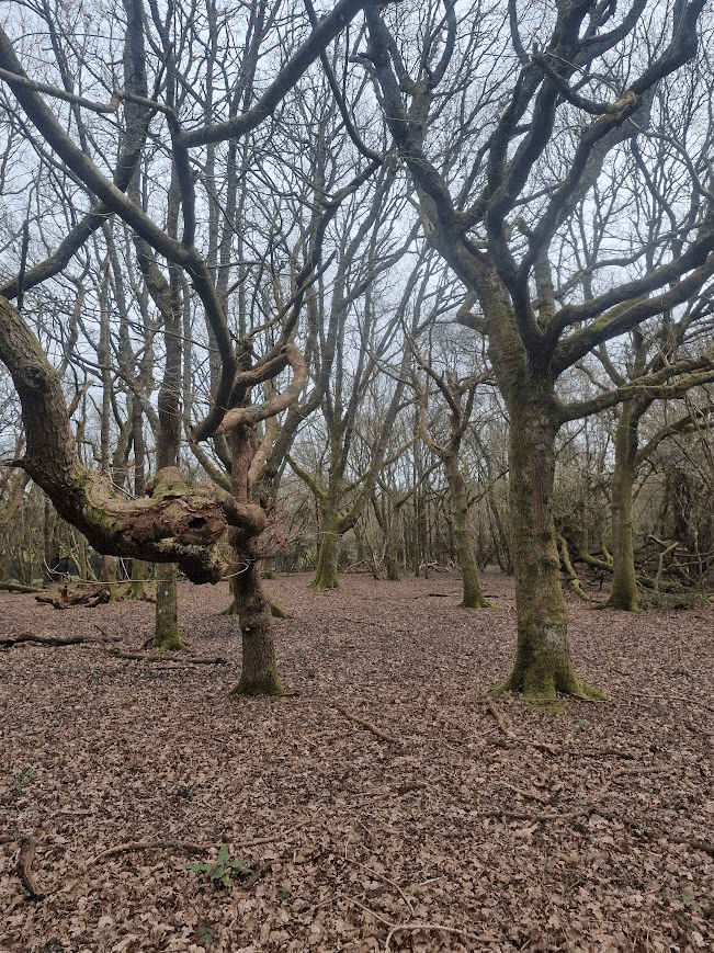
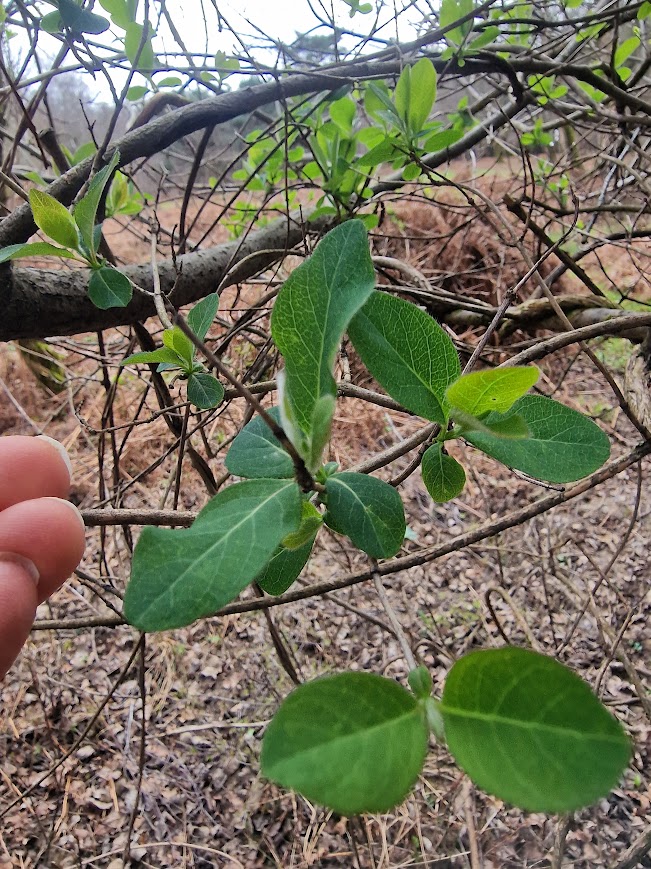
Much of the south part of Wapsbourne has Oaks, Hornbeams and Bluebells.
However, walking further north there is much replanting and the quality of the woodland declines as much of the wood is replanted.
Hammer Wood on OS Map; but called part of Wapsbourne Wood on the Nature England database)
There are many Hammer Woods in the weald and the name indicates connection with the Weald iron industry. But most of this ancient woodland is replanted with conifers; as in many places in Sussex. The land owners of many ancient woodlands in Sussex are not primarily interested in stewarding ancient woodland; but in making money out of it.
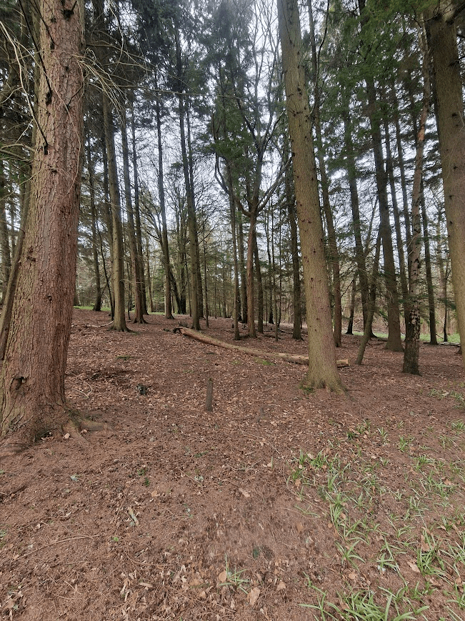
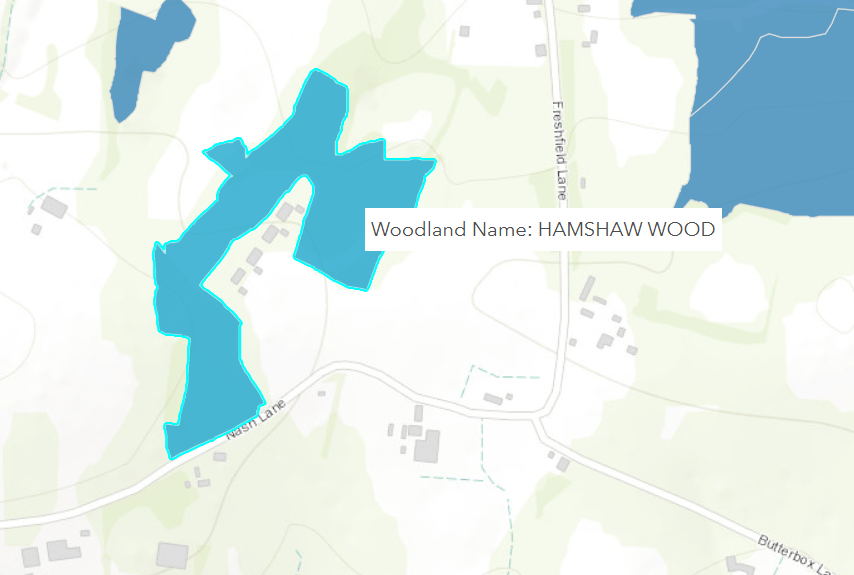
Hamshaw Wood
This not named on the OS map but is named on the Nature England Ancient Woodland; and is designated as ancient and semi-natural woodland
Ancient Woodland (England) | Natural England Open Data Geoportal
A stable at Hamshouse Stud with the right of the door covered in Psilolechia lucida lichen. Note that it here favours the chemical nature of the bricks not the mortar (abotioc zonation)
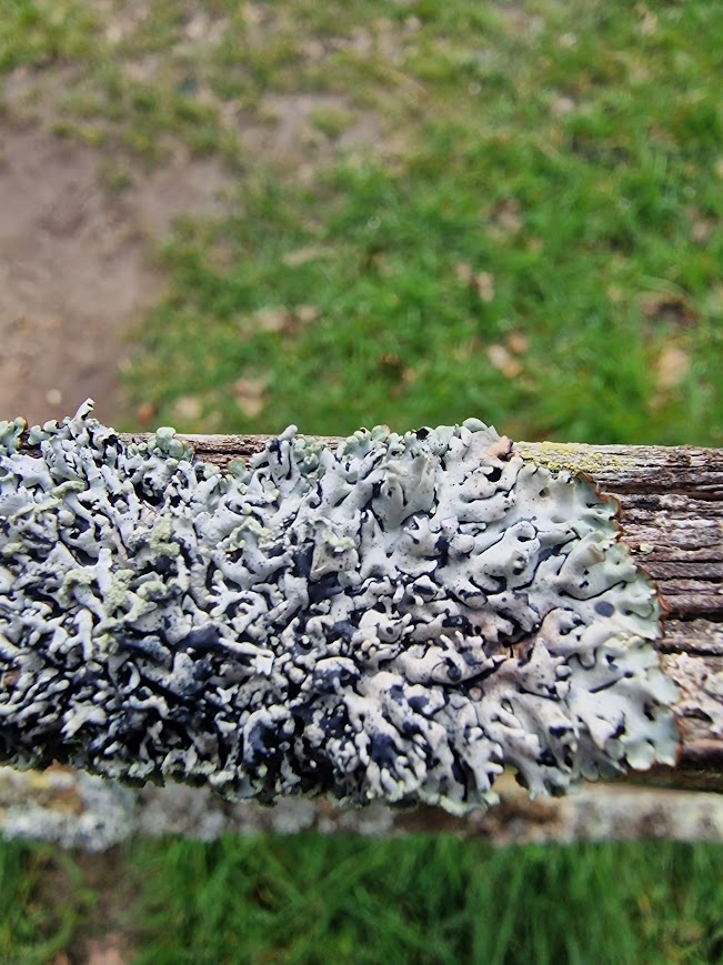
An old gate; a perfect substate for lichens that like worked wood. Hamshaw Wood behind
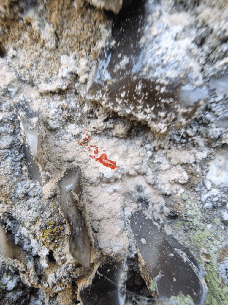
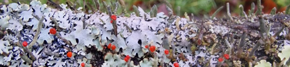
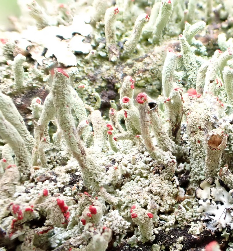
Cladonia parasitica, fertile with red apothecia (fruiting bodies) on the top of podetia (tubes of the thallus (body)) of the the lichen
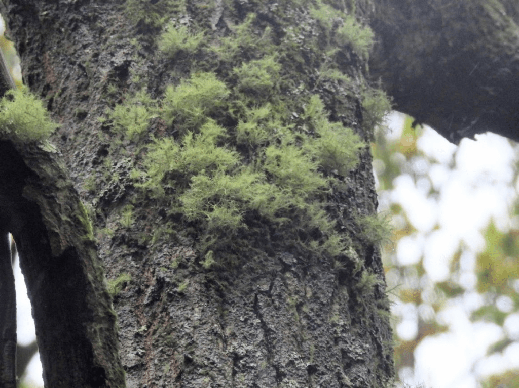
Hypogymnia physodes Hooded Tube Lichen
Flavoparmelia caperata, Common Greenshield Lichen
Coppiced Ash
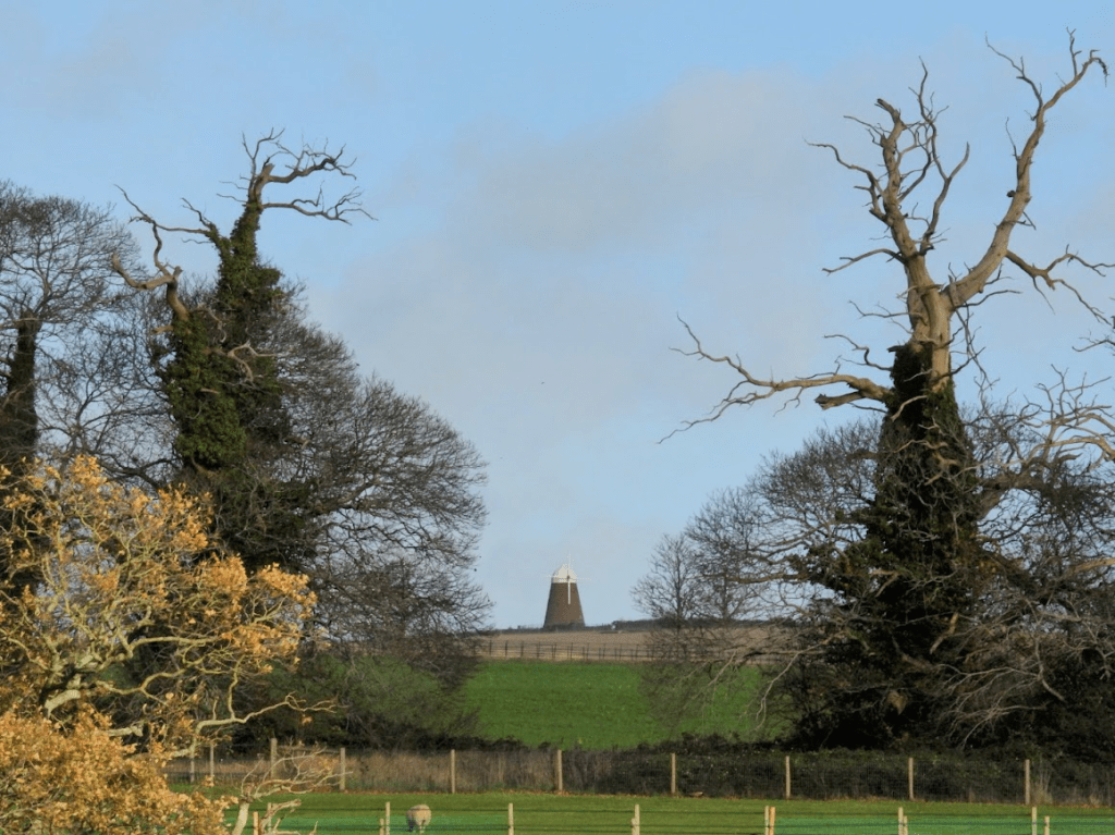
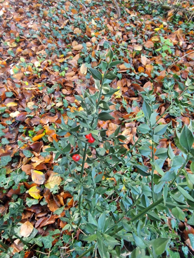
Wild Daffodils and a concrete sheep in part of the ancient woodland captured as the private garden of a large house
Concrete sheep amongst bluebells and planted (non-native ) rhododendron; how the High Weald is spoilt
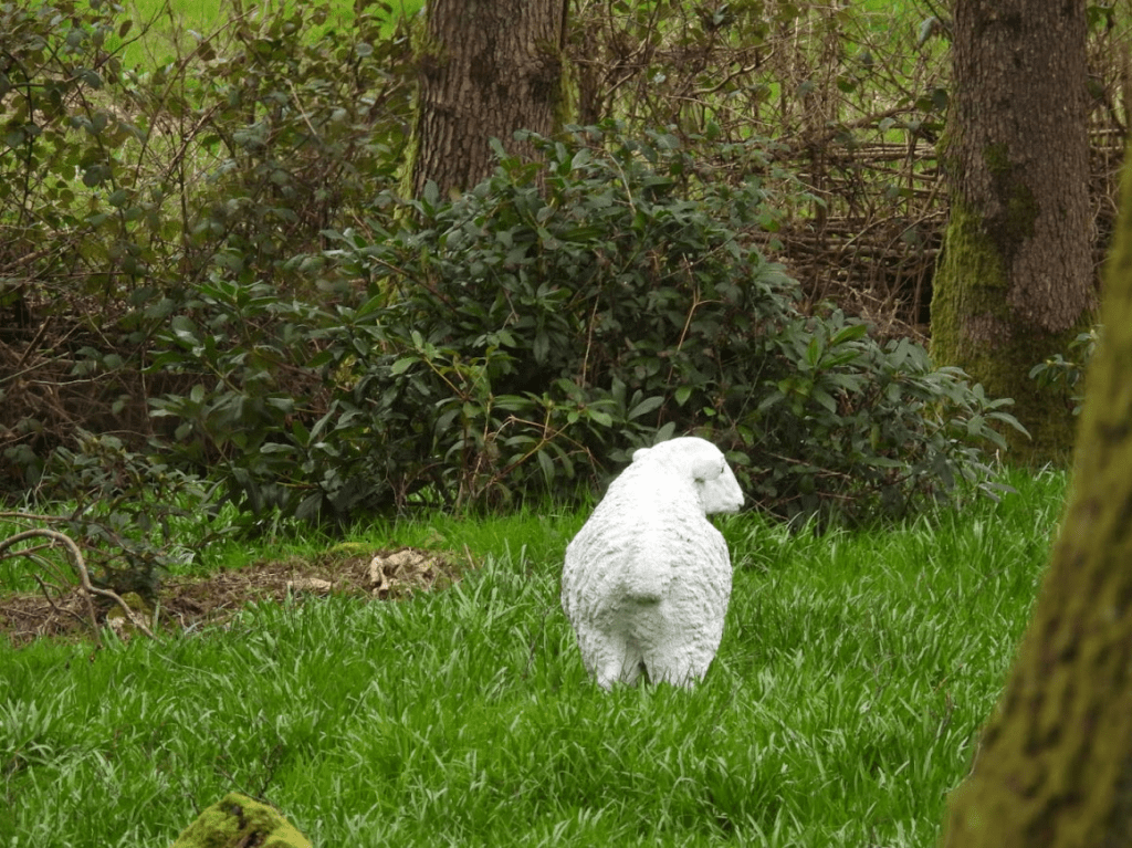
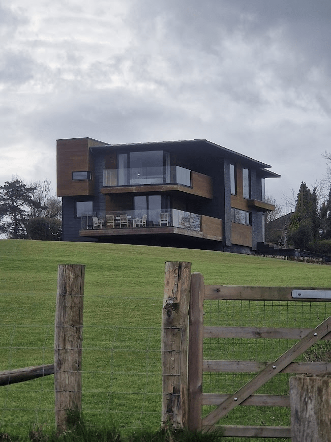
Much of the High Weald now feels like a middle class landscape of leisure rather than a landscaper of employment. This house would never have got planning permission if it wasn’t on the site of a previous building, presumably a farmhouse
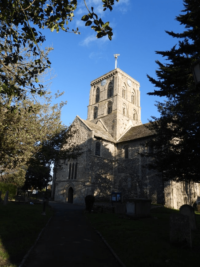
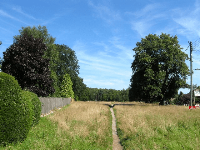
Scaynes Hill Common
Photo © Simon Carey and licensed for reuse under a Creative Commons Licence from the Geograph Website
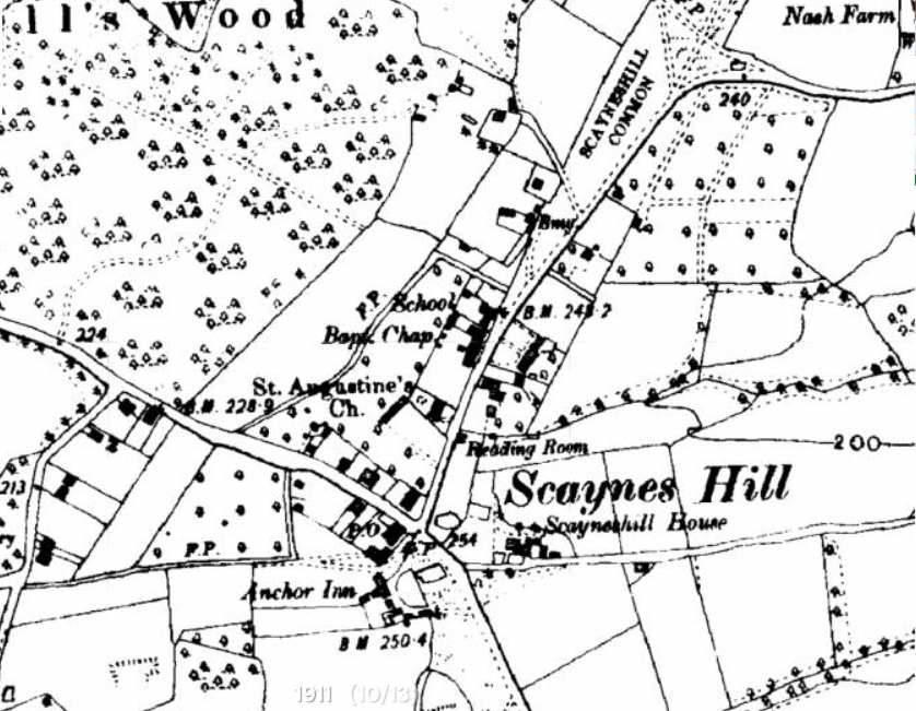
Map (n.d.) showing Common from Scaynes Hill Village Community Website
Much of the south of the common has been lost to development. Scaynes Hill Common used to be Henfield Common and looks like a typical edge green of a woodland common such as you still find in the New Forest. It retains an archaic acid grassland flora David Bangs (2018) The Land of the Brighton Line: A field guide to the Middle Sussex and South East Surrey Weald p.212.
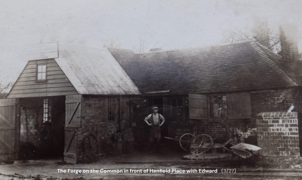
Forge on the common. Photo from Scaynes Hill Village Community Website
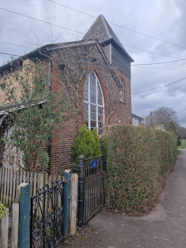
Old School House on the edge of Scaynes Hill Common
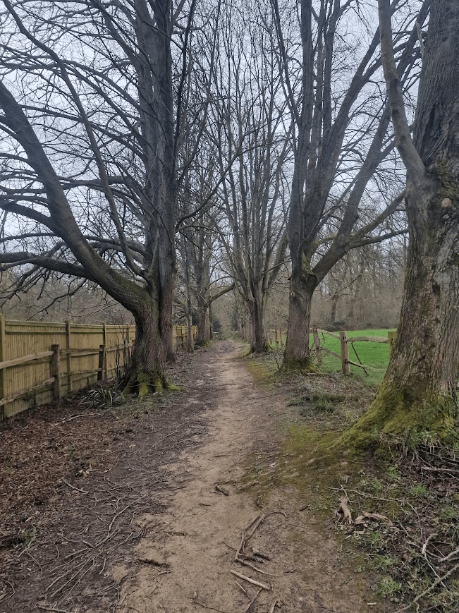
Costells Wood
Costells Wood is part of a larger continuous woodland that include Henfield and Nashgill Woods. It is the only part of the wood that had public access.
Costells Wood is a 21 hectare (53 acres) site on the edge of the village of Scaynes Hill, West Sussex, just within the southern boundary of the High Weald National Character Area (NCA), where it meets the Low Weald NCA. Woodland Trust Costells Wood Management Plan
An “avenue” of planted planted Pedunculate Oaks from Costells Manor into Costells Wood
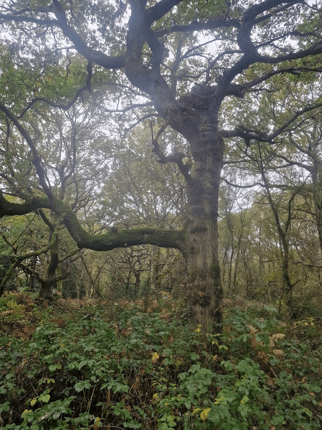
A very typical High Weald Oak: one side moss; the other, the lichen Lecanactis abietina, an old woodland lichen
Bluebells
Pedunculate Oak
Hornbeam
A Pedunculate Oak covered in Usnea cornuta