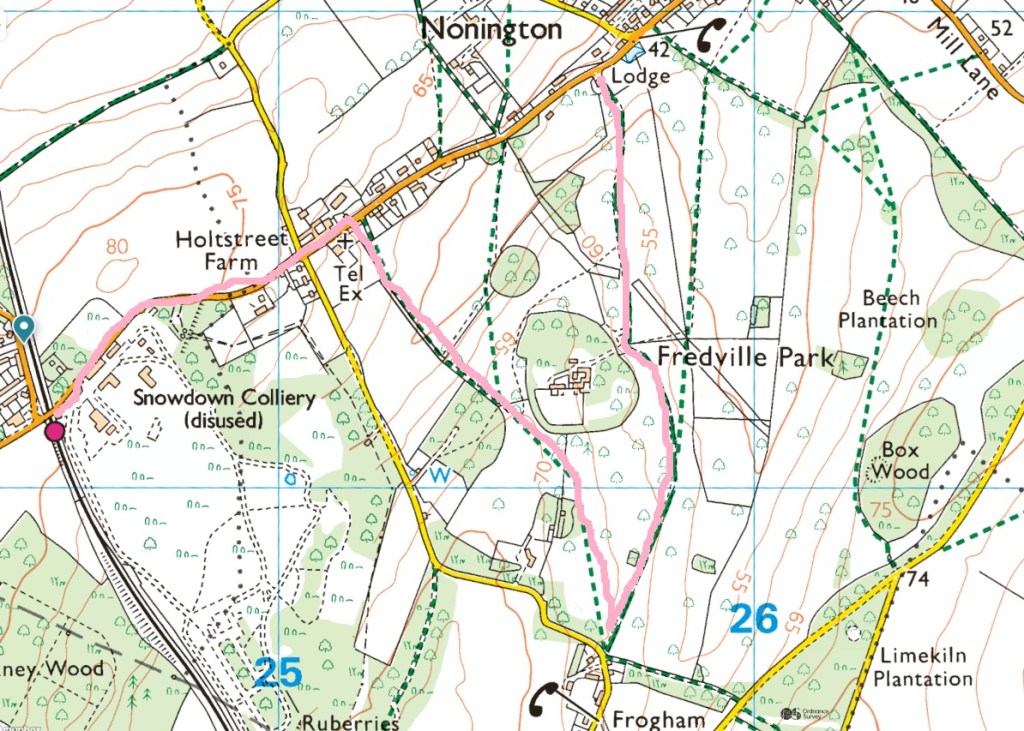
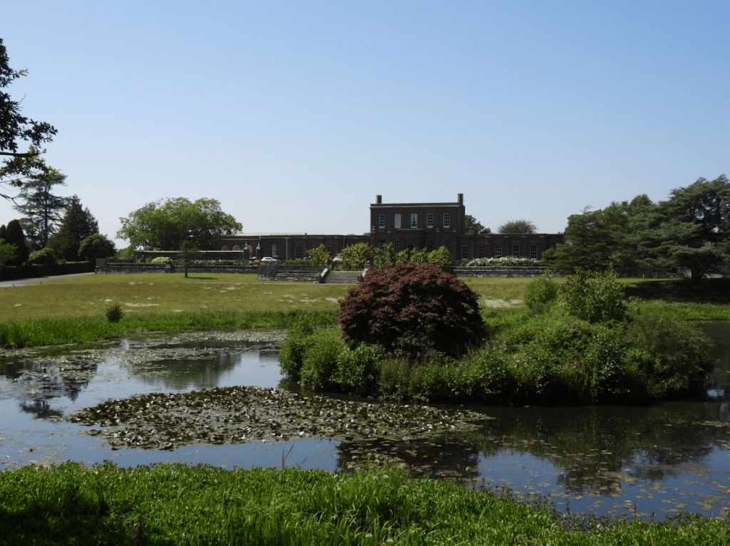
I reached Fredville Park from Brighton by train (4 trains: Brighton to Hamden Park, Hamden Park to Ashford International; Ashford International to Dover Priory, Dover Priory to Snowdown); three and half hours journey time. But it was well worth it; this is an outstanding medival deer park now ornamental parkland.
Originally given to Odo, Bishop of Bayeau and warrior knight, by William of Normandy (King William I, The Conqueror); it has been passed from aristocratic family to aristocratic family. It is still in private ownership. The fact that huge parts of England are still owned by the landed gentry, who inhereited or bought it from Norman Barons who were given land that wasn’t theirs, and they still prohibit the public from much of this land, is a national disgrace.
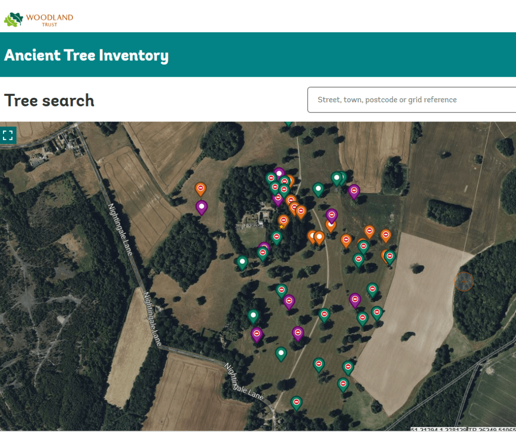
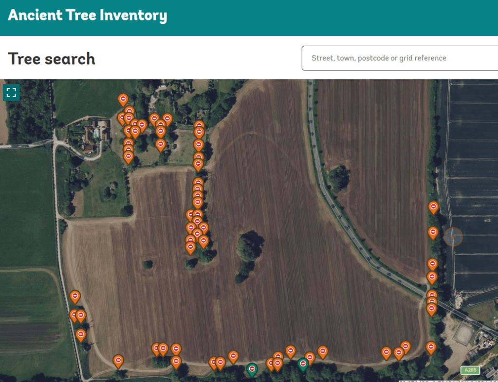
On the Woodland Trust Ancient Tree Inventory map all but the trees next to the footpaths are marked as “no public access” but except for the woodland around Fredville House, which is fenced, I roamed freely off the the paths and got close to many of the trees that the Woodland Trust says has no public access. Toward the end of the afternoon a stream of 4x4s drove up the road into Fredville House. They were a hunting party, of shootists and game keepers (as I had heard shotguns being used all afternoon, close by, but not in Fredville Park); none of them challenged me and I was clearly off the public footpaths.
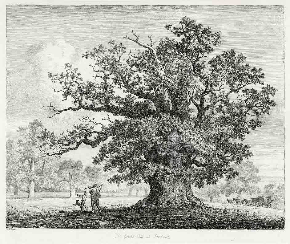
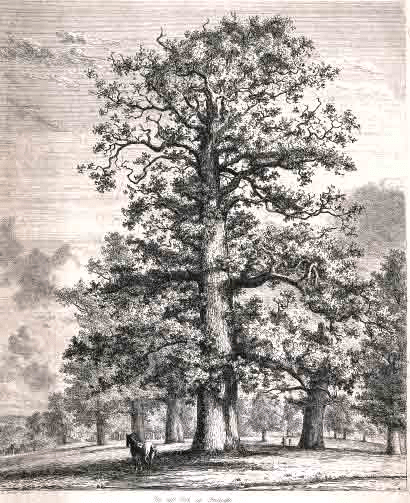
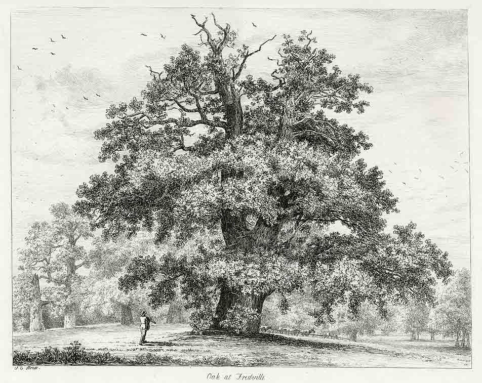
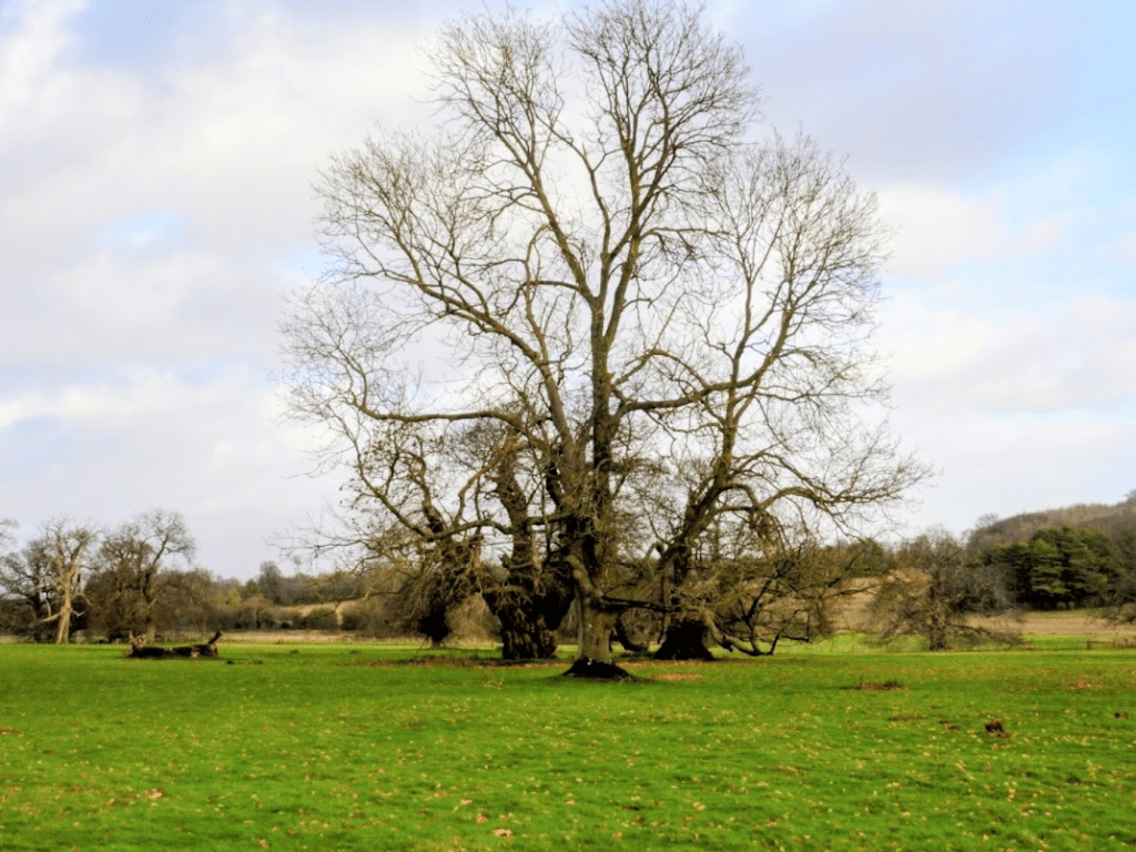
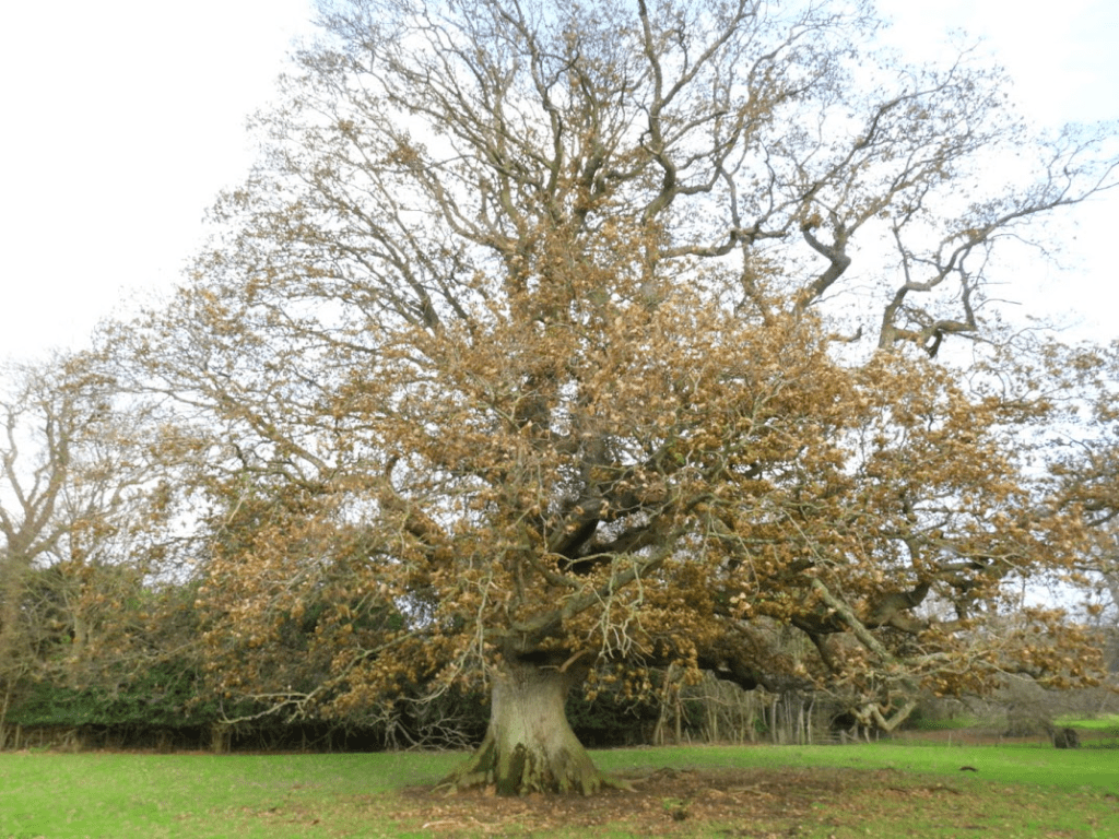
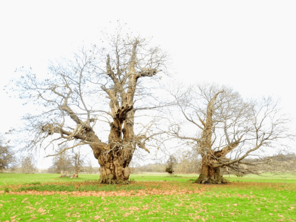
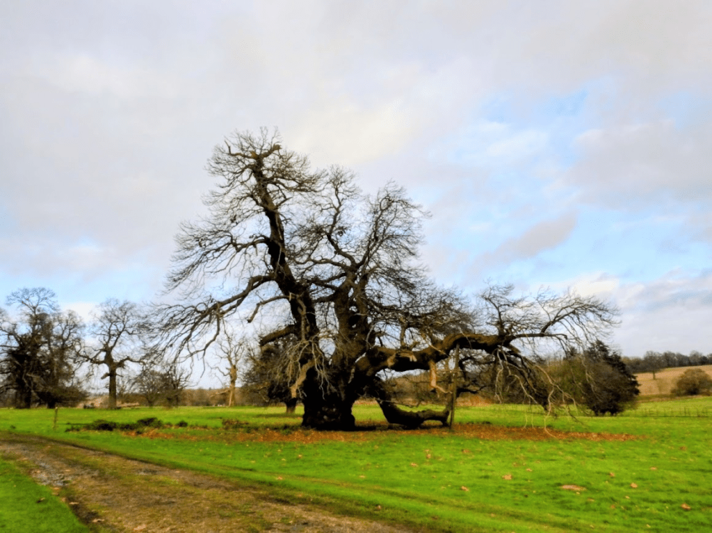
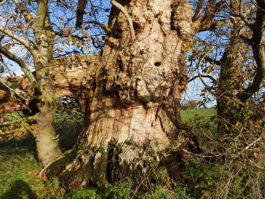
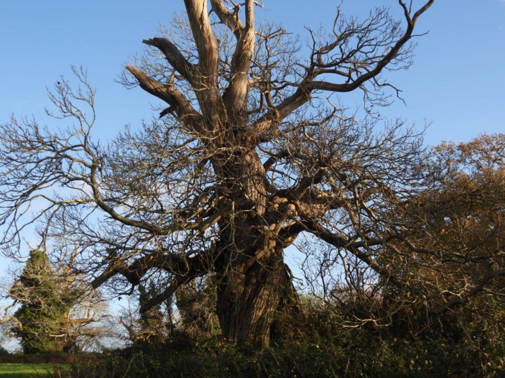
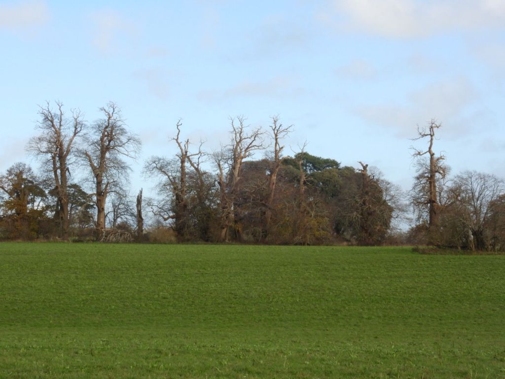
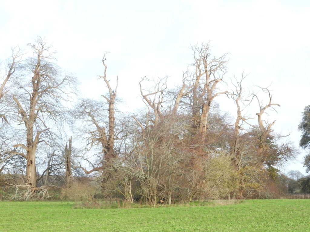
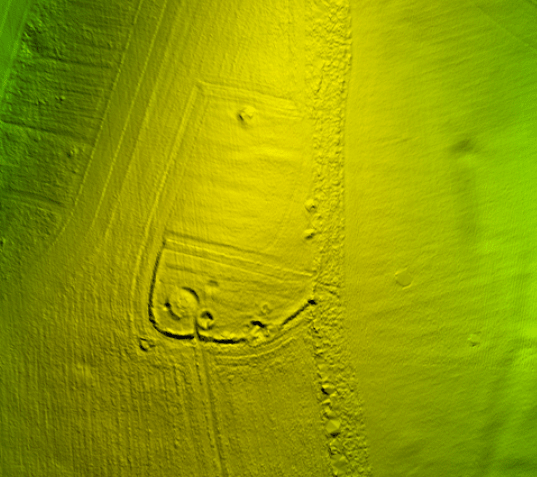
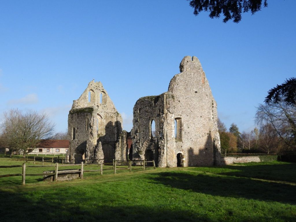
It is not possible to see the three large ancient oak trees, “Majesty”, “Stately”, and ”Beauty”probably 500 years old, including “Majesty” or “The Fredville Oak”, believed to have the largest girth in England, because they are in the fenced of grounds of the former mansion. This is another example of precious natural assets that should be viewable by the public, being shut off to the public.
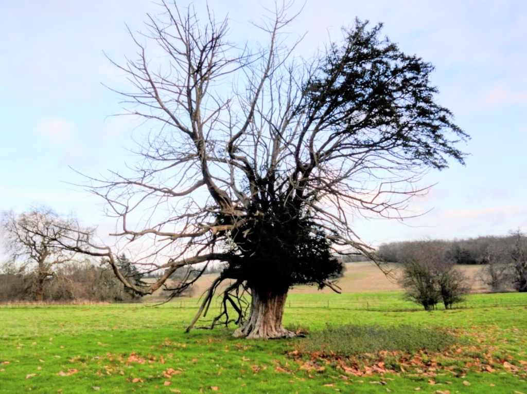
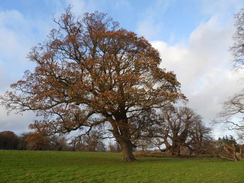
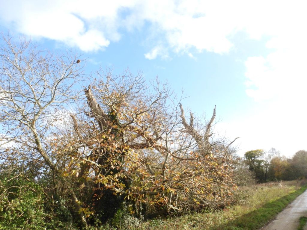
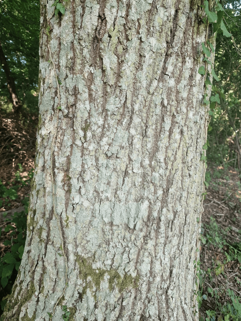
Fredville Park has many parkland trees. ,,, Not far from the former mansion are the remains of a Spanish chestnut avenue, planted at least 250 years ago. Many of these trees are still in very good condition (2017).
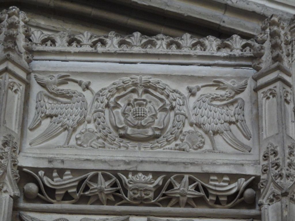
The boundary of the C18 pleasure ground enclosure is intact and encompasses the remaining historic structures including the walled kitchen garden, stables and ice house as well as potential archaeological remains of the mansion.Of particular note, within the immediate grounds of the former mansion, are three large ancient oak trees, probably 500 years old, and a mid-late C19 Wellingtonia. One of these oaks, named “Majesty” or “The Fredville Oak”, is believed to have the largest girth in England.
The origin of the name “Fredville” is not known for certain. Traditionally it is believed to be derived from the Old French: freide ville, meaning a cold place, vecause of its cold, wet, low position. It could, however, be derived from the OldEnglish: frith, meaning the outskirts of a wooded area, plus vill, meaning a manor or settlement, giving “a manor next to the wooded area”.
Fredville House and park was originally part of Essewelle Manor. It is recordedin Domesday that in the time of Edward the Confessor it was held by a woman,Molleve, but in 1086 it was held by Ralph de Courbepine from Bishop Odo. DeCourbepine’s holdings passed to the Maminot family and in the late 1100’s to the Barony de Saye. By 1250 Essewelle had been divided into Esol and Freydevill.The spelling varied over the centuries: Frydewill (1338), Fredeule (1396), Fredevyle (1407), Froydevyle (1430), ffredvile (1738).
Hasted lists the families who held Fredville from the Colkins, in the reign of Edward I, to the Boys, in the reign of Richard III. William Boys’ descendant, Major Boys, had many of his estates confiscated for being a Royalist, but Fredville remained in the Boys family until two of his sons sold it to Denzill, Lord Holles in 1673 in order to pay debts. In 1745, Thomas Holles sold it to Margaret, sister of Sir Brook Bridges, baronet of Goodnestone, which is nearby. Margaret Bridges married John Plumptre, a wool merchant of Nottinghamshire, in 1750, but they had no children. The estate passed to John Plumptre through the marriage. Margaret died in 1756 and her husband remarried in 1758 and had a son. John Plumptre rebuilt the manor as a Georgian house. Sir Brook Bridges’ daughter, Elizabeth, married the author Jane Austen’s brother, Edward.
Jane Austen’s letters (1796-1814) show that she was a regular visitor to the Bridges’ estate at Goodnestone and later to Edward’s new home at Godmersham. She was well acquainted with the Plumptres of nearby Fredville (Jane Austen letters to her sister Cassandra, September – October 1813 and March 1814). John Pemberton Plumptre was for a time a suitor of Jane’s niece Fanny. Jane Austen wrote “Anything is to be preferred or endured rather than marrying without Affection; and if his deficiencies of Manner &c &c strike you more than all his good qualities, if you continue to think strongly of them, give him up at once.” (Jane Austen letter to Fanny November 1814).
Fanny rejected John Pemberton. In the late 19th century the house was greatly enlarged, its 50 bedrooms accommodating the family of 11 children and the necessary staff. In 1921 Henry Western Plumptre built the much smaller “Little Fredville” nearby in the park as the family home and Fredville mansion was abandoned. It was requisitioned during WWII and occupied by a Canadian tank regiment. A fire destroyed most of the house in 1942 and after the war J H Plumptre, son of Henry Western, decided to demolish the building. Only the clock tower and some converted outbuildings now stand. The site remains in private ownership.
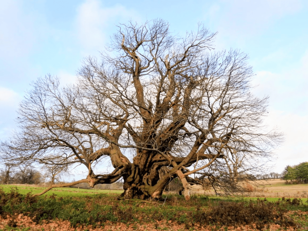
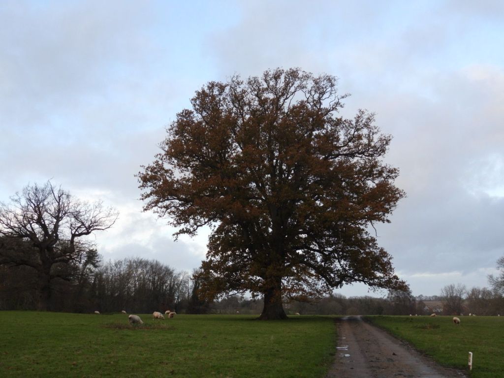
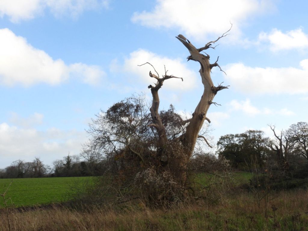
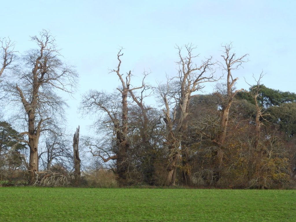
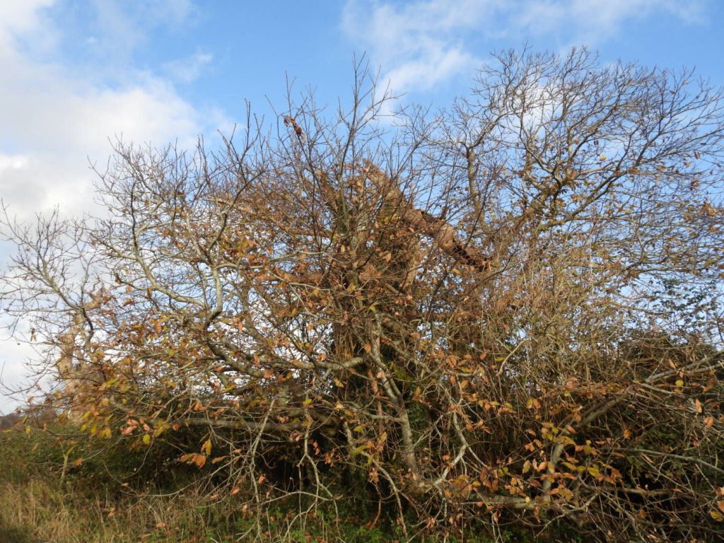
The visible trees of Fredville Park in the order that I saw them:
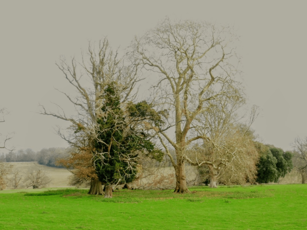
The parkland west of the wood surrounding Fredville House from outside the park
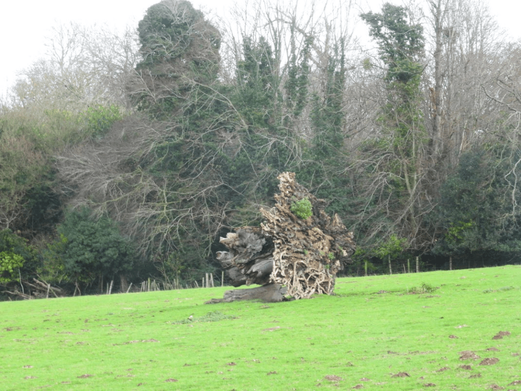
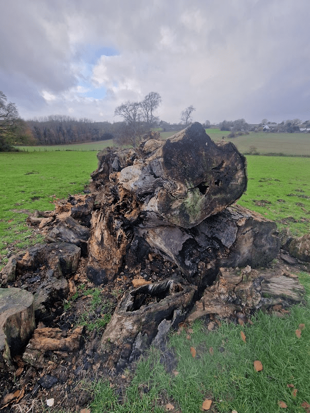
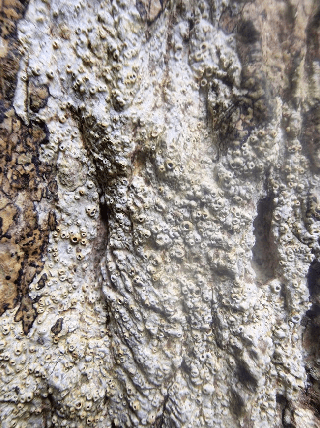
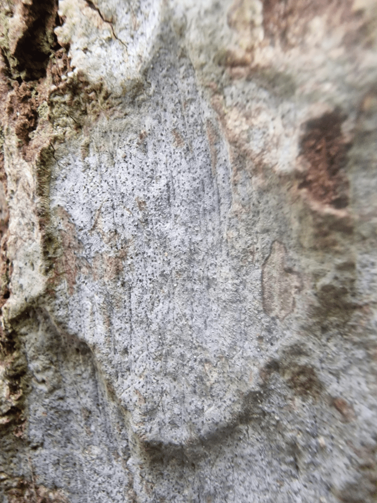
Roots and lower trunk of a felled Pedunculate Oak
Rotting felled Pedunculate Oak
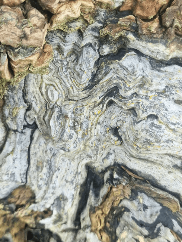
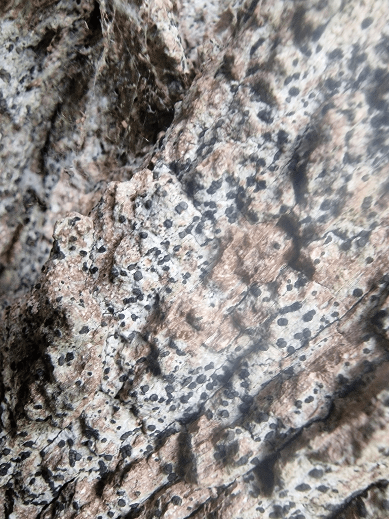
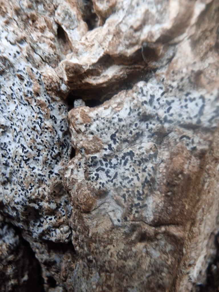
Texture of its bark
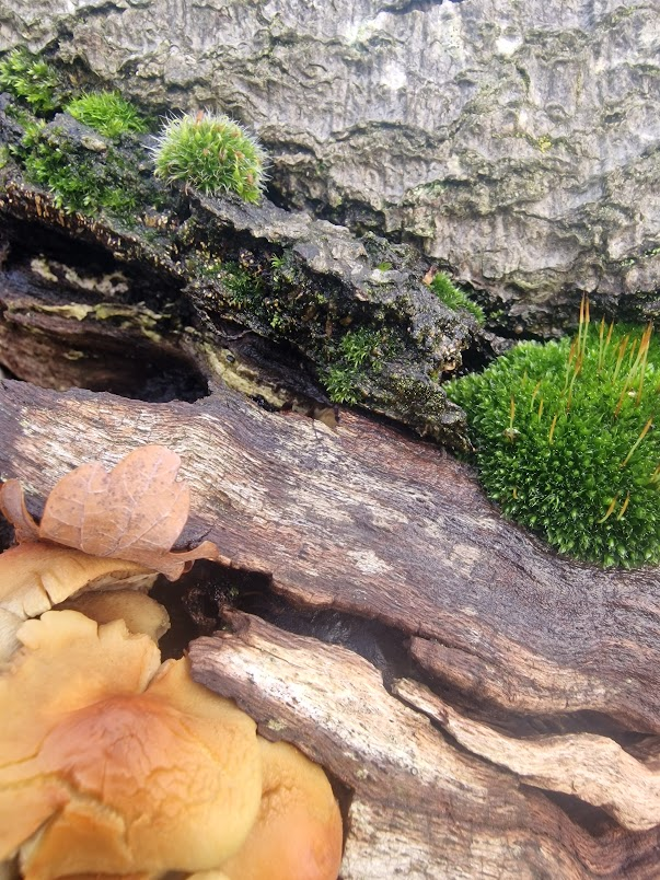
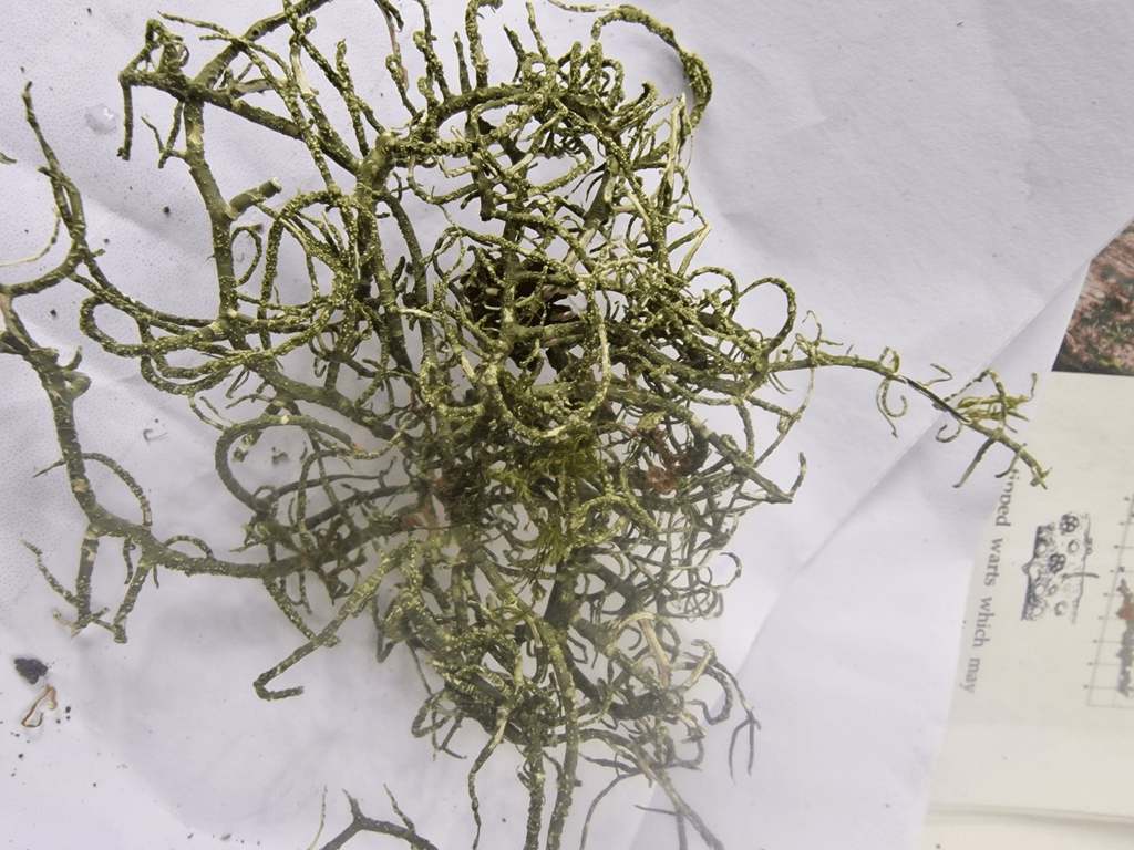
Fallen chestnut
With deliquesced Chicken of the Woods, Laetiporous sulphureus
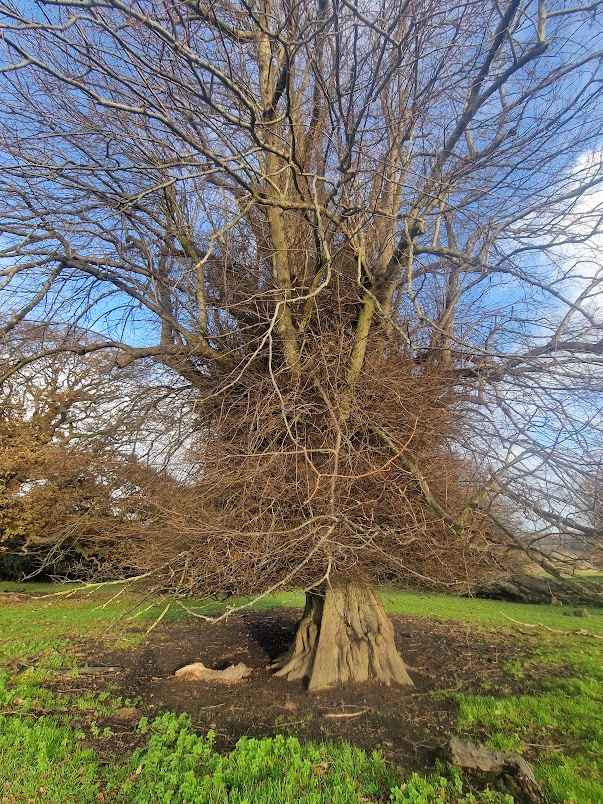
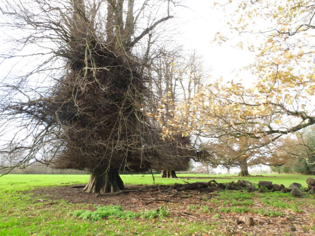
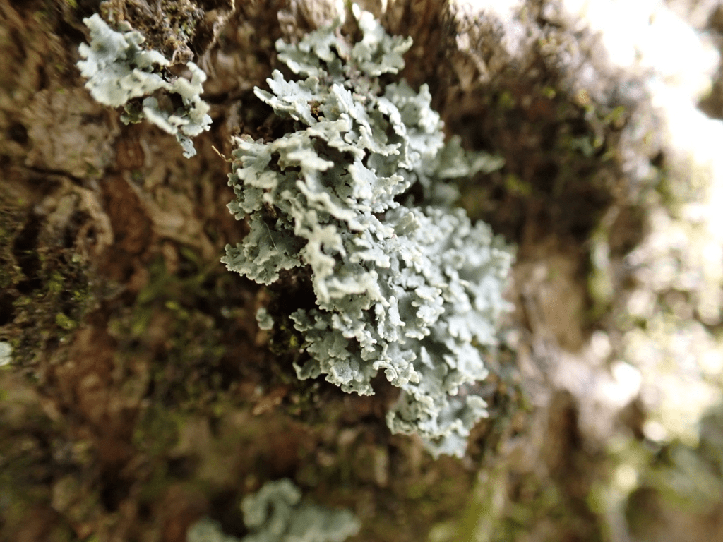
An ancient Beech
Notable Oriental Plane
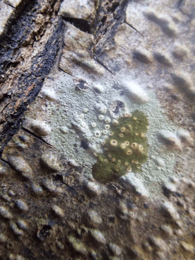
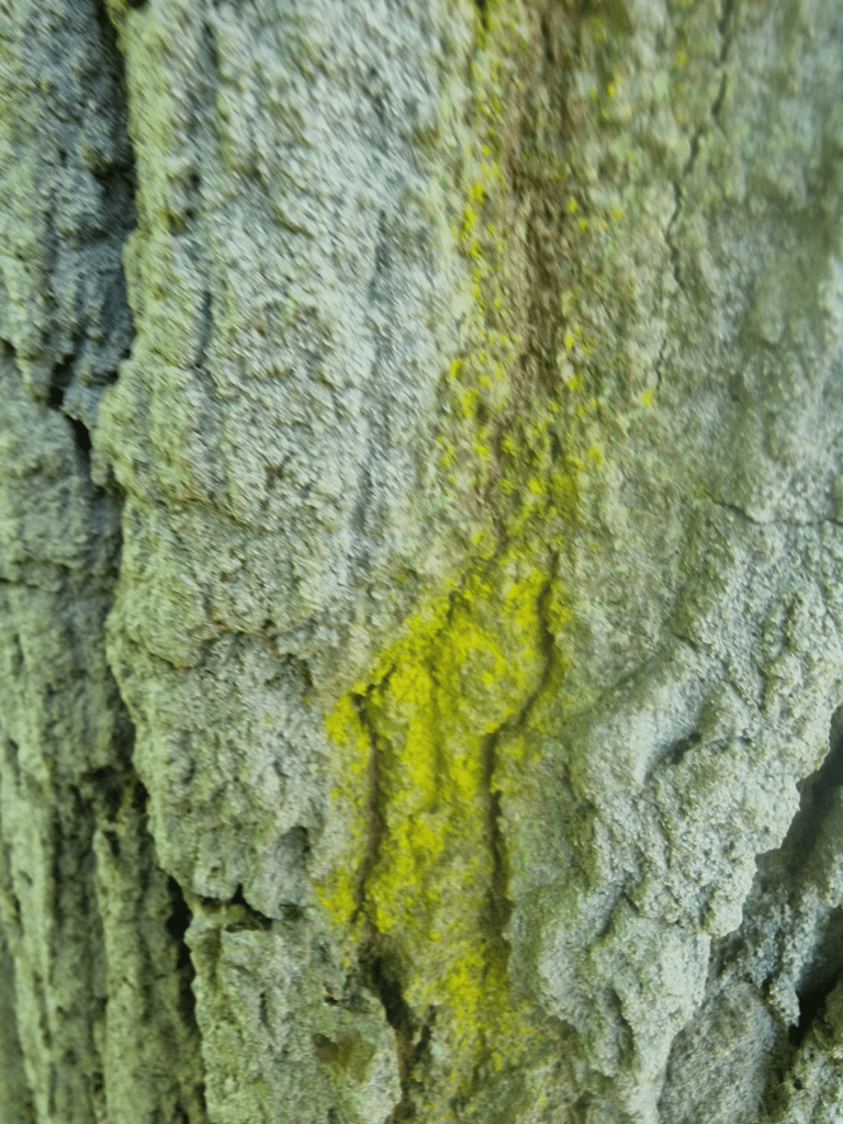
Fallen Pedunculate Oak
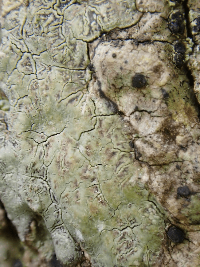
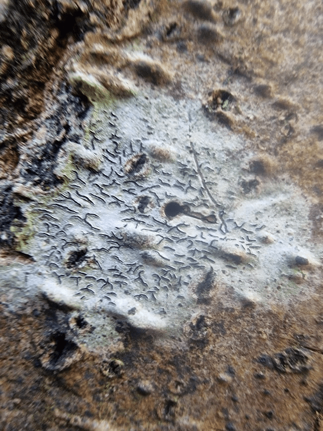
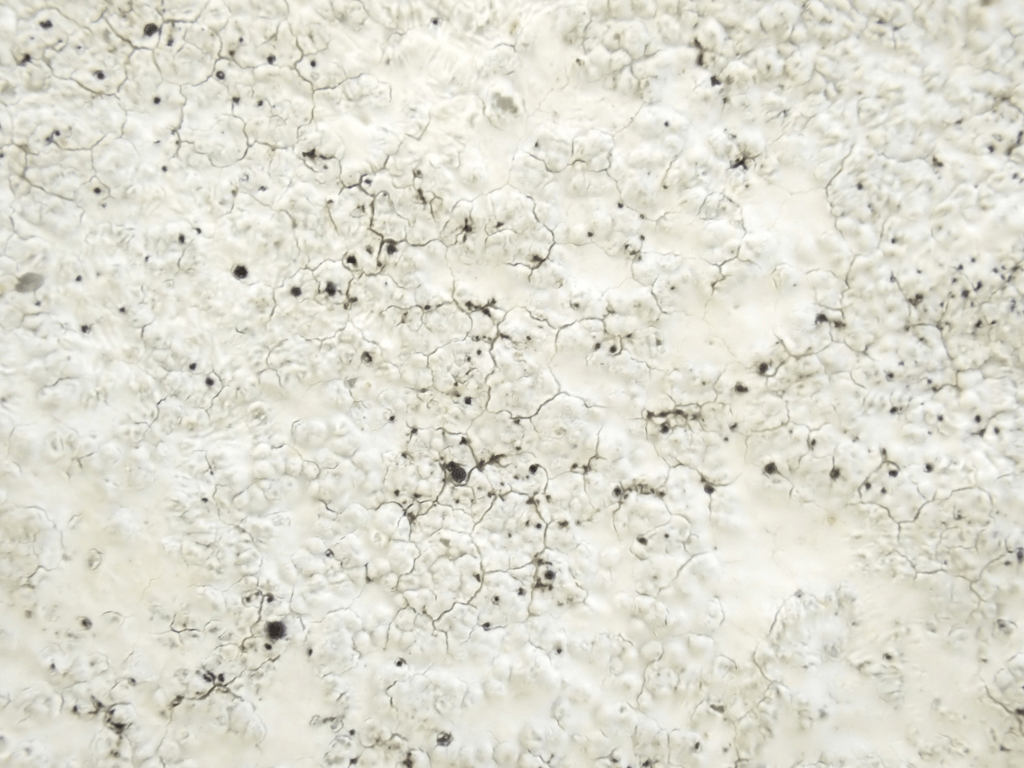
The fungus Hypholoma fasciculare and the mosses Ptychostomum capillare and Grimmia pulvinata, and unidentified lichens, on this tree’s decorticated trunk
Yew, London Plane and Pedunculate Oak
Oriental Plane
Fruit and leaf of Oriental Plane
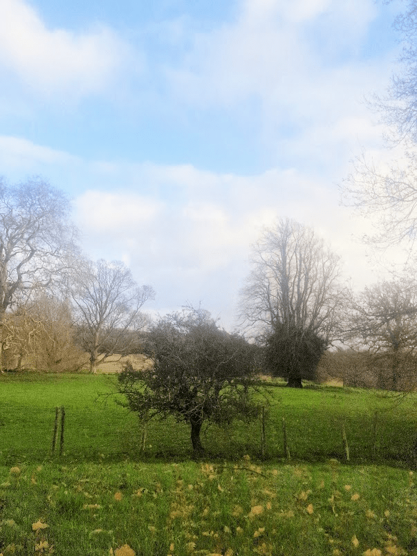
Hawthorn
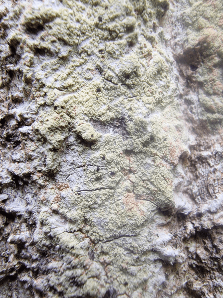
Pedunculate Oak in front of two Sweet Chestnuts
Ancient Sweet Chestnuts
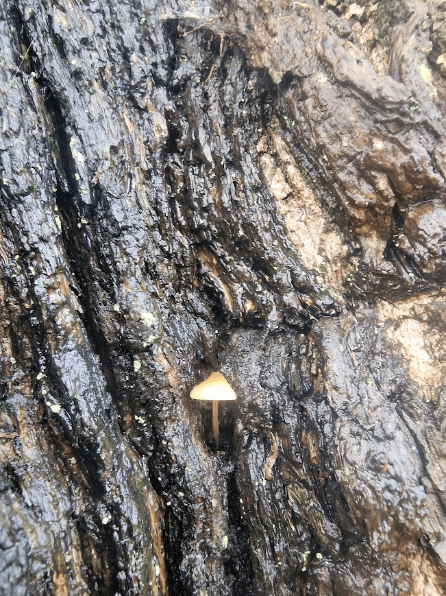
A Mycena sp. mushroom on the bark of one og these chestnuts
Ancient Sweet Chestnut
Ancient Yew
Hard to identify this as an ancient Yew, Taxus baccata, at first. It’s shape is nothing like the Yews of its native strongholds: chalk scarp-face woodland. It’s a pasture woodland Yew, sculpted by nibbling deer. Deer can tolerate Yew.
Pedunculate Oak
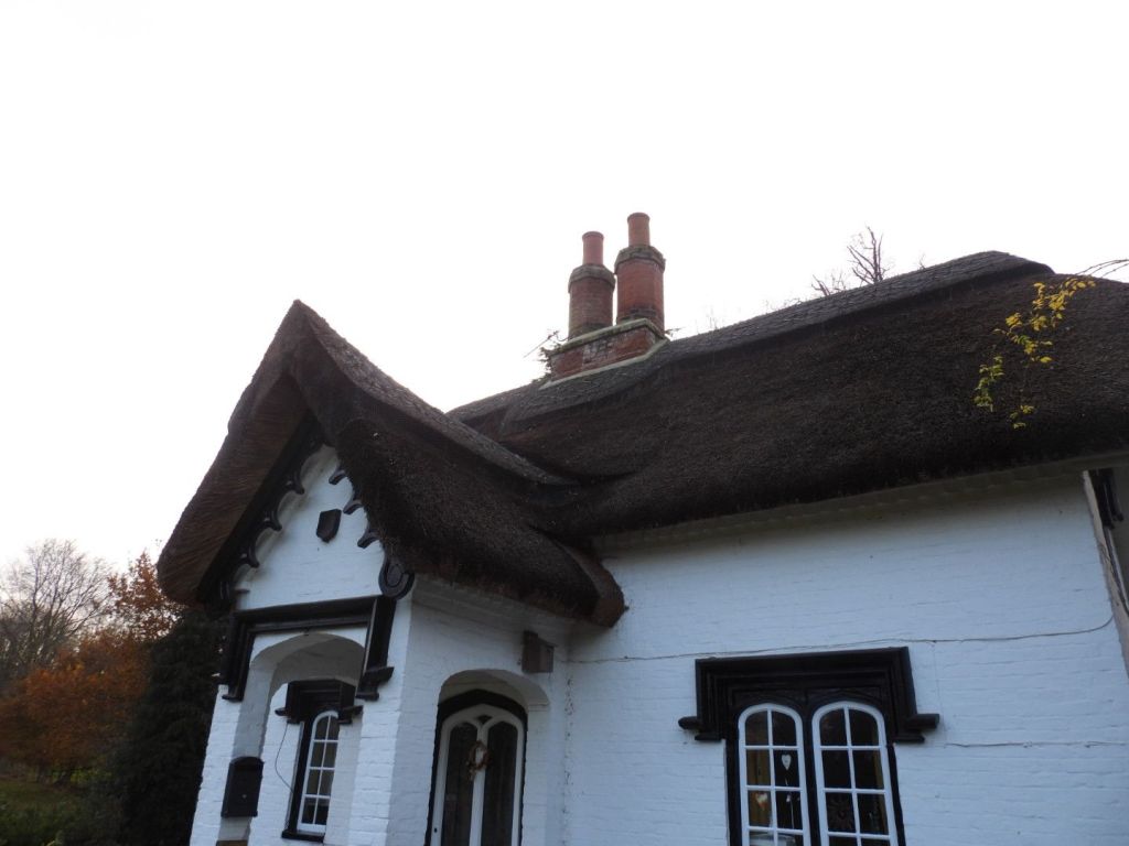
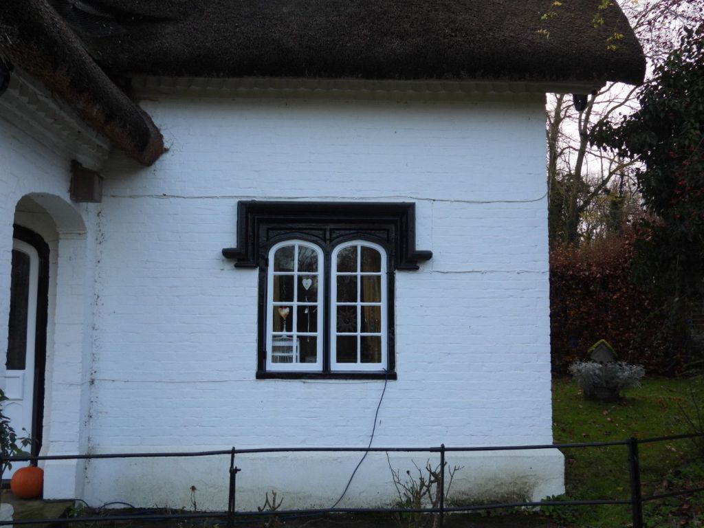
Lodge to Fredville Park
Historic England listing: Lodge to Fredville Park 11.10.63 II Gate lodge. Early C19. Painted brick with thatched roof. One storey and garret on plinth with dogtooth cornice to half-hipped roof with pierced bargeboards. Central stack with double polygonal flues. Single storey gabled porch with elliptical openings on all 3 sides, that to front with label hood. Arched 2 light wooden casements with label hoods either side of porch, with central four centred arched door with Gothick tracery. Canted bay with Gothick windows on left return front
A postscript
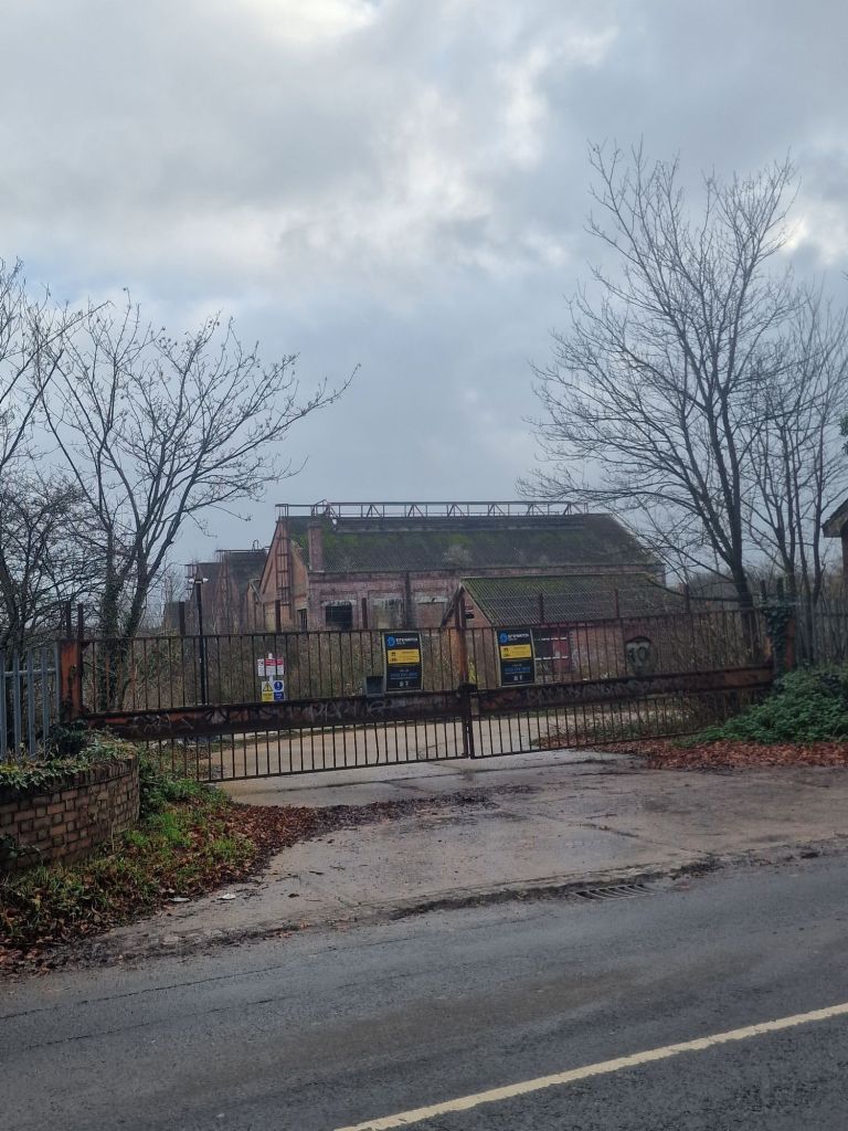
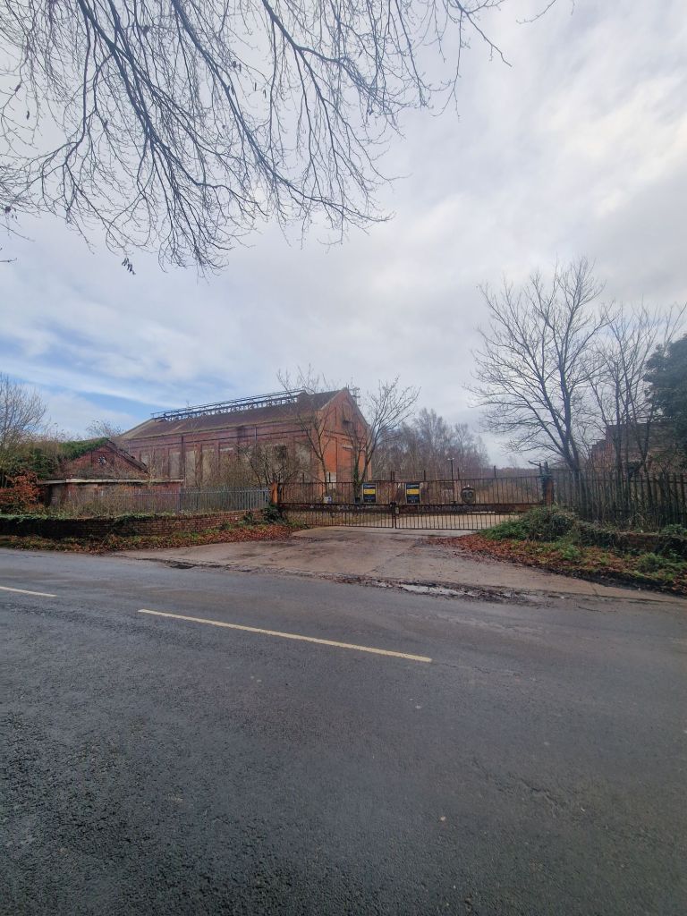
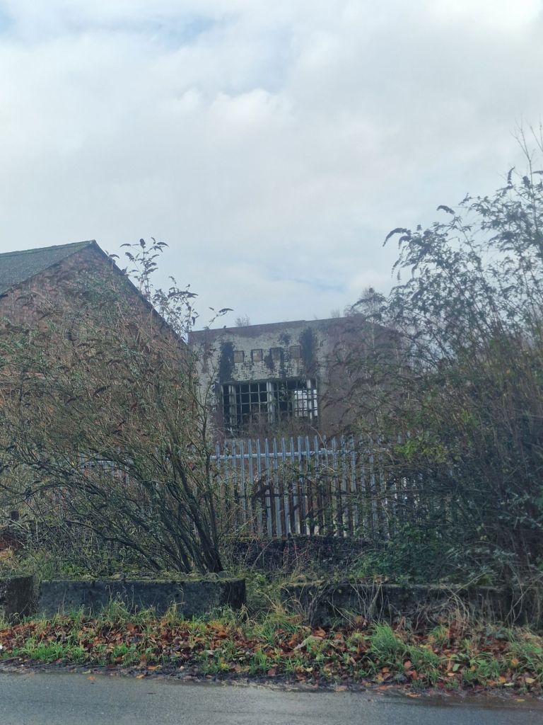
Right next to Fredville Park is the remains of the closed Snowdown Colliery.
The miners were on strike in 1984-85 and I remember well Brighton Trades unions collected food outside supermarkets to send to them. The strikers knew, as did we, that they were fighting the ruling class under Thatcher who wanted to close the pit. Forty years later, in 2025, a merchant banker has persuaded many working people in Kent that their enemy is migrants; but its the Tory ruling class that has impoverished them. The decline in class awareness and the ability of the ruling class to spin false narratives that are believed I find very sassy. Wake up people.
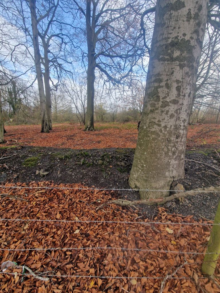
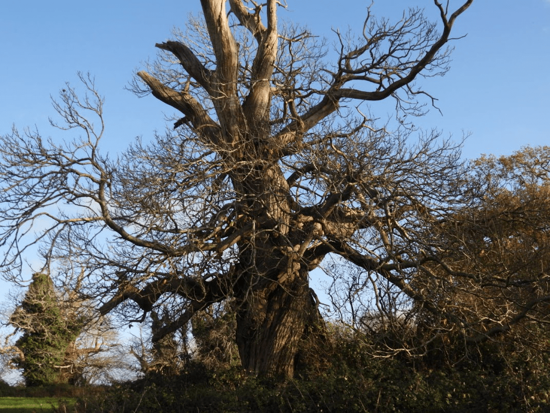
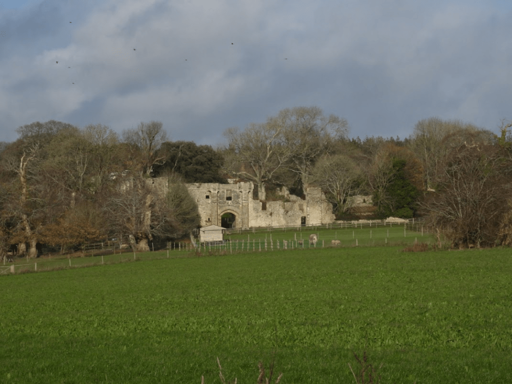
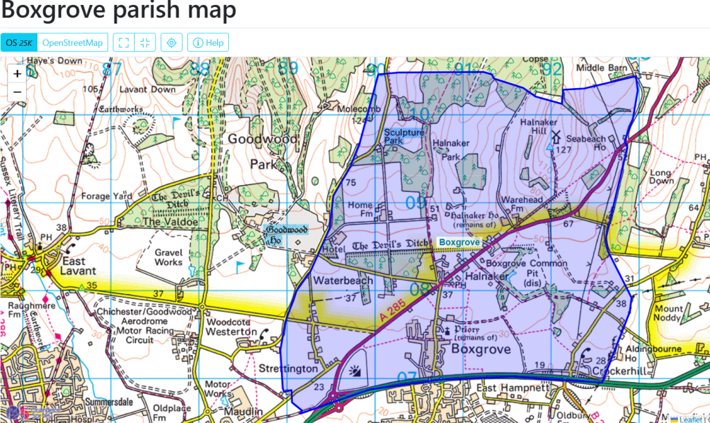
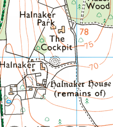
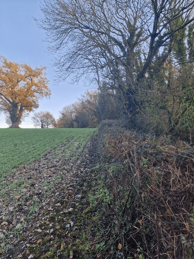
On a recent trip to the parish of Boxgrove, I walked up the footpath to the west of Halnaker Park, an ancient deer park. Most deer parks have mostly pollarded Oaks, but this one has mostly Sweet Chestnuts. Some other deer parks have Sweet Chestnuts too; such as Bushy, Richmond and Petworth; but in these Oaks domiate; at Halnaker Sweet Chestnut dominates. The Sweet Chestnuts in the park are magnificent; but close-up examination of those by the path revealed them to be in a parlous state.
The Park of Halnaker possibly originated in a grant of free warren made in 1253 to Robert de St. John for his demesnes at Halnaker, Goodwood, and elsewhere, outside the limits of the forest. An inquiry as to the recent enlargement of the park by 60 acres was ordered in 1283, and it was said to contain 150 acres in 1329, and to be 2 leagues round in 1337. Hugh, elder son of Lord St. John, had licence in 1404 to inclose 300 acres of land and wood within the lordship of Halnaker and make a park, according to the metes begun by his father, but possibly did not avail himself of it, as the licence was renewed to Thomas and Elizabeth West in 1517. This may be the origin of Goodwood Park, which first appears in 1540, when it was part of the Halnaker estate, as it was also in 1561. In 1570 Halnaker Park was estimated to be 4 miles in compass and supported 800 deer. It continued to descend with the manor, but Goodwood Park was sold in 1584 by Lord Lumley to Henry and Elizabeth Walrond, who transferred it in 1597 to Thomas Cesar; he conveyed it in 1599 to Thomas Bennett, who in 1609 sold it to Sir Edward Fraunceis. The Earl of Northumberland in 1657 sold it, with ‘the house lately erected therein’, to John Caryll, who conveyed the park and mansion house to Anthony Kempe in 1675, and it subsequently came to the Comptons of East Lavant, from whom it was bought, about 1720, by the Duke of Richmond. from: http://www.british-history.ac.uk/ Quoted on https://boxgroveparishcouncil.gov.uk/about-boxgrove/halnaker/#:~:text=The%20PARK%20of%20Halnaker%20possibly,fn.
The importance of ancient deer parks is outlined in the University of Oxford’s Ancient Oaks of England Project Deer Parks: After the Norman conquest of England in 1066 deer parks became a ‘craze’ among the new nobility, who had taken over almost all the land held before by the Anglo-Saxons. While the Domesday Book in 1086 only recorded 37 deer parks, by around 1300 there may have been as many as 3,000. Every nobleman wanted a park and many had one, while great magnates and some bishops owned 10 or more and the king could boast as many as 80 to 100. It was all about hunting deer and having venison available for feasts. To be able to present guests with this ‘noble’ meat instead of the plain beef and pork that common people (sometimes) had was a serious matter of status.
A deer park was usually created in an area of the manor that was not under cultivation or occupied by hayfields or woods managed as coppice. It was called ‘waste’ (we would now say nature reserve) and often consisted of some open rough grassland or heath and pasture woodland. There were wild growing native trees, mainly oaks. These and some underwood or shrubs were necessary to provide for winter food and shelter. This became especially important with the introduction by the Normans of fallow deer from southern Europe to stock the parks. These animals would not survive the English winter otherwise.
The park was surrounded by a park pale, a ditch on the inside and an earth wall on the outside on top of which was a pale fence of cleft oak. The deer could not scale such a barrier from inside the park, but ‘deer leaps’ could lure them in from outside, a clever construction. … Also inside was usually a park or hunting lodge and if this building was moated we can often still recognize this moat as well as lines of the park pale in the form of lanes, field boundaries or even the earth wall of the park pale. We now know where most of these parks were even if few of these traces remain. By analyzing the position of ancient oaks in the landscape we can find out if they stood in a medieval deer park.
My research has established that medieval deer parks were by far the most important form of land use associated with ancient and veteran oaks in England. Some 35% of all oaks in England with a girth >5.99 m are associated with medieval deer parks and of 115 oaks with >9.00 m girth 60 once stood in those ancient deer parks. Of 23 ‘most important sites’ for ancient oaks I have so far identified, 20 were deer parks and 16 of these were medieval. There are many other landscape associations with ancient oaks and for a significant number of these trees the historical context remains unknown, lost in the mists of time. But the medieval deer parks are the main reason why England has so many of these venerable oaks.https://herbaria.plants.ox.ac.uk/bol/ancientoaksofengland/Deerparks
Typical location [of Sweet Chestnut]: Parkland, designed landscapes, fields, woodland (often found as coppice) and wood pasture. Occasionally avenues, street trees and gardens. Age: Sweet chestnut may be able to live for 1,000 years, although 600 may be more typical on many sites. All sweet chestnut will be ancient from 400 years onwards, although many will have ancient characteristics from around 300 years.Woodland Trust Sweet Chestnut
Jarman identifies seven types of British ‘sweet chestnut landscape’: ancient inclosures; ancient coppice woods; historic boundaries; historic gardens; historic deer parks and designed parklands; historic formal avenues; and more recent high forest and production coppice. R.A Jarman (2019) Sweet chestnut (Castanea sativa Mill.) in Britain: a multi-proxy approach to determine its origins and cultural significance; unpublished PhD Theses. University of Gloucester. https://eprints.glos.ac.uk/7484/1/Robin%20Jarman%20PhD%20Thesis%20Sweet%20chestnut%20in%20Britain.pdf retrieved 01/12/25 p. 2
Sweet Chestnuts Outside of woodland habitats, sweet chestnut performs a different ecological role, as in wood pastures and historic parklands, where stands of single or groups of ancient trees, stubs and stools support many veteran tree features (Lonsdale, 2013). Such trees sustain a wide diversity of scarce and sometimes endangered invertebrate and other animal species; and host a specialised flora, notably lichens, bryophytes and fungi. These trees and their associated communities are typically many centuries old and provide sites of high ‘ecological continuity’ (Rose, 1974 and 1976) in landscapes where these are rare. Johnson op. cit. p. 45
In that context of ecological continuity and antiquity, cultural significance is not a separate concept – humans can be considered as part of nature, and the ‘sweet chestnut scapes’ that were discovered and surveyed during this research reflect that: ancient inclosures, ancient coppice woods, historic boundaries, historic gardens, historic deer parks and designed parklands, historic formal avenues, and high forest and production coppice are all artefacts of management. Johnson op. cit. p.47
The Sweet Chestnuts in Halnaker Park are ca. 400 years old; they look very unlikely to make it to 600 years, let alone 1000 year.
The Sweet Chestnuts are listed by the Woodland Trust Ancient Tree Inventory as all ancient.
They are pollarded, as was typical for trees in deer parks. These ancient Sweet Chestnuts are one of the most important natural assets of the parish of Boxgrove, West Sussex. These Sweet Chestnuts are biologically important and a benefit to the landscape.
(The 18th, 19th and 29th century practice of replanting semi natural ancient woodland with Sweet Chestnut, which was then coppiced for timber, was not a benefit to landscape of Sussex; but it was profitable.)
(Parks & Gardens UK is the leading online resource for historic parks and gardens. It is an essential resource across multiple fields, from heritage preservation and academic research to personal enrichment and professional garden design).
The most impressive feature of the landscape [of Halnaker] is the mature Sweet Chestnut Trees. In essence, the landscape of Halnaker Park has changed little in 370 years, with the exception of changes in land use. More of the park is now under arable cultivation rather than grassland and pasture (as indicated by the field names in 1629). …
The most impressive feature of the landscape is the mature Sweet Chestnut Trees. There are 74 in total distributed along the lower southern boundary, in a block to the south-west of the ruins, in a long row to the south-east of the gate house entrance, and as isolated trees in the lower park. The trees are all in a poor state, with die back and bark loss. They are clearly very old. One has a girth of more than eight meters.….
… [T]he names and location of woodland blocks in 1629 are similar to the current situation, that is: Haflewoode coppice (1629) = Hazel Wood Winkinge Woode = Ladys Winkins; Hoke Woode = Rook Wood; Harthill Wood = Hathill Copse West; Saley Coppice = Seely Copse
The gap or ride through the woodland to the northern boundary, apparent on maps of 1778, 1813, 1880 is still evident as Halnaker Gallop. The shape of the woodland blocks are almost identical to the 1880 map and very similar to the 1778 map. Many of the parkland trees and clumps on the 1880 map are still present today.
In essence, the landscape of Halnaker Park has changed little in 370 years, with the exception of changes in land use. More of the park is now under arable cultivation rather than grassland and pasture (as indicated by the field names in 1629).
The greatest threat to the historic landscape in the short term is the loss of the Sweet Chestnuts in the lower park. All the trees are showing signs of severe stress mainly due to agricultural activities, for example spray drift, ploughing too close to the tree base, or ring barking due to mechanical damage from equipment.
This has not be done. The Lower Park is owned by the Goodwood Estate. All of the chestnuts are on their private land and there is no permissive access.
It is possible that the Goodwood Estate has not taken seriously the preservation of the precious natural assets of the Chestnut-planted deer park because of a prejudice against non-native trees, but as Jarman, et al., point out in (2019) Landscapes of sweet chestnut (Castanea sativa) in Britain – their ancient origins. Landscape History, 40(2), pp.5-40, there is a general consensus on the ecological importance of sweet chestnut in Britain. It can be concluded that, irrespective of whether it is ‘native’ or ‘alien’, the species performs an important ecological function in specific types of ancient semi-natural woodlands, notably in southern Britain where it does behave like the ‘honorary native’ that Rackham (in Rackham, O. (1980). Ancient Woodland) observed it to be. Johnson op. cit. p.47
What the Goodwood Estate says about stewardship: Nestled in the heart of rural West Sussex, the Goodwood Estate spans 11,000 acres, and has a great responsibility to protect, maintain and enhance its distinctive character and landscape. Ensuring that future generations can cherish Goodwood as we all do today..Goodwood Sustainability
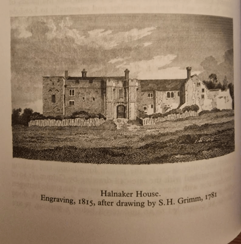
To the north are the remain of Halnaker House, again private with no permissive access. From Elizabeth Williamson, Tim Hudson, Jeremy Musson, Ian Nairn, Nikolaus Pevsner (2019) Sussex: West (Pevsner Architectural Guides: Buildings of England) pp. 409-401:HALNAKER HOUSE (ruins). Halnaker and Cowdray (q.v.) have remarkably similar history. Both were medieval houses given a wholesale remodelling in the C16 by owners who used up-to-date Renaissance ornament. Both became ruined about 1800. But where Cowdrav still impresses as architecture, too much has gone at Halnaker to make it more than a pretty, picturesque group of walls. This is not only the fault of the weather. Details were transplanted wholesale to Chichester, … It is a pity, for the complete Halnaker would have been very impressive.
It was begun by the de Haye family, the founders of Boxgrove Priory and came by descent into the hands of the St John and Poynings families and eventually to Lord de la Warr. The site faces south at the exact point where the Downs begin to rise out of the coastal plain, and consists of an irreg-lar retaining wall enclosing separate hall and chapel ranges. Closed at the south end by a nearly symmetrical C14 gatehouse and wings, achieving a semi-fortified, semi-regular effect which suited both the political climate and the visual inclinations of the C14. Halnaker was the type of Stokesay, not Bodiam. In the C16 the hall range was extended by a solar range that linked it to a chapel: work mainly done for Thomas West, Lord de la Warr (of the Renaissance chantry at Boxgrove and the Renaissance tombs at Broadwater …). The house became redundant when Goodwood was built but was not fully abandoned until the C19.
When you walk around the parish of Boxgrove, West Sussex, history collides in the landscape and the built environment; with extraordinarily diverse and interesting physical evidence of building and other human activity from the Neolithic, Iron Age, Roman Occupation, Norman, Plantagenet and Tudor periods.
The landscape of the Downs, itself formed by human activity – human introduced sheep grazing – is stunning beautiful; as are the ancient chestnuts of the Halnaker medieval Deer Park (which gets its own post). The importance of sheep to the creation of the South Downs, and the medieval economy of Sussex, is referenced in the name of the Boxgrove Priory Church: St Blaise is the patron saint of wool carders.
Sheep were vital to the medieval economy of Sussex, providing the primary raw material for the region’s thriving wool and cloth industry, which was the backbone of the national economy. Beyond wool, sheep provided other valuable resources like meat, milk, and manure, and their management was integral to the agricultural practices that made the area one of the wealthiest in England. P.F. Brandon (1971) Demesne Arable Farming in Coastal Sussex during the Later Middle Ages Agricultural History Review
The pinnacle of its built environment is the Plantagenet and Tudor Boxgrove Priory Church with the De la Warr Chantry being of international art historical importance.
It is a magical church full of echoes of French influence along the Sussex coast. Its crossing is a mystery of light and dark and the great chancel is alive with Tudor roses and heraldry. The De La Warr chantry contains beautiful early French motifs from a Book of Hours. These must be some of the best renaissance carvings in any English church. They make Boxgrove very special. Sir Simon Jenkins
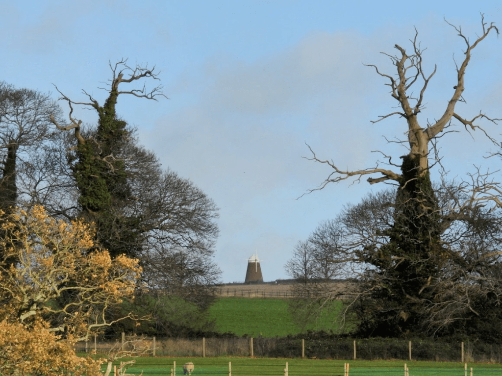
There are later building of historical importance too, specifically the 18th century tower Wind Mill on Halnaker Hill (1740) and Sir Edwin Lutyens’s Halnaker Park, built in 1938.
On Halnaker Hill is a neolithic (10000 BC – 2200 BC) causeway enclosure. Below Halnaker Hill. is the late Iron Age Devil’s Ditch; it dates probably from the late Iron Age (ca. 100 BC – AD 43). The Ditch terminates where it meets Stane Street. The Roman Stane Street may have been built shortly after the Devil’s Ditch in the first decade of the Roman occupation of Britain (as early as 43–53 AD). There was an Anglo-Saxon church at Boxgrove (recorded in the Doomsday Book) but there are no physical remains of it. Over it was built an early Norman Benedictine Priory, completed ca. 1170.; its nave is now ruined but the Priory Church of St Mary and St Blaise remains, with the addition of a C14 porch and a C15 vestry, and the addition of outstandingly beautiful C16 C De la Warr chantry (ca 1530).
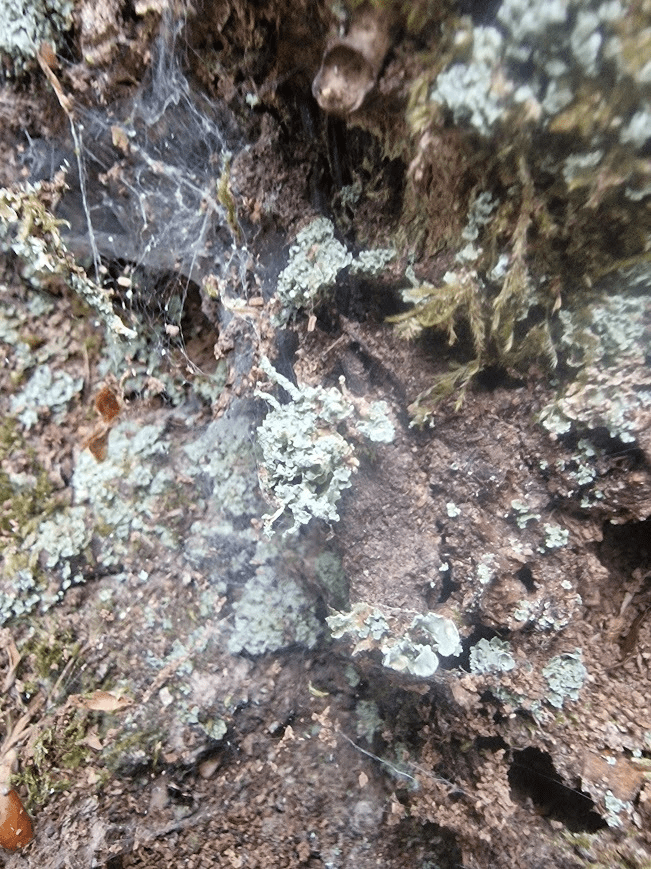
One of the ancient Sweet Chestnuts; now is very poor condition.
Halnaker Hill’s Windmill from the Deer Park – in this perspective its looks dwarfed by the ancient Sweet Chestnuts!
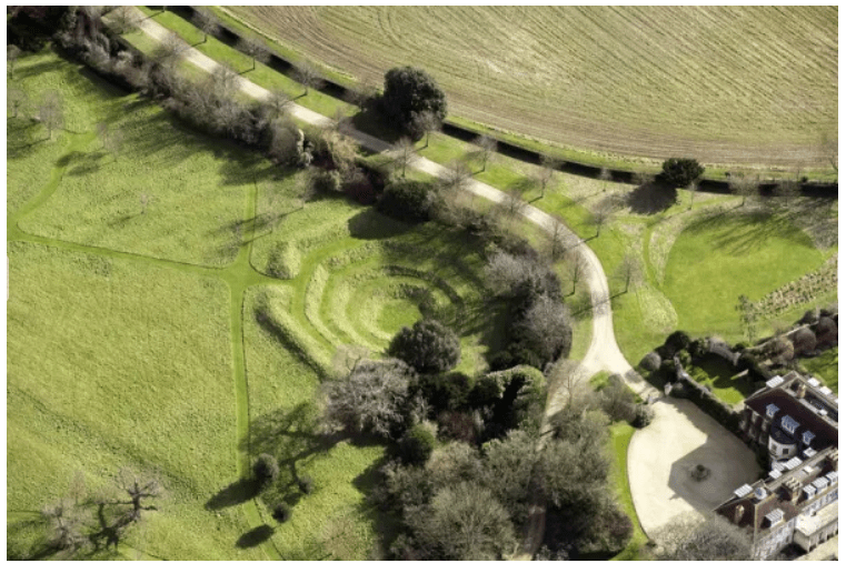
A fascinating man-made feature of the parish is the octagonal reservoir in the Halnaker House. This is not accessible publicly. The OS map calls it a cockpit; but it may not have been.
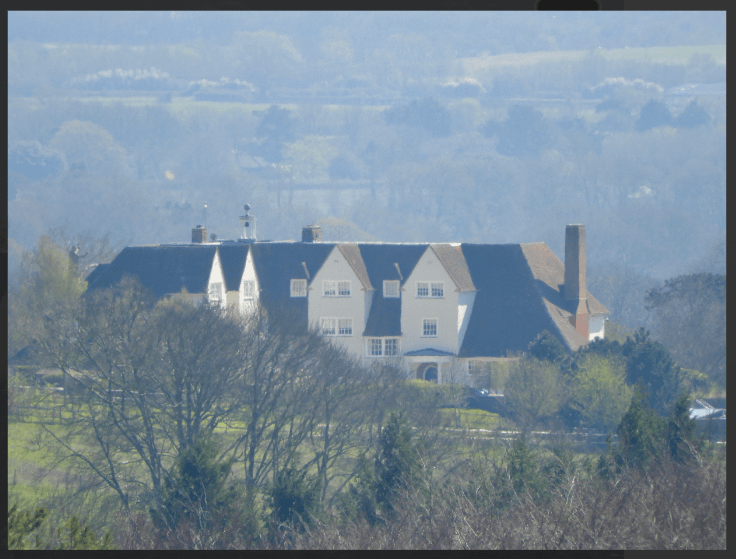
A later and important part of the landscape is house of Sir Edwin Lutyens, built in 1938, see Historic England Halnaker Park but this listed building is invisible from roads and public footpaths and is hidden from view by the trees of the medieval deer park in which it is located; and it is private.
The occasion of the Second World War added to the historic melange of Boxgrove Parish’s Halnaker Hill concrete and octagonal brick structures which formed the base of searchlight emplacements. All that remains of these structures is parts of the bases; this are particularly ugly but are of historical importance and are listed by Historic England However, the brick and concrete does provide a substrate for some beautiful lichens e..g the very common Lecanora campestris which I photographed there on 07/12/2024
There are some interesting sixteenth to nineteenth century vernacular houses in the parish; these are excellently described, with photographs, by John Bennett and Beryl Bakewell, available at January 2021 – Boxgrove and Halnaker Listed properties
Halnaker Hill Causeway Enclosure
The oldest feature of the landscape is the neolithic Causeway Enclosure on the top of Halnaker Hill, close to the Halnaker Mill. Between 50 and 70 causewayed enclosures are recorded nationally, mainly in southern and eastern England. They were constructed over a period of some 500 years during the middle part of the Neolithic period (c.3000-2400 BC) but also continued in use into later periods. They vary considerably in size (from 0.8ha to 28ha) and were apparently used for a variety of functions, including settlement, defence, and ceremonial and funerary purposes. However, all comprise a roughly circular to ovoid area bounded by one or more concentric rings of banks and ditches. The ditches, from which the monument class derives its name, were formed of a series of elongated pits punctuated by unexcavated causeways. Causewayed enclosures are amongst the earliest field monuments to survive as recognisable features in the modern landscape and are one of the few known Neolithic monument types. Due to their rarity, their wide diversity of plan, and their considerable age, all causewayed enclosures are considered to be nationally important.Historic England Causeway Enclosure, World War II searchlight emplacements and associated remains on Halnaker Hill
The Devil’s Ditch consist of a banked ditch, the bank being wooded mostly with Pedunculate Oak and Field Maple
The Devil Ditch forming the south boundary of the Halnaker Deer Park:
Butchers Broom in the ditch.
The bank and ditch of the Devil’s Ditch is continuously wooded mostly with Pedunculate Oak and Field Maple. Butcher’s Broom is an ancient woodland indicator species ; so the Devil’s Ditch has biological importance as well as historic importance,
The earthwork is denoted by a bank and a ditch, which grows fainter as it heads east. It runs west to east, forming a boundary at the northern edge of Redvins Copse, passes north of Oak Cottage and Stanefield house before it ends at Stane Street Roman Road. At the eastern end it forms the southern boundary to Halnaker Park. Towards the western end, the bank is about 2.5m above the bottom of the ditch, which is about 6m wide. At the eastern end, near Stane Street, the ditch is wide and shallow indicating that it may have been recut at a later date and possibly used as an early trackway.
The Devil’s Ditch in Sussex has been documented by antiquarians since at least the 18th century. It is part of a group of linear earthworks on the gravel plain between the foot of the South Downs and Chichester Harbour. The entrenchments run from Lavant to Boxgrove and appear to enclose the area of the coastal plain to the south. It has been suggested that these marked out a high status, proto-urban tribal settlement (or ‘oppidum’) preceding the Roman invasion. The Devil’s Ditch is thought to date to the Late Iron Age (about 100 BC – AD 43) but was recut and extended in places during the medieval period. The name of the entrenchment is derived from a local tradition, which holds that the ditch was the work of the devil in an attempt to channel the sea and flood the churches of Sussex. Historic England Devil’s Ditch, section extending 1730yds (1580m) from Stane Street to NW end of Redvin’s Copse
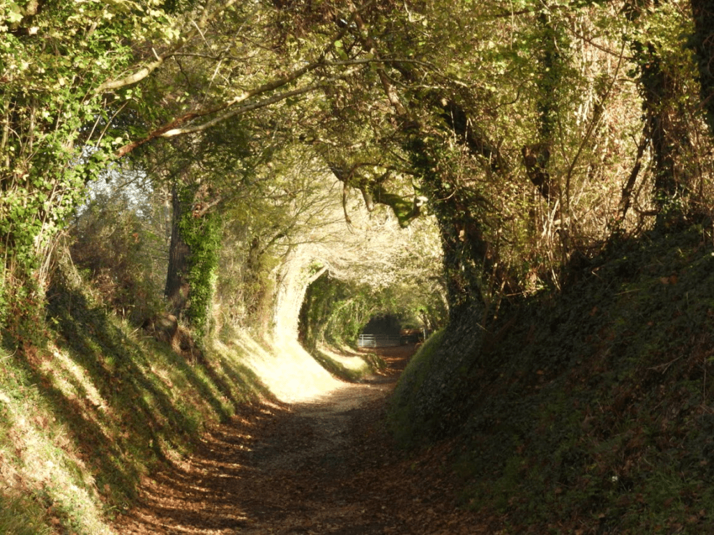
Stane Street and the Halnaker “Tree Tunnel”
Stane Street linked London (Londinium) to Chichester (Noviomagus Reginorum); and runs through the South Downs. Stane is an old spelling of “stone” (Old Norse: steinn) which was used to differentiate paved Roman roads from muddy native trackways. At Halnaker Hill, Stane Street becomes a “tree tunnel”; which is famed on social media, with may photographs like mine below. There are far better photos of the tree tunnel than mine; just Google Halnaker Tree Tunnel and you will see them. Whilst the Halnaker Tree Tunnel is beautiful, from my experience of walking in Sussex there are far more beautiful and historically significant sunken trackways (hollow-ways) in Sussex than this tree tunnel; but for some reason Halnaker Tree Tunnel has “gone viral”; which shows how social media can distort public attention to what is important in the country side.
Remains of the Priory
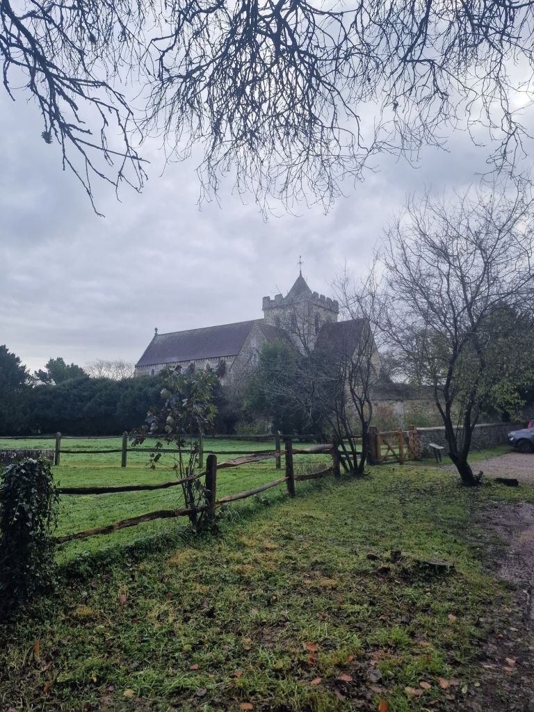
The small Benedictine priory of Boxgrove in West Sussex was founded in about 1107, originally for just three monks. In a beautiful setting at the foot of the South Downs, the principal remains include a fine two-storey guest house, roofless but standing to its full height at the gable ends. The eastern parts of the priory church became Boxgrove’s parish church after the Suppression of the Monasteries.English Heritage Boxgrove Priory
The importance of the ruins as a picturesque spectacle drew tourists, artist and antiquarians throughout the 18th and 19th century; perhaps enhanced by William Gilpin, who in the eighteenth century wrote essays that explored the picturesque as a new aesthetic concept
Starting in the 18th century, the history of the priory and its ruins attracted the attention of antiquarians and artists. The latter included Samuel and Nathaniel Buck, who in 1737 published an engraving of the church and surviving portions of the roofless monastic buildings. English Heritage Boxgrove Priory
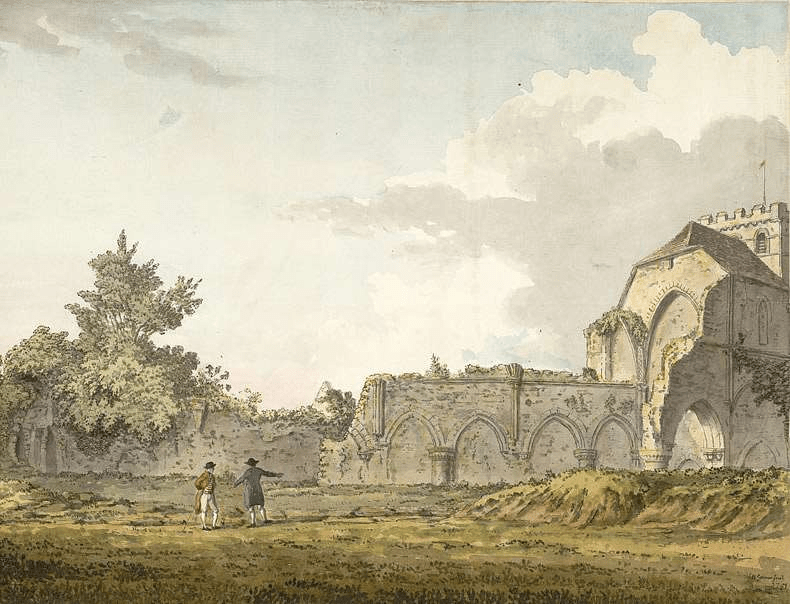
Below, a watercolour view of the ruins of the nave of Boxgrove Priory, seen from the churchyard, by Samuel Hieronymous Grimm, 1781
Samuel Hieronymus Grimm (18 January 1733 – 14 April 1794) was an 18th-century Swiss landscape artist who worked in oils (until 1764), watercolours, and pen and ink media. Grimm specialised in documenting historical scenes and events; he also illustrated books such as Gilbert White’s The Natural History and Antiquities of Selborne. Tate Samuel Hieronymus Grimm
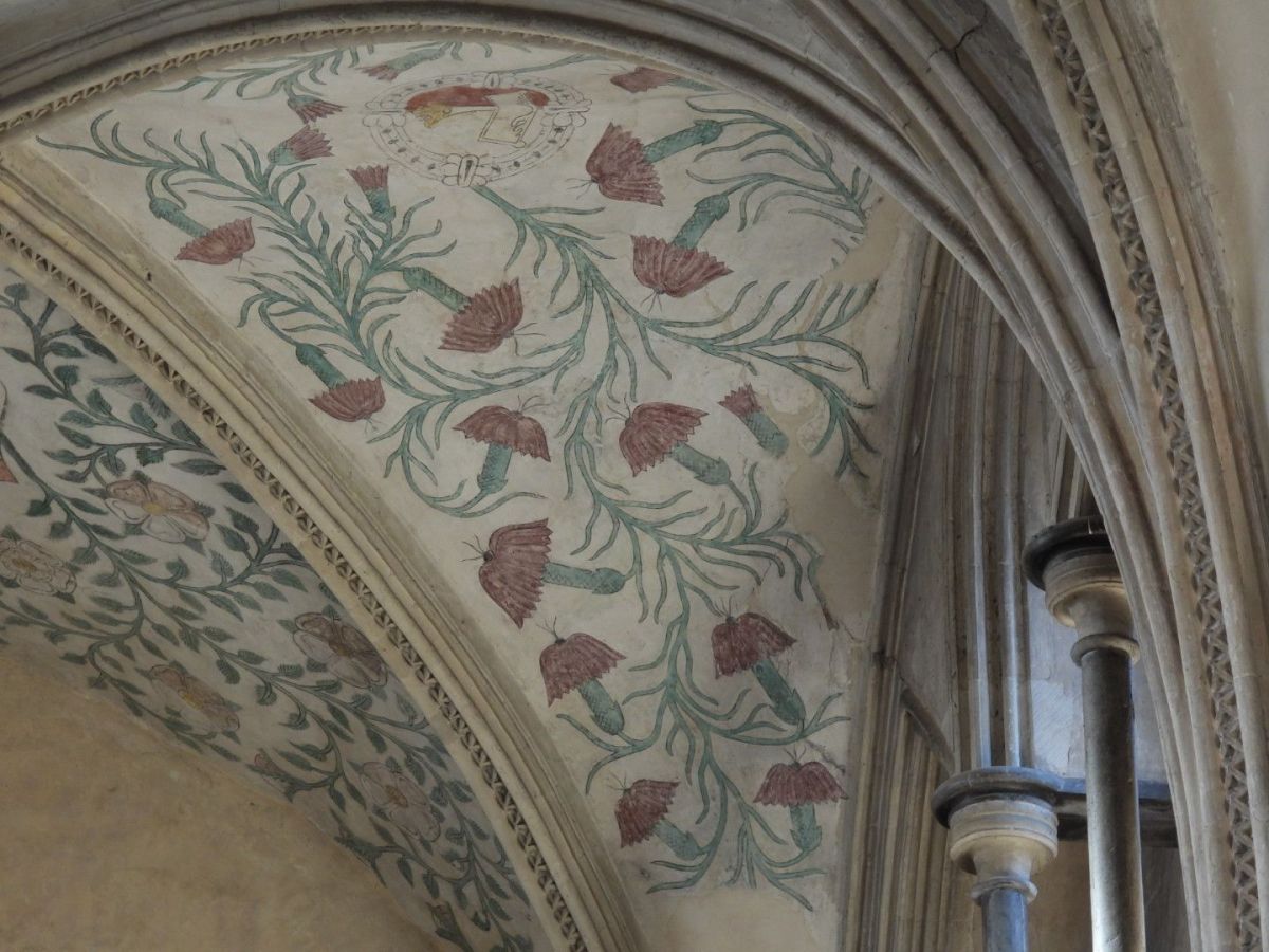
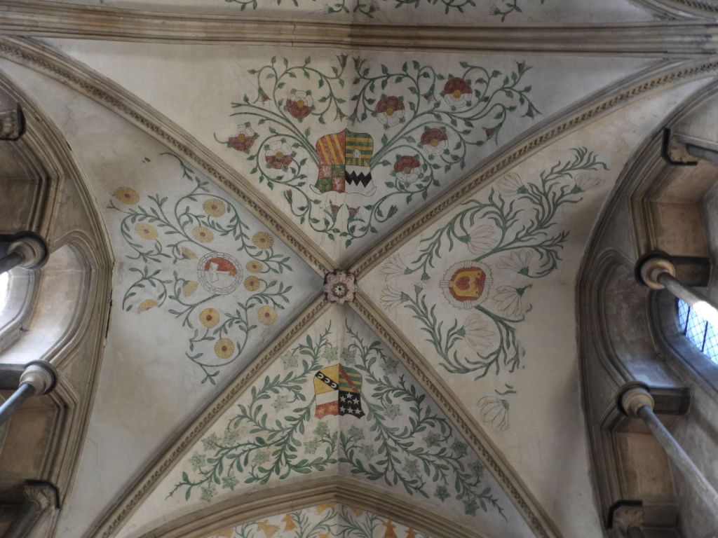
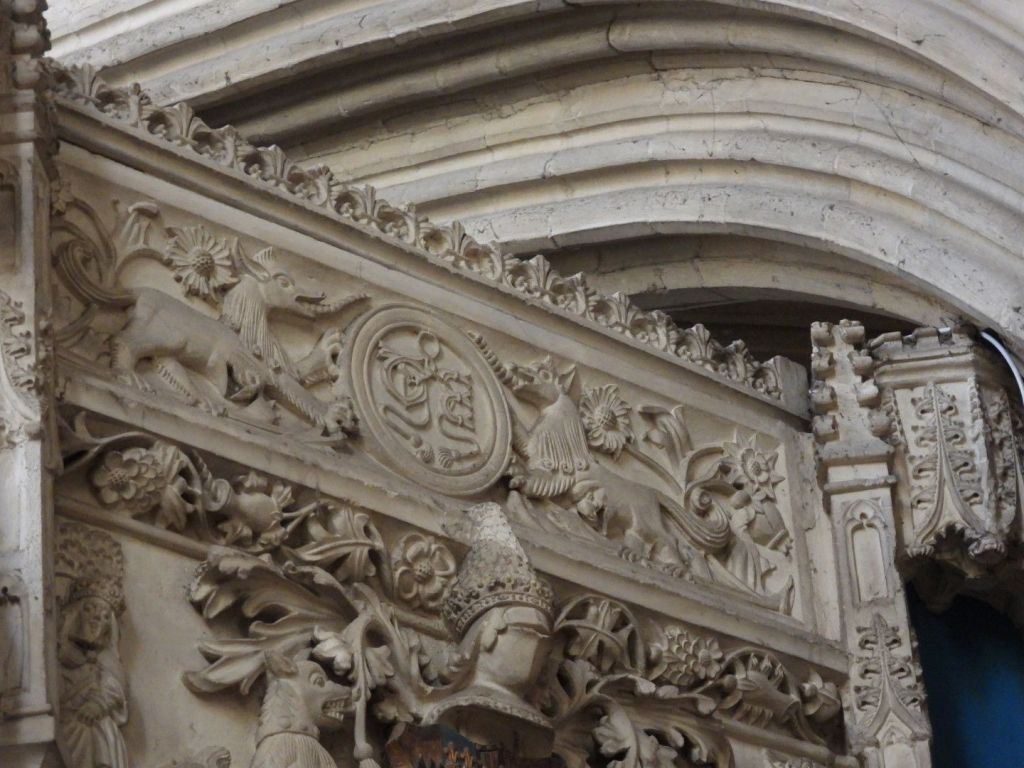
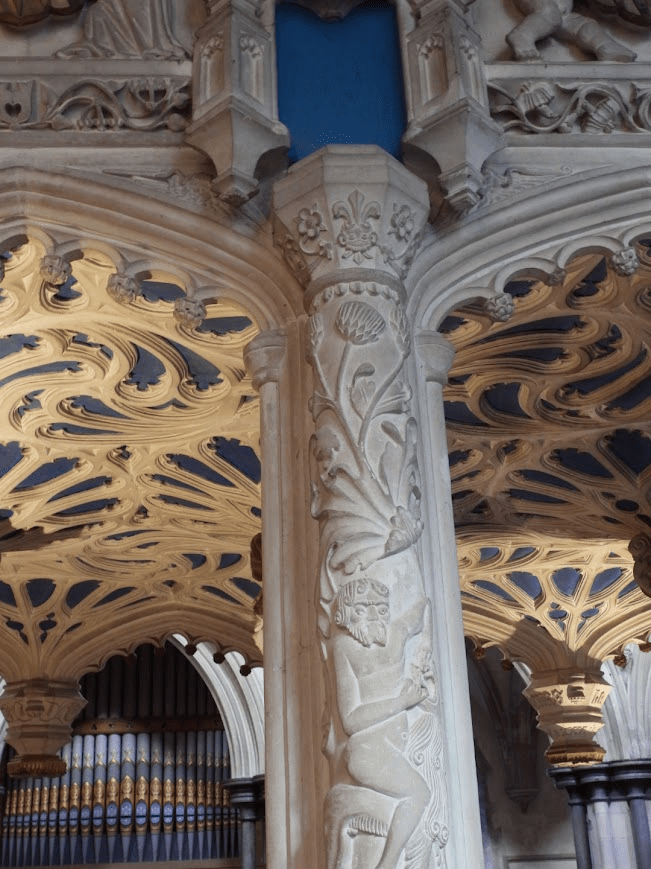
The decorations by Lambert Barnard of the choir vault and the sculpture of De La Warr Chantry are of international art-historical importance.
On the choir vault there are decorations by Lambert Barnard for Lord de la Warr (Croft-Murray p112), probably linked with his chantry. Naturalistic foliage, interspersed with the arms of de la Warr and relatives.Sussex Parish Churches Boxgrove Priory Church. Lambert Barnard (d1567/68) did much work for Bishop Sherburn (1508-38), notably in Chichester cathedral. Little is known of his life, but stylistically, if not by birth, he had Netherlandish links. E Croft-Murray: Lambert Barnard: an English Early Renaissance Painter, AJ 113 (1957) pp 108-25Sussex Parish Churches Architects and Artists B
It is hard to know what particular species the flowers depicted on the C16 ceiling painting, commissioned by Thomas West, the 9th Lord de la Warr, are intended to be. They are described as a “delightful mix” of various local plants; but I think it more likely that they are a symbolic representation of the importance of flora to Thomas Wests beliefs; with their decorative pattern being more important than close observation of actual flowers. Botanical accuracy in botanical art was a feature of 17th and 18th century still lives and botanical illustration for florae. The flowers on this 16th century ceiling were probably not meant to be accurate representations of local plants, even if they were inspired by them; they are more symbolic than representational. The symbolic religious use of flowers as symbols of God’s creation was common in medieval churches, as I reminder that all of creation praises God, and perhaps representing the Garden of God, Eden, or the beauty of heaven. Considering that 9th Baron De La Warr was expecting to be buried in this church, it is likely they he wanted them to represent his ascent into heaven.
The chantry in the choir was built by Thomas, Lord de la Warr for himself and his wife between 1530 and 1535 and led to a major internal alteration. … [A chantry is a chapel or area within a church where a priest who would say daily masses for the donor’s soul] The chantry is more a piece of architecture than a monument in any conventional sense. Ironically, … de la Warr was buried at Broadwater in 1554. This was probably because he fell out of favour and was compelled by the King [Henry VIII] to exchange the manor of Halnaker in Boxgrove for Wherwell in Hampshire in 1540 and thus had no further link with Boxgrove, …. Added to this was the abolition of chantries in 1547, which meant that by the time of de la Warr’s death this could only have functioned as a tomb.
The plan is rectangular with two bays on the long sides, each with pairs of cusped arches separated by pendants, which are also present on the vault inside – the short ends have none. The base is essentially gothic, decorated with shields within lozenges. The upper part, especially the corner-shafts and those between the bays, is covered in Renaissance ornament of shallow incised figures and foliage, some based on Paris woodcuts of c1500 The canopy also combines such decoration with gothic elements – pairs of angels and putti hold shields with straight heraldic decoration. Tiered niches for statues, if ever filled, are now empty. Inside, the reredos has more empty niches, either side of a blank space intended for a carving. Each side of the reredos is an opening, of which that to the main nave of the church served as a squint. The purpose of the recess to the south was probably to provide symmetry. A small opening on the south side but lower down is too small for a piscina and its purpose is uncertain. The painted interior is mostly restored and the iron gates survive. Sussex Parish Churches Boxgrove St Mary and Saint Blaise
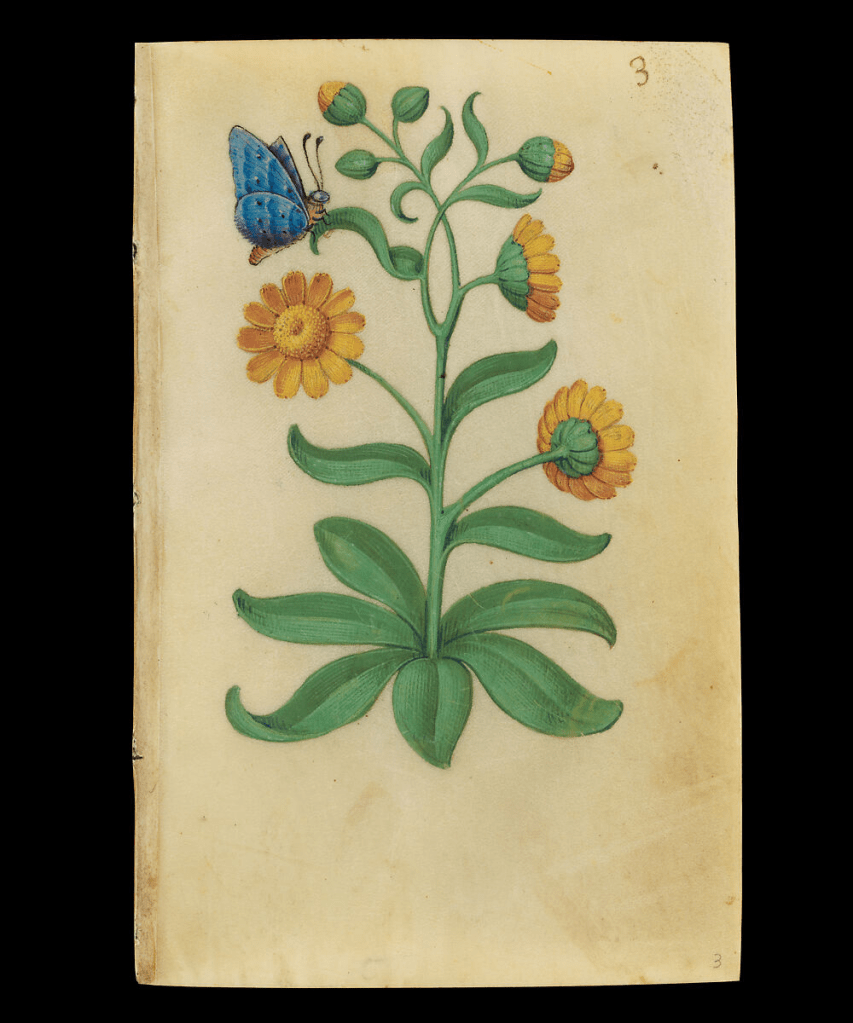
Foliage is a key aspect of the iconography of the chantry It is believed that the animals (real and fictious) come from a French Book of Hours (which one not known); but there are other sixteenth century resources that could be a source for the sculptured imagery e.g. Master of Claude de France’s Book of Flower Studies (ca. 1510–1515); some of the studies can be viewed on-line from the Metropolitan Museum of Art collection in New York see Book of Flower StudiesMaster of Claude de France ca. 1510–1515
The flowers above these imaginary beasts look very similar to the marigolds
but that does not mean that the anonymous sculpture of the De La Warr used this study as a pattern, as images of all flowers in the 16th century are very stylised; the idea could have come from many manuscripts depicting flowers
The marigold was nicknamed “Mary’s Gold” due to several legends linking it to her. One story claims that when Mary’s purse was stolen on the flight to Egypt, all the thieves found were petals, so early Christians left marigold petals around her statues as a substitute for coins.Jonathan Hoyle, Society of Arts, Medieval Natural Symbols
Heaven is often depicted as a return to the garden of Eden in Medieval and Early Modern manuscripts. So the intent of the artist in including much foliage in the chantry may have been to suggest that heaven was where Thomas, Lord de la Warr would go after death. The Tudor roses on the Chantry show Thomas’s allegiance to Henry VIII; opponents of Henry often had their earthly lives shortened by judicial or extrajudicial execution
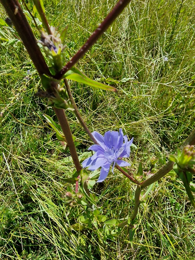
The flowers on to the left of this beast may be chicory
they are similar to Master of Claude’s chicory. Pre-reformation church sculpture was typically polychrome, often painted painted in gaudy colours but the colour wears away over the years; the colour of sculptured plants would make it easier to assign to possible specific botanical species
The plant’s ability to thrive along roadsides in difficult, disturbed soil, coupled with its strong, deep taproot, made it a symbol of Christian perseverance and resilience in the Middle Ages. The plant’s steadfast nature, even through cold winters, linked it to the endurance of faith. Riklef Kandeler, Wolfram R. Ullrich, Symbolism of plants: examples from European-Mediterranean culture presented with biology and history of art: NOVEMBER: Chicory, Journal of Experimental Botany, Volume 60, Issue 14, October 2009, Pages 3973–3974, https://doi.org/10.1093/jxb/erp248
Here is some Chicory I photographed at Singleton; close by Boxgrove, in 2024. Chickweed was grown for its seed; and it is common in Sussex as a arable weed.
Though C. intybus was formerly regarded as a native, at least in England and Wales, doubt is now cast on that status in most counties, and it is almost always treated as a relic of cultivation. Historically, it was cultivated for its seed (subsp. intybus) British and Irish Botanical Society Plant Atlas 2000 It would have been common in the arable fields around Boxgrove in the C16
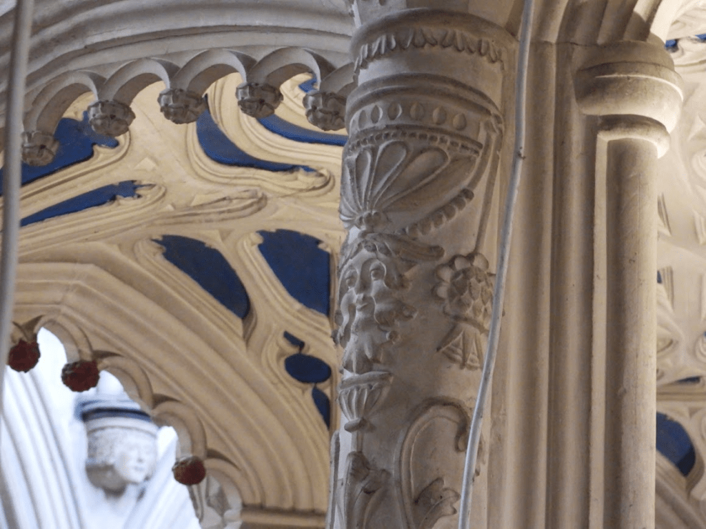
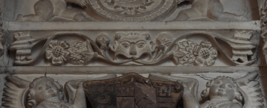
There are foliate heads. often called Green Men;, carved in the chantry, although the second of these images looks more like a foliate head of an animal or mythical beast. Lady Raglan only coined the name Green Men in 1939; it has no historical heritage
There is voluminous writing on the Green Man motif representing a pagan mythological figure, as proposed by Lady Raglan in 1939 Raglan, Lady. “The Green Man in Church Architecture.” Folklore, vol. 50, no. 1, 1939, pp. 45–57. doi:10.1080/0015587x.1939.9718148 but her view is not supported be the evidence. Many folklorists believe that foliate heads indicate a perseverance of pagan beliefs after the Christianisation of England. However, as De La Warr had gone to great expense to have the chantry built and have priests pray for his soul (although did not happen because of Henry VIII’s reformation) he would hardly have risked his salvation with what might have been be perceived as pagan imagery. It is far more likely that foliate heads in churches were Christianised symbols of resurrection, as I J B S Corrigan (2019) points out in The Function And Development Of The Foliate Head In English Medieval Churches. Unpublished theses, University of Birmingham accessed 30.11.25 https://files.core.ac.uk/download/pdf/323305511.pdf, which includes consideration of the Boxgrove foliate heads.
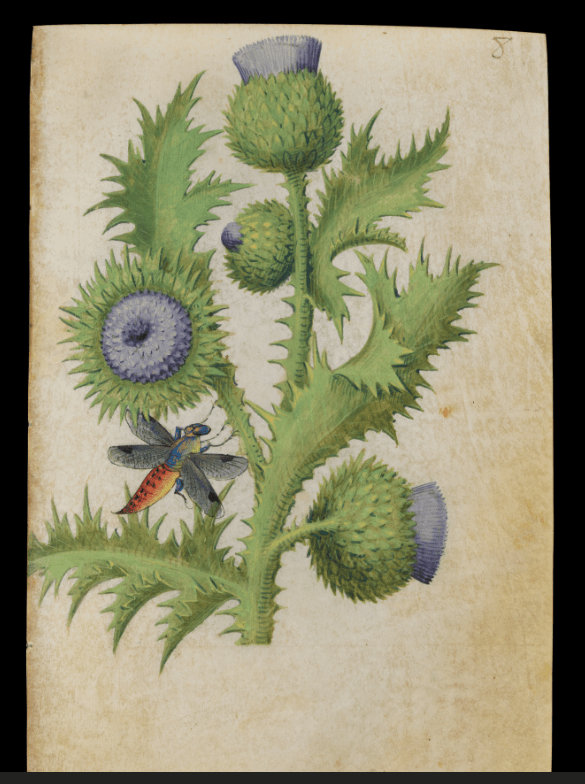
This appears to be a thistle
Master of Claud’s thistle
Thistles are associated with the Virgin Mary, It is impossible to say which form of thistle is sculpted on the Chantry but Milk Thistle, Silybum marianum, Also known as the Marian or Mary Thistle, the species name Marianum comes from the Latin and refers to a legend that the milky white streaks on the spiny leaves of this species of thistle came from the milk of the Virgin Mary nursing her child whilst fleeing to Egypt.Bolton Castle Plants
Whether the foliage painting and carvings are attempts at botanical verisimilitude or are entirely symbolic – or something in between – does not bother me – as all you need to do to enjoy the art of Boxgrove Priory Church is visit and look at its art yourself.
A Footnote
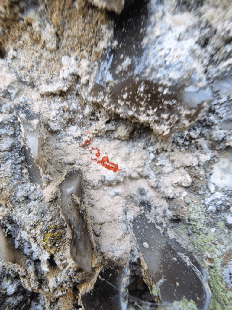
Boxgrove Priory Church not only has outstanding Renaissance ceiling painting and Chantry carving, it has some cracking lichens on its external walls, including Ingaderia vandenboomii, which is deemed a “Nationally Scarce” by the British Lichen Society. But it is not that scarce on the north walls of old (mostly Saxo-Norman) coastal churches in Sussex.
Ingaderia vandenboomii has a pink thallus i.e body (the red is a reaction to a chemical reagent spot test used to confirm its identity.
I went to Ashburnham Park with two lichen friends, Dave and Sarah, to look at its lichens. Ashburnham Park is a top site in Sussex for epiphytic 0lichens. This is not necessarily a representative account of the lichen diversity at Ashburnham as we only had time to walk aploound part of the SSSI; further visits to this outstanding site are required. All the identifications were made collaboratively and are based on morphological features. Lichens marked # require spore microscopy to confirm identification. Thus, some of these identifications are provisional
JAshburnham one Nettlefold tdr a former medieval deer park lying on Tunbridge Wells Sandstone and Wadhurst Clay. The ancient woodland is one of the largest remaining areas of its kind in the country and contains many overmature trees with outstanding lichen floras.
Overmature oaks and beeches occur throughout and support a great variety of epiphytic lichens with over 160 species recorded from the site as a whole. Holly is also an important host supporting a number of particularly interesting species which are not common this far east of the New Forest.
Ash Fraxinus excelsior is more frequent on calcareous soils in the west of the site while damp alder Alnus glutinosa woodland occupies the stream valleys and lake margins. Areas of coppiced hazel Corylus avellana, hornbeam Carpinus betulus and sweet chestnut Castanea sativa occur throughout the site, and there are also small mixed plantations and many scattered exotic species.
Woodland corticolous lichens
Usnea ceratina
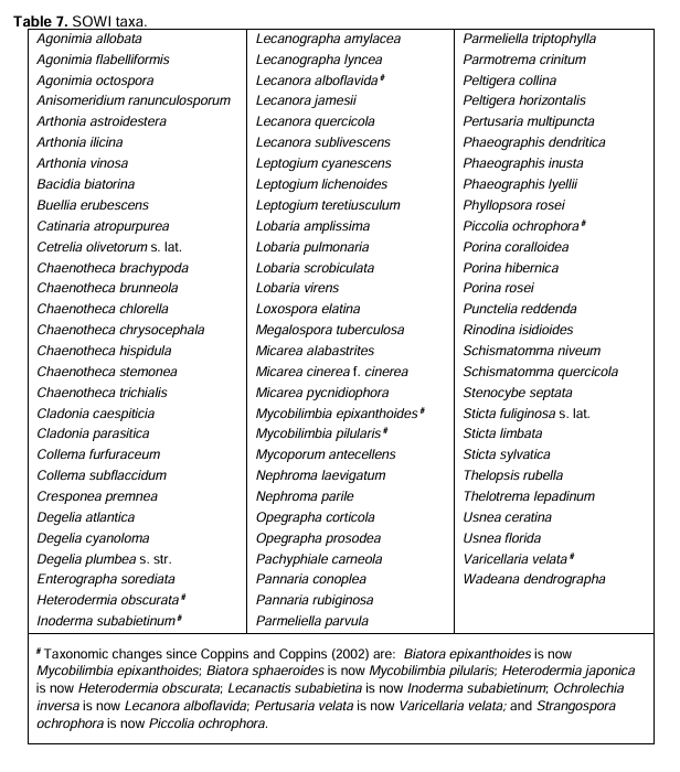
Fallen from a Quercus robur (Pedunculate Oak), U. ceratina is one of the Southern Oceanic Woodland Index (SOWI) lichens of ecological continuity used to asses the quality of woodland sites for lichens (including determining which site might become SSSIs). At the end of this post is a table of all the SOWI lichens. Other SOWI lichens are marked SOWI.
A Quercus robur covered in Thelotrema sp. Bark Barnacle Lichen (SOWI). In the past there was only one Thelotrema sp., T. lepadinum but not it has been subdivide into two: T. lepadinum and
This is probably Thelotrema lueckingii SOWI, and Pertusaria leioplaca., on a Sweet Chestnut, Castanea sativa; one of a few planted in Ashburnham Park. When C. sativa is the main tree in replanted ancient woods it has only Graphidaceae lichens & Pertusaria spp. mostly P. leioplaca. But in here in semi-natural ancient woodland it is joined by a Thelotrema sp.
Similar to Thelotrema lepadinum in almost all details but deviating by the partly citrine yellow medulla (especially in the warts); the pigment reacts K+ red and darkens to an more orange colour when exposed. British Lichen Society Thelotrema luekingii
This is probably Cladonia floerkeana on lignum; red apothecia on podetia difficult to see in this photo
Cladonia caespiticia (SOWI) on Quercus robur
Cresponea premnea (SOWI) on Quercus robur
The dominant species of the Ancient Dry Bark Communities in souther oceanic woodlands (Lecanactidetumpremneae) on dry bark on old trees, often with Lecanographa lyncea
Lecanographa lyncea (SOWI) on Quercus robur
Enterographa crassa meeting Cresponea premnea on a smooth patch of Quercus robur. It is possible, but unlikely that this is Enterographa sorediata (SOWI)
Arthonia radiata # on Quercus robur
Phaeographis dendritica # (SOWI) on Quercus robur with Thelotrema sp.
Possibly Phaeographis smithii # on oak twig.
Chaenotheca ferruginea
Anisomeridium sp. # probably: A. biforme
Chrysothrix candelaris Gold Dust Lichen
Pyrrhospora quernea, on Quercus robur
Lecanactis abietina, on Quercus robur
Graphis scripta # on Castanea sativa
Saxicolous Lichens on Capability Brown Bridge
Tephromela atra Black-eye Lichen
Glaucomaria (lecanora) sulphurea
Lecanora sulphurea parasitising Tephromela atra . Very few lichens are parasitic but L. sulphurea is very fond of T. atra.
Saxicolous lichens on walls of church and gravestones of Ashburnham, St Peter
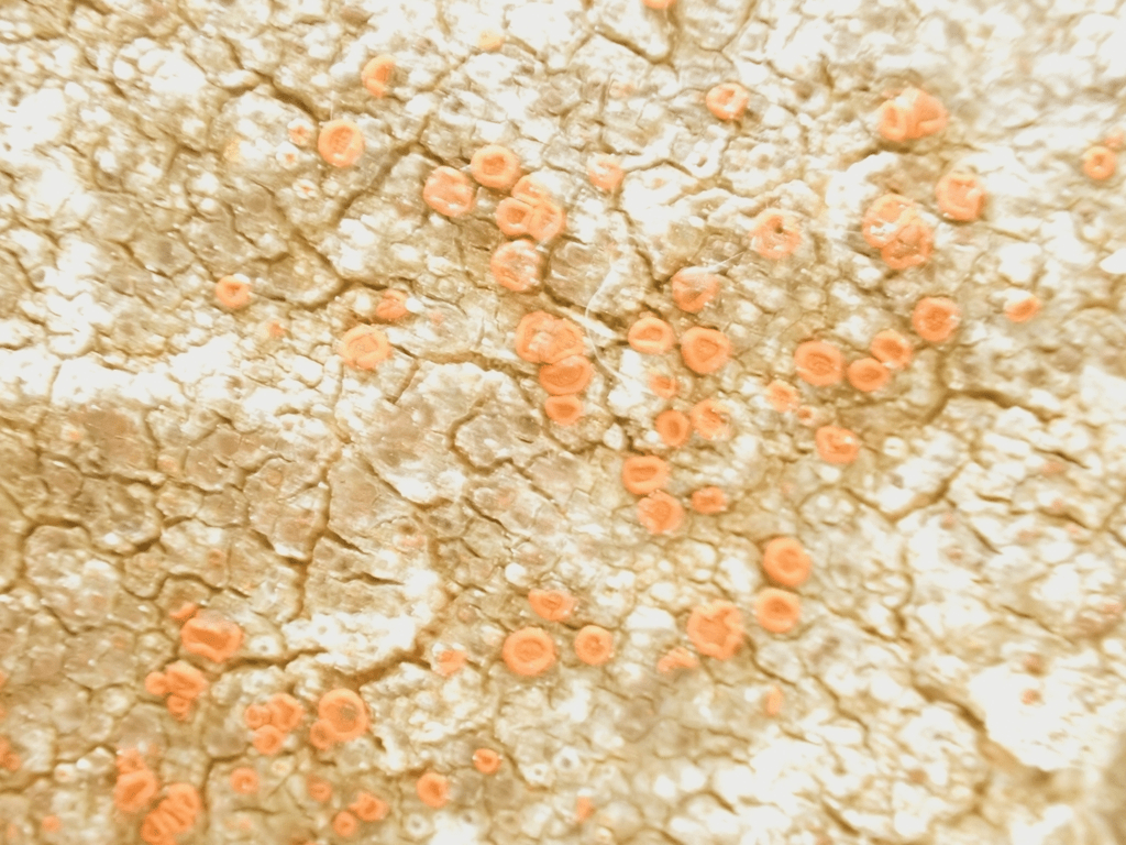
Blastenia crenularia
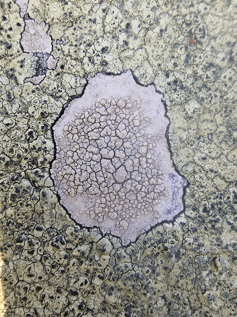
Calogaya (Caloplaca) decipiens (yellow) and to the right (pits) Verrucaria hochstetteri
Verrucaria muralis
Myriolecis (Lecanora) albescens
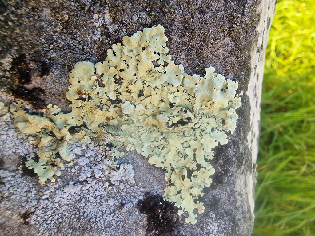
Flavoparmelia caperata Common Greenshield Lichen
Ochrolechia parella, surrounded by Glaucomaria (Leanora) sulphurea
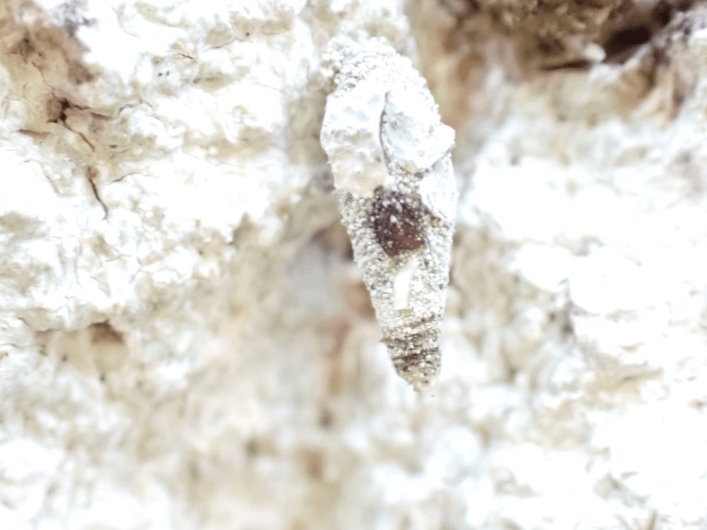
Not a lichen but a moth lava surrounded by lichen! Probably Luffia lapidella, one of the bagworm moths, whose larvae make cases out of lichen, and eat lichen.
I went to Ashburnham Park with two lichen friends to look at its lichens. Ashburnham Park is a top site in Sussex for epiphytic lichens. This is not necessarily a representative account of the lichen diversity at Ashburnham as we only had time to walk around part of the SSSI; further visits to this outstanding site are required. All the identifications were made collaboratively and are based on morphological features. Lichens marked # require spore microscopy to confirm identification. Thus, some of these identifications are provisional
Ashburnham is a former medieval deer park lying on Tunbridge Wells Sandstone and Wadhurst Clay. The ancient woodland is one of the largest remaining areas of its kind in the country and contains many overmature trees with outstanding lichen floras.
Pedunculate oak Quercus robur andbeech Fagus sylvatica woodland covers the majority of the site including all of the northern outlier. It varies from a closed high forest to a very open woodland with holly Ilex aquifolium and birch Betula species and a shrub layer of bracken Pteridium aquilinum and bramble Rubus fruticosus. Mature Scots pines Pinus sylvestris occur throughout.
Overmature oaks and beeches occur throughout and support a great variety of epiphytic lichens with over 160 species recorded from the site as a whole. Holly is also an important host supporting a number of particularly interesting species which are not common this far east of the New Forest.
Ash Fraxinus excelsior is more frequent on calcareous soils in the west of the site while damp alder Alnus glutinosa woodland occupies the stream valleys and lake margins. Areas of coppiced hazel Corylus avellana, hornbeam Carpinus betulus and sweet chestnut Castanea sativa occur throughout the site, and there are also small mixed plantations and many scattered exotic species.
Woodland corticolous lichens
Usnea ceratina
Fallen from a Quercus robur (Pedunculate Oak), U. ceratina is one of the Southern Oceanic Woodland Index (SOWI) lichens of ecological continuity used to asses the quality of woodland sites for lichens (including determining which site might become SSSIs). At the end of this post is a table of all the SOWI lichens. Other SOWI lichens are marked SOWI.
A Quercus robur covered in Thelotrema sp. Bark Barnacle Lichen (SOWI). In the past there was only one Thelotrema sp., T. lepadinum but not it has been subdivide into two: T. lepadinum and
This is probably Thelotrema lueckingii SOWI, and Pertusaria leioplaca., on a Sweet Chestnut, Castanea sativa; one of a few planted in Ashburnham Park. When C. sativa is the main tree in replanted ancient woods it has only Graphidaceae lichens & Pertusaria spp. mostly P. leioplaca. But in here in semi-natural ancient woodland it is joined by a Thelotrema sp.
Similar to Thelotrema lepadinum in almost all details but deviating by the partly citrine yellow medulla (especially in the warts); the pigment reacts K+ red and darkens to an more orange colour when exposed. British Lichen Society Thelotrema luekingii
This is probably Cladonia floerkeana on lignum; red apothecia on podetia difficult to see in this photo
Cladonia caespiticia (SOWI) on Quercus robur
Cresponea premnea (SOWI) on Quercus robur
The dominant species of the Ancient Dry Bark Communities in souther oceanic woodlands (Lecanactidetumpremneae) on dry bark on old trees, often with Lecanographa lyncea
Lecanographa lyncea (SOWI) on Quercus robur
Enterographa crassa meeting Cresponea premnea on a smooth patch of Quercus robur. It is possible, but unlikely that this is Enterographa sorediata (SOWI)
Arthonia radiata # on Quercus robur
Phaeographis dendritica # (SOWI) on Quercus robur with Thelotrema sp.
Possibly Phaeographis smithii # on oak twig.
Chaenotheca ferruginea
Anisomeridium sp. # probably: A. biforme
Chrysothrix candelaris Gold Dust Lichen
Pyrrhospora quernea, on Quercus robur
Lecanactis abietina, on Quercus robur
Graphis scripta # on Castanea sativa
Saxicolous Lichens on Capability Brown Bridge
Tephromela atra Black-eye Lichen
Glaucomaria (lecanora) sulphurea
Lecanora sulphurea parasitising Tephromela atra . Very few lichens are parasitic but L. sulphurea is very fond of T. atra.
Saxicolous lichens on walls of church and gravestones of Ashburnham, St Peter
Blastenia crenularia
Calogaya (Caloplaca) decipiens (yellow) and to the right (pits) Verrucaria hochstetteri
Verrucaria muralis
Myriolecis (Lecanora) albescens
Flavoparmelia caperata Common Greenshield Lichen
Ochrolechia parella, surrounded by Glaucomaria (Leanora) sulphurea
Not a lichen but a moth lava surrounded by lichen! Probably Luffia lapidella, one of the bagworm moths, whose larvae make cases out of lichen, and eat lichen.
If you are interested in the class structure of the Sussex landscape and how that interacts with lichen distribution, lichen conservation and public access to nature, and the historic relationship between pasture woodland, tall forest woodland and coppicing for charcoal production for the iron furnaces of the weald, see Lichens of Ashburnham Park SSSI, East Sussex. 12.06.25. Part 2: The impact of the class structure of the Sussex landscape on lichen distribution, conservation and access to the public. 25/https://simelliottnaturenotes.blog/2025/06/13/lichens-of-ashburnham-park-sssi-east-sussex-12-06-25/
Whilst this post specifically addresses issues concerning the impact of class structure of the Sussex landscape on lichen distribution, conservation, and access to nature, class structure of the landscape impacts on the conservation of and access to all nature.
The existence of “high quality” old woodland lichens and access to them are partly a function of the class structure of the Sussex landscape. The “best” (or what is considered as best) corticolous/epiphytic (tree) lichens in Sussex are often in places that were owned, and in some places, are still owned, by the aristocracy; often descendants of the feudal barons who were allocated land by William the Conqueror in exchange for military service and loyalty.
The distribution of lichens in Sussex, and current access to see them, is intrinsically linked to that class structure of the landscape. Old parklands (deer parks) of pasture woodland, and ancient tall forest woodland, like Ashburnham Park, and ancient coppiced woodland (coppice with standards) are some of the best places to see old woodland lichen species. Aristocratic medieval deer parks (the larders of the rich) entailed pollarding; pollarded pasture oaks live longer, thus have long ecological continuity, and have lots of light, which is propitious for lichen growth and survival. Having a deer park was a function of wealth, and intrinsically linked to the feudal class structure of the mediaeval and early modern periods. Tall forest ancient woodland in aristocratic estates are also good for old woodland lichens because of the length of ecological continuity, although many former ancient broadleaved woodlands have been replanted with Sweet Chestnut or pines, were profit trumped conservation of ancient woodland. The part of Ashburnham we visited was ancient tall forest woodland; we have yet to visit the parts of the SSSI which were pasture woodland.
The survival of pasture woodland, tall forest ancient woodland and coppice with standards woodland in the modern period is dependent on the actions of aristocrats, or of the new rich landowners who bought aristocratic land holdings. Many historic park woodlands and ancient tall forest woodland have been partially or completely destroyed by cash cropping i.e., the replanting of ancient woodland with Sweet Chestnut (e.g. Flexham Park and Fittleworth Wood) or conifers (e.g. Worth Forest), or sold for development (as nearly happened at Old House Warren). Once vast [ancient woodland] now cover just 2.5% of the UK. Around half of what remains has been felled and replanted with non-native conifers and even more is under threat of destruction or deterioration from developmentWoodland Trust
Moreover, access to remaining historic ancient pasture woodland, tall forest ancient woodland and coppice with standard woodland is dependent on the ownership of the Sussex landscape. Some woodlands have public access; some of those are in public ownership but local authorities or the ownership of conservation charities e.g. Bexhill Highwoods (coppice with standards), Petworth Park (pasture woodland), and Marstakes Common and Ebernoe Common (pasture woodland and high forest woodland). Marstakes and Ebernoe Commons’ pasture woodland are not related to keeping deer but pre-enclosure commoners’ rights to common grazing, often pig grazing (pannage), which still, though, entailed the largesse of aristocratic land owners. Common land was “manorial waste” and was poor quality land within a manor that was not cultivated or enclosed, and over which tenants and other individuals had rights of common, such as grazing or gathering resources.
Much woodland in Sussex landowners is still owned by it original aristocratic families; some have partial access on limited public footpaths e.g. Eridge Park and Buckhurst Park, and some have no public access e.g. Paddockhurst Wood, Pads Wood and East Dean Park Wood; the latter due to its use for shooting for profit, the curse of public access to woodland in Sussex. Ashburnham Park is an anomaly; it is owned by a Christian trust, for study and retreats, and is currently pretty permissive of public access through a network of private footpaths on the estate. Long may that remain!
The Ashburnham family were lords of the village of Ashburnham, and elsewhere, for some 800 years. The village itself was Esseborne in Domesday Book (1086) and Esburneham in the twelfth century; the name is thought to mean ‘meadow by the stream where ash-trees grow’. By about 1120 the family had taken its name as their own. It may be that the first of them may have been the feudal lord of Ashburnham in 1086 – Peter de Creil or Criel or Crull, a Norman immigrant awarded land by the Conqueror. For almost all of the remaining time up to living memory – with two intermissions – the Ashburnham estate was owned by this one family. The second such intermission led to a peerage; the first (1611 to 1640) resulted from disastrous financial management.Battle and District Hisotrical Society Archive, George Kiloh, 2016,
In 1665, John Ashburnham built a new house on the site of the present mansion, replacing an older house. He died in 1671. His nephew was created Baron Ashburnham, the baronetcy becoming an earldom in 1731. The second Earl reconstructed and enlarged the house between 1759 and 1763 and commissioned Lancelot Brown (1716-83) in 1767 to lay out a new park and gardens around the house of which the lakes and much of the planting structure survive.
The third Earl succeeded in 1812, his additions between 1812 and 1817 including the terraces to the south and east of the house and the bridge across Front Water. The sixth Earl died in 1924 and the line ended with the death of his niece, Lady Catherine Ashburnham in 1953. The Rev J Bickersteth, a grandson of the sixth Earl, inherited the estate and in 1960 gave Ashburnham Place and 89ha, including the main gardens and pleasure grounds, to the Ashburnham Christian Trust.
Ashburnham Place (listed grade II), with St Peter’s church (listed grade I) immediately to its west sits on the north-west slope of the valley, overlooking the chain of lakes and the park woodland beyond. Although the house is truncated from its C18 form, with the church (rebuilt to its present form in 1665) and the stable block (built between 1720 and 1730 and listed grade II*) a visually cohesive group of buildings is created. The house was built in 1665 and enlarged to its final form by 1763 with the addition of the domestic wing facing the church, the long range of state rooms which made up the south front. Brown’s greenhouse, with seven bays (now the Orangery, listed grade II), stands attached on the west side. The brick house was refaced twice, once in 1813 by George Dance and again in 1850 with the present red and grey brick. The house had reduced to a state of decay by the mid C20. It is now about three-quarters of its former size, the remainder having been demolished in 1959. The present (1990s) owners have made considerable additions from the 1960s onwards, on and around the house’s previous ground plan. Brown’s Orangery survives intact .
The Ashburnhams’ wealth came from rents from their extensive land holdings; but also from the Wealden iron industry, including the manufacturing of arms. This is a feature of many other Wealden aristocratic estates, and had a significant impact on woodland in Sussex. The High Weald wasn’t always a pastoral/arable landscape (or the leisure landscape of middle-class wealth that it is now); the High Weald was an industrial landscape in the Tudor and Stuart periods (as it partly been during Roman exploitation of iron in the Weald). Iron ore was dug out of the weald clays, and wood was cut to make charcoal for the iron furnaces. The mill ponds (hammer ponds), which powered the hammers of the furnaces, were sometimes then converted into landscape features, such as ornamental lakes, e.g. at Leonardslee. Visiting the relict hammer ponds in Sussex is fascinating. The website Hammer Ponds details them. However, many of them can not be visited as they have been turned into private fishing ponds. The lakes at Ashburnham are not converted hammer ponds but creations of Lancelot “Capability” Brown who charged a lot to posh-up your estate and make it appear an arcadian paradise. Capability Brown’s work at Ashburnham Place involved significant costs, with direct payments to Brown totalling £7,296 (1753). Landscape Institute: Capability Brown: Ashburnham equivalent to £960,992.20 today.
It cost the the 2nd Earl of Egrement a pretty penny too to get Capability Brown to landscape the Petworth deer park, and turn it into a simulacrum of the faux antique landscape paintings of Claude and Poussin, which hung in the Earl’s painting collection inside the neo-Palladian Petworth House. Capability Brown received five contracts from Lord Egremont between 1753 and 1765, totalling £5,500 (1773). Landscape Institute: Capability Brown: Petworth This is equivalent to over £1,051,136.88 in 2025.
Part of the forge pond survives just to the west by a road on private land at 684161, with a modern weir. Looking down east from the bridge here, a rusty channel can clearly be seen far below, running under the conservatory of Forge Cottage. Hammer Ponds: Ashburnham Forge
North along the track down a detour right at the path fork (685172) there is a footbridge over a rusty ford with several large reddish ‘bears’ in the stream: a bear is a rock of imperfectly smelted ore and iron. Slightly further along, left in a private meadow, a high bank is visible. This is the old furnace bay, and the furnace pond, now dry, lay beyond it. This is now a low field. The old spillway is roughly halfway along the bay and still serves a stream – depending on the overgrowth, this may be seen as well as heard. Hammer Ponds: Ashburnham Forge
Ashburnham was an important Wealden complex of furnace, forges and boring mills, built by John Ashburnham before 1554, and the last Wealden furnace to close in 1813, although the forge continued until the late 1820s. The sites worked together during the Civil War, the premier Wealden ordnance suppliers until about 1760, and later produced guns and shot for the Dutch Wars. The main furnace pond is now dry, but a secluded pen pond survives on private land just north of the furnace site in Andersons Wood (685173). [The Ashburnham iron furnaces supplied arms to the Royalists during the civil war.]
An unmade road, heavily metalled with waste iron slag, runs about half a mile between this remaining furnace pen pond and the dry site of Ashburnham (Upper) Forge. Known originally as the ‘sow track’, this not only took sows and guns from the furnace down to the forge and boring mill but also extended up past Robertsbridge to Sedlescombe, where iron goods were shipped to London via the river Brede.”
Ashburnham forge was “…the most persistent of the Sussex works were those at Ashburnham, extending into the next parish of Penhurst, and obtaining fuel supplies from Dallington Forest. The furnace, which is mentioned in 1574 and was probably established much earlier, lasted till 1811, and the forge continued working until 1825. Mary Cecilia Delany, 1921; The Historical Geography Of The Wealden Iron Industry available online
As well as tall forest woodlands, there are many relict coppiced woodlands, some with relict with charcoal hearths across, the weald. Coppice with standards was the typical coppicing practice; and the standard (maiden) Oaks of these relict coppiced woodlands are important for lichens. Charcoal was critical to the production of iron. Coppiced wood (mainly oak, alder and hornbeam) was used to make the charcoal in round ‘clamps’ of 4-5 metres which were often constructed on levelled ground. The presence of nearly black soil and small pieces of charcoal can confirm past use [of land as charcoal hearths.High Weald National Landscape: Archaeology
The peaceful pleasure of walking through relict coppices belies one of the reason why those coppices were there: the Wealden ironmasters began to concentrate increasingly on gun founding, and examples can be found all over the world, wherever Britain fought or traded. Eventually, the onset of the Industrial Revolution took heavy industry north to the coalfields, and the last furnace in the Weald, at Ashburnham, closed in 1813.Wealden Iron: History. The Wealden coppices fuelled the furnaces that made the weapons the made Britain’s early modern imperial colonialism possible
Cast-iron guns were particularly needed by the government at this time. … There are many references to Levett’s deliveries of guns and shot to the Crown in the 1540s. In 1546 he was paid £300 for making iron guns, and typical of his trade in ammunition is an order of 1545 for 300 shot for cannon. The Iron Industry of the Weald. Henry Cleere and David Crossley with contributions from Bernard Worssam and members of The Wealden Iron Research, Second Edition Edited By Jeremy Hodgkinson Merton Priory Press 1995. Available online
Coppiced woodland in the weald was not only used for charcoal to produce the iron that produced munitions, in places Oak was planted to be cut later for ship building. The thick multi-stems of relict coppiced Sessile Oak at Highwoods near Bexhill, provides the only opportunity to see lichens on coppiced Sessile Oak (Quercus petraea) in Sussex. But these Sessile Oaks were not planed for their beauty, or to be a substrate for liches, they were planted to build Henty VIII’s navy. Ship building has always had a strong reliance on natural resources and Britain would not have been able to conquer the seas without the abundance of wood that was available to construct its mighty vessels. … Overall, Britain built its place in the world through the power of its maritime endeavours, and in this way, the forests of Britain helped to build the nation that it became. This quotation from Rural History obscures the fact that the nation that the UK became because of its exploitation of oak woods for its naval ships, was a nation that ruthlessly subjugated people to colonial slavery.
A postscript: another class-based use of Wealden iron from Ashburnham:


